Kryvyi Rih
Zmiiv
Trypillia
Ladyzhyn
Dnieper
Starobesheve
Dobrotvir
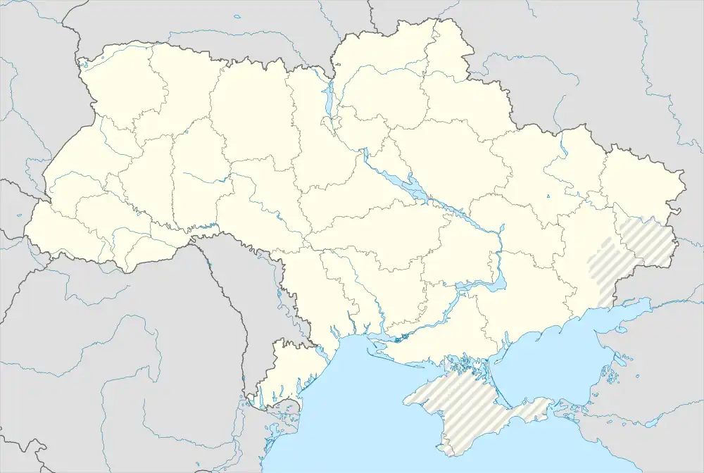
Location of major power stations in Ukraine:  Nuclear,
  Coal,
Coal,  Hydroelectric
The following page lists power stations in Ukraine.
Nuclear
In service
| Name | Location | Coordinates | Type | Capacity (MWe) | Commissioned | Notes | Refs |
|---|---|---|---|---|---|---|---|
| Khmelnytskyi | Netishyn | 50°18′09″N 26°38′52″E / 50.302512°N 26.647875°E | VVER | 2000 | 1987, 2004 | [1][2] | |
| Rivne | Varash | 51°19′37″N 25°53′26″E / 51.326857°N 25.890634°E | VVER | 2819 | 1980-2004 | [1][3] | |
| South Ukraine | Yuzhnoukrainsk | 47°48′43″N 31°13′03″E / 47.812031°N 31.217372°E | VVER | 3000 | 1982, 1985, 1989 | [1][4] | |
| Zaporizhzhia | Enerhodar | 47°30′31″N 34°35′04″E / 47.508519°N 34.584392°E | VVER | 6000 | 1984-1995 | The largest nuclear power plant in Europe | [1][5] |
Historic
| Name | Location | Coordinates | Type | Capacity, MWe | Operational | Notes | Refs |
|---|---|---|---|---|---|---|---|
| Chernobyl Unit 1 | Pripyat | 51°23′22″N 30°06′25″E / 51.389445°N 30.10682°E | RBMK | 1000 | 1977–1996 | [1] | |
| Chernobyl Unit 2 | 51°23′22″N 30°06′16″E / 51.389445°N 30.104406°E | RBMK | 1000 | 1978–1991 | [1] | ||
| Chernobyl Unit 3 | 51°23′23″N 30°06′02″E / 51.389586°N 30.100436°E | RBMK | 1000 | 1981–2000 | [1] | ||
| Chernobyl Unit 4 | 51°23′23″N 30°05′56″E / 51.389606°N 30.09902°E | RBMK | 1000 | 1983–1986 | Exploded in the Chernobyl accident | [1][6] | |
| Chernobyl Unit 5 | RBMK | 1000 | Never | ~75% Complete. Work stopped ~1989 | [1] | ||
| Chernobyl Unit 6 | RBMK | 1000 | Never | Building foundation & floor laid. Work stopped ~1989 | [1] | ||
| Crimea | Shcholkine | 45°23′31″N 35°48′13″E / 45.391937°N 35.803727°E | VVER | 1000 | Never | Remains unfinished Commenced 1975 Unit 1 80% complete and Unit 2 18% finished in 1989 | [1] |
| Chyhyryn | Chyhyryn | 49°05′05″N 32°47′07″E / 49.08472°N 32.78528°E | VVER | 1000 | Never | never finished since 1977 and stopped in 1989 | |
| Odesa | Teplodar | 46°27′38″N 30°18′58″E / 46.46056°N 30.31611°E | VVER | 1000 | Never | never finished since 1980 and stopped in 1986 | [7] |
| Kharkiv | Birky | 49°41′17.7″N 36°04′06.4″E / 49.688250°N 36.068444°E | VVER | 1000 | Never | never finished since 1986 and stopped in 1990 |
Hydroelectric
Thermal
Solar
| Name | Location | Coordinates | MW |
|---|---|---|---|
| Okhotnykovo Solar Park (Crimea) | Okhotnykove | 45°14′20″N 33°35′34″E / 45.23889°N 33.59278°E | 82.65 |
| Perovo Solar Park (Crimea) | Kliuchi | 44°55′N 34°02′E / 44.917°N 34.033°E | 100 |
| Starokozache Solar Park | Starokozache | 46°28′N 30°44′E / 46.467°N 30.733°E | 42.95 |
| Nikopol Solar Park | Starozavodske | 246 | |
| Danube Solar Park | Artsyz | 43.14 | |
| Mytiaeve Solar Park (Crimea) | Mytiaieve | 31.55 | |
| Lymanske Solar Park | Reni | 43.4 | |
| Tryfonivka Solar Park | Tryfonivka | 10 | |
| Solar Chornobyl | Pripyat | 100 | |
| Pokrovske Solar Park | Pokrovske | 240 | |
| Kamianets-Podilskyi Solar Park | Kamianets-Podilskyi | 63 |
Wind
- Botievska wind power plant - 200 MWp
- Zaporizhzhia wind power plant - 500 MWp
- Kramatorsk wind farm - 67,5 MWp
- Prymorska wind farm - 200 MWp
- Tiligul Wind Power Plant - 565 MWp
- Novoazovska wind farm - 107,5 MWp
- Krasnodon Wind Farm - 25 MWp
- Syvash wind farm - 246 MWp
- Orlivska Wind Power Plant - 100 MWp
See also
References
- 1 2 3 4 5 6 7 8 9 10 11 "Nuclear Power Plants in Lithuania & Ukraine". Gallery. Power Plants Around The World. 26 June 2011. Archived from the original on 9 December 2012. Retrieved 17 April 2014.
- ↑ "KHMELNITSKI-1". Power Reactor Information System. International Atomic Energy Agency. Retrieved 20 April 2014.
- ↑ "RIVNE-1". Power Reactor Information System. International Atomic Energy Agency. Retrieved 20 April 2014.
- ↑ "SOUTH UKRAINE-1". Power Reactor Information System. International Atomic Energy Agency. Retrieved 20 April 2014.
- ↑ "ZAPOROZHYE-1". Power Reactor Information System. International Atomic Energy Agency. Retrieved 20 April 2014.
- ↑ "CHERNOBYL-4". Power Reactor Information System. International Atomic Energy Agency. Retrieved 20 April 2014.
- ↑ "What is ATEC?". Blog. Sovietologist. 9 June 2008. Retrieved 20 April 2014.
- ↑ "Hydroelectric Power Plants in Ukraine". Gallery. Power Plants Around The World. 26 July 2010. Archived from the original on 8 December 2012. Retrieved 22 April 2014.
- ↑ "Dniprodzerzhynsk Hydroelectric Power Plant". Global Energy Observatory. Retrieved 22 April 2014.
- ↑ "Tashlyk PSPs". Public Joint Stock Company Ukrhidroprogect. Retrieved 22 April 2014.
- ↑ "Tashlyk Pumped Storage Hydroelectric Power Plant". Global Energy Observatory. Retrieved 22 April 2014.
- 1 2 3 4 5 6 7 8 9 10 NJSC - The characteristics of Thermal Power Plants Archived 2010-12-13 at the Wayback Machine
| Reactors of Power Stations |
| ||||||
|---|---|---|---|---|---|---|---|
| Other reactors |
| ||||||
| Companies | |||||||
| Related topics | |||||||
Harvesting and resource extraction in Ukraine | ||
|---|---|---|
| Mining |
| |
| Agriculture |
| |
| Energy |
| |
This article is issued from Wikipedia. The text is licensed under Creative Commons - Attribution - Sharealike. Additional terms may apply for the media files.