


This is a list of lakes in New Zealand.
A lake's location is identified by the region and either the territorial authority or national park (N.P.).
There are:
- 43 lakes with a surface area larger than 10 km2 (1000 ha)
- 231 lakes greater than 0.5 km2 (50 ha)
- 3822 lakes greater than 0.01 km2 (1 ha)
Largest
Lakes with a surface area of more than 10 square kilometres (3.9 sq mi)
| Rank | Name | Surface area | Region | Notes |
|---|---|---|---|---|
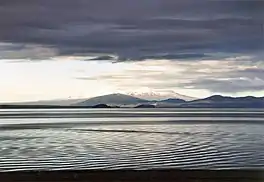
| 1 | Lake Taupō | 616 km2 (238 sq mi) | Waikato | Largest lake in New Zealand; second-largest freshwater lake in Oceania |
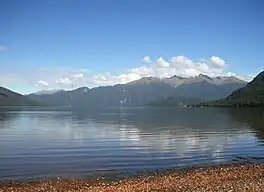
| 2 | Lake Te Anau | 344 km2 (133 sq mi) | Southland | Largest lake in the South Island |
| 3 | Lake Wakatipu | 291 km2 (112 sq mi) | Otago | Longest lake in New Zealand (80 kilometres (50 mi)) |
| 4 | Lake Wānaka | 192 km2 (74 sq mi) | Otago | |
| 5= | Lake Ellesmere / Te Waihora | 180 km2 (69 sq mi) | Canterbury | Largest lagoon in mainland New Zealand |
| 5= | Te Whanga Lagoon | 180 km2 (69 sq mi) | Chatham Island | Largest lake outside the North Island and South Island |
| 7 | Lake Pukaki | 179 km2 (69 sq mi) | Canterbury | |
| 8 | Lake Manapouri | 142 km2 (55 sq mi) | Southland | Contains largest inland island within New Zealand, Pomona Island |
| 9 | Lake Hāwea | 141 km2 (54 sq mi) | Otago | |
| 10 | Lake Tekapo | 83 km2 (32 sq mi) | Canterbury | |
| 11 | Lake Rotorua / Te Rotorua nui ā Kahumatamomoe | 79 km2 (31 sq mi) | Bay of Plenty | |
| 12 | Lake Wairarapa | 78 km2 (30 sq mi) | Wellington | |
| 13 | Lake Benmore | 75 km2 (29 sq mi) | Canterbury/Otago | Largest artificial lake in New Zealand |
| 14 | Lake Hauroko | 63 km2 (24 sq mi) | Southland | Deepest lake in New Zealand |
| 15 | Lake Ōhau | 63 km2 (24 sq mi) | Canterbury | |
| 16 | Lake Waikaremoana | 54 km2 (21 sq mi) | Hawke's Bay | |
| 17 | Lake Coleridge | 47 km2 (18 sq mi) | Canterbury | |
| 18 | Lake Poteriteri | 43 km2 (17 sq mi) | Southland | Largest lake in New Zealand without road access |
| 19 | Lake Brunner / Moana | 40 km2 (15 sq mi) | West Coast | |
| 20 | Lake Tarawera | 39 km2 (15 sq mi) | Bay of Plenty | |
| 21 | Lake Rotoiti / Te Roto kite ā Ihenga i ariki ai Kahu | 35 km2 (14 sq mi) | Bay of Plenty | |
| 22 | Lake Waikare | 34 km2 (13 sq mi) | Waikato | |
| 23 | Lake Monowai | 31 km2 (12 sq mi) | Southland | |
| 24 | Lake Aviemore | 29 km2 (11 sq mi) | Canterbury | Artificial |
| 25 | Lake McKerrow / Whakatipu Waitai | 28 km2 (11 sq mi) | Southland | |
| 26 | Lake Dunstan | 26 km2 (10 sq mi) | Otago | Artificial |
| 27 | Lake Rotoroa | 23.5 km2 (9.1 sq mi) | Tasman | Largest lake in the Tasman Region |
| 28 | Lake Kaniere | 22 km2 (8.5 sq mi) | West Coast | |
| 29= | Lake Ōmāpere | 14 km2 (5.4 sq mi) | Northland | |
| 29= | Lake Sumner | 14 km2 (5.4 sq mi) | Canterbury | |
| 31 | Lake Rotoaira | 13 km2 (5.0 sq mi) | Waikato | |
| 32= | Ōkārito Lagoon | 12 km2 (4.6 sq mi) | West Coast | |
| 32= | Lake Ohakuri | 12 km2 (4.6 sq mi) | Waikato | Artificial |
| 33 | Lake Rotomā | 11.2 km2 (4.3 sq mi) | Bay of Plenty | |
| +9 other lakes | >10 km2 |
Deepest lakes
Maximum depth and average depth in metres:
- Lake Hauroko: 462 and ~117.
- Lake Manapouri: 444 and 149.
- Lake Te Anau: 425 and ~169.
- Lake Wakatipu: 420 and 130.
- Lake Hāwea: 392 and ~101.
- Lake Wānaka: ~311 and 99.
These six lakes are all in the South Island. The deepest lake in the North Island is Lake Waikaremoana, which has a depth of 256 m.[1]
North Island
Northland
The following lakes are located in the Northland Region.
Auckland
The following lakes are located in the Auckland Region.
Many of the lakes in the Auckland Region are man made reservoirs, constructed in the hilly catchment areas of the Waitakere and Hunua ranges in order to provide a water supply for the Auckland urban area.
Waikato
The following lakes are located in the Waikato region. The various pools of the Tongariro River system, as listed below, can be found in detail on their own page at Pools of the Tongariro River.
Pools of the Tongariro River
The following is a list of named pools on the Tongariro River. Full details of these pools, many of which are little more than widenings of the river or clear areas of the river's delta marshes, can be found at Pools of the Tongariro River.
- Admirals Pool
- Bain Pool
- Barlows Pool
- Beggs Pool
- Big Bend Pool
- Blue Pool
- Boulder Pool
- Breakaway Pool
- Breakfast Pool
- Cattle Rustlers Pool
- Cherry Pool
- Cliff Pool
- Cobham Pool
- Dans Pool
- DeLatours Pool
- Downs Pool
- Duchess Pool
- Fan Pool
- Fence Pool
- Graces Pool
- Hydro Pool
- Island Pool
- Jellicoe Pool
- Jones Pool
- Judges Pool
- Kamahi Pool
- Log Pool
- Lonely Pool
- Lower Birch Pool
- Major Jones Pool
- Never Fail Pool
- Poplar Pool
- Poutu Pool
- Red Hut Pool
- Reed Pool
- Sand Pool
- Shag Pool
- Silly Pool
- Stag Pool
- Swirl Pool
- The Bends Pool
- The Rip
- Upper Birch Pool
- Upper Island Pool
- Waddells Pool
- Whitikau Pool
Bay of Plenty
The following lakes are located in the Bay of Plenty Region.
Gisborne
The following lakes are located in the Gisborne Region.
| Lake | Location | Area | Notes | Coordinates | |||||
|---|---|---|---|---|---|---|---|---|---|
| Lake Karangata | Gisborne District | Between Gisborne and Wairoa, south of the Tiniroto Lakes | 38°46′20″S 177°32′40″E / 38.77222°S 177.54444°E | ||||||
| Lake Repongaere | Gisborne District | North of Patutahi | 38°35′45″S 177°52′30″E / 38.59583°S 177.87500°E | ||||||
| Lake Rotokaha | Gisborne District | Between Gisborne and Wairoa, southeast of the Tiniroto Lakes | 38°46′30″S 177°33′30″E / 38.77500°S 177.55833°E | ||||||
| Otopotehetehe Lake | Gisborne District | West of Hicks Bay | 37°36′55″S 178°08′20″E / 37.61528°S 178.13889°E | ||||||
| Lake Te Horonui | Gisborne District | 30 ha (74 acres) | On the Hawke's Bay region boundary, with a smaller Lake Tukemokihi just downstream | - | Tiniroto Lakes | Gisborne District | Between Gisborne and Wairoa | 38°46′05″S 177°32′30″E / 38.76806°S 177.54167°E | |
| Wherowhero Lagoon | Gisborne District | Close to Muriwai at the south end of Poverty Bay | 38°44′30″S 177°56′10″E / 38.74167°S 177.93611°E | ||||||
Hawke's Bay
The following lakes are located in the Hawke's Bay Region.
Taranaki
The following lakes are located in the Taranaki Region.
Manawatū-Whanganui
The following lakes are located in the Manawatū-Whanganui region.
Wellington
The following lakes are located in the Wellington Region.
South Island
Tasman
The following lakes are located in the Tasman Region.
Nelson
The following lakes are located in the Nelson Region.
| Lake | Location | Area | Notes | Coordinates |
|---|---|---|---|---|
| Dew Lakes | Nelson | 41°19′31″S 173°24′38″E / 41.32528°S 173.41056°E | ||
| Maitai Dam | Nelson | Reservoir | 41°17′40″S 173°22′30″E / 41.29444°S 173.37500°E | |
| Rush Pool | Nelson | 41°18′42″S 173°23′12″E / 41.31167°S 173.38667°E | ||
Marlborough
The following lakes are located in the Marlborough Region.
West Coast
The following lakes are located in the West Coast region.
Canterbury
The following lakes are located in the Canterbury region.
Otago
The following lakes are located in the Otago region.
Southland
The following lakes are located in the Southland region.
Other islands
Auckland Islands
| Lake | Location | Area | Notes | Coordinates |
|---|---|---|---|---|
| Lake Hinemoa | Northern Auckland Island | 0.17 km2 | Upper reaches of a moraine-dammed fiord. Lower reaches form Musgrave Inlet.[27] | 50°38′55″S 166°08′20″E / 50.64861°S 166.13889°E |
| Lake Speight | Southwestern Auckland Island | 0.04 km2 | Stream flows from lake to Coleridge Bay, Carnley Harbour.[27] | 50°49′15″S 165°58′50″E / 50.82083°S 165.98056°E |
| Lake Turbott | Southern Adams Island | 0.20 km2 | Moraine dammed fiord.[27] | 50°54′30″S 166°02′50″E / 50.90833°S 166.04722°E |
| Lake Tutanekai | Northern Auckland Island | 0.08 km2 | Upper reaches of a moraine-dammed fiord. Lower reaches form Granger Inlet.[27] | 50°37′40″S 166°09′20″E / 50.62778°S 166.15556°E |
| Teal Lake | Enderby Island | 0.003 km2 | Small pool close to south shore of the island.[27] | 50°30′21″S 166°18′31″E / 50.50583°S 166.30861°E |
Campbell Island
| Lake | Location | Area | Notes | Coordinates |
|---|---|---|---|---|
| Six Foot Lake | Southern Campbell Island | 0.08 km2 | Separated from Monument Harbour on the south coast by a narrow channel.[28] | 52°35′20″S 169°08′50″E / 52.58889°S 169.14722°E |
Chatham Islands
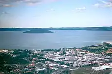
Many of the lakes in the Chatham Islands are either lagoons filling sinkholes in the island's limestone structure, or low-lying peat lakes. The island chain is dominated by Te Whanga Lagoon, which occupies the centre of the main island and accounts for one sixth of the surface area of the archipelago.
Cook Islands
| Lake | Location | Area | Notes | Coordinates |
|---|---|---|---|---|
| Lake Tiriara | Mangaia | 21°57′03″S 157°55′45″W / 21.95083°S 157.92917°W | ||
| Lake Tiroto | Aitu Island | 20°00′35″S 158°07′25″W / 20.00972°S 158.12361°W | ||
| Te Rotonui | Mitiaro | 19°52′02″S 157°41′34″W / 19.86722°S 157.69278°W |
Kermadec Islands
| Lake | Location | Area | Notes | Coordinates |
|---|---|---|---|---|
| Blue Lake | Raoul Island | 0.80 km2 | Crater lake | 29°15′20″S 177°54′50″W / 29.25556°S 177.91389°W |
| Green Lake | Raoul Island | 0.15 km2 | Crater lake | 29°15′50″S 177°55′09″W / 29.26389°S 177.91917°W |
Ross Dependency
The following lakes are located in Ross Dependency, New Zealand's claim in Antarctica.
See also
References
- ↑ Lowe, D.J.; Green, J.D. (1987). Viner, A.B. (ed.). Inland waters of New Zealand. Wellington: DSIR Science Information Publishing Centre. pp. 471–474. ISBN 0-477-06799-9.
- ↑ Hayward, Bruce W (July 2019). "The campaign to Save Crater Hill continues" (PDF).
- ↑ "Bromley exhibits" (PDF). Waikato Regional Council.
- 1 2 3 4 5 6 7 8 9 10 11 12 13 14 15 16 17 18 19 20 21 22 23 24 25 26 27 28 29 30 31 32 33 34 "Waikato Regional Council Technical Report 2011/05 Significant Natural Areas of the Waikato Region – Lake Ecosystems" (PDF).
- 1 2 3 4 5 6 7 8 9 10 11 12 13 14 15 16 17 18 19 20 21 22 23 24 25 26 27 28 29 30 31 32 33 34 35 36 37 38 39 40 41 42 43 44 45 46 47 48 49 50 51 52 53 54 55 56 57 58 59 60 61 62 63 64 65 66 67 68 69 70 71 72 73 74 75 76 77 78 79 80 81 82 83 84 85 86 87 88 89 90 91 92 93 94 95 96 97 98 99 100 101 102 103 104 105 106 107 108 109 110 111 112 113 114 115 "Shallow lakes management plan: Volume 2" (PDF). Waikato Regional Council. 10 October 2014.
- 1 2 3 4 5 6 7 8 9 10 11 12 13 14 15 16 17 18 19 20 21 22 23 24 25 26 27 28 29 30 31 32 33 34 35 36 37 38 39 40 41 42 43 44 45 46 47 48 49 "How we monitor". Waikato Regional Council. Retrieved 3 October 2017.
- 1 2 "Lake Kaituna (B)". www.waikatoregion.govt.nz. Retrieved 4 January 2016.
- ↑ Peters, Monica. "Monitoring & Management Plan" (PDF). Landcare.
- ↑ "Huntly Domain and Lake Hakanoa Reserve Management Plan" (PDF). Waikato District Council. 28 August 2012.
- ↑ "Environment Waikato Technical Report 2008/36 The Condition of 43 Lakes in the Waikato Region Using Lake SPI" (PDF).
- ↑ Peters, Monica (14 September 2015). "Lake Koromatua: One = 1000 community restoration projects". monicalogues. Retrieved 31 August 2016.
- ↑ "Waipa District Council Draft Lake Management Plan para 11.1" (PDF). www.waipadc.govt.nz. Retrieved 31 August 2016.
- ↑ "Significant Natural Areas of the Waikato Region – Lake Ecosystems" (PDF). Waikato Regional Council. p. 205. Archived from the original (PDF) on 5 October 2013.
- ↑ NIWA (December 2005). "The condition of lakes in the Waikato Region using SPI" (PDF). Archived from the original (PDF) on 29 October 2013.
- ↑ "Field Trip to Twin Dune Lakes • Awhitu Landcare". www.awhitu.org.nz. Retrieved 21 June 2016.
- ↑ "Puketirini management plan" (PDF). Waikato District Council. 2009.
- ↑ "Land, Air, Water Aotearoa – Lake Waahi". www.lawa.org.nz. Retrieved 28 May 2017.
- 1 2 3 4 5 6 7 8 9 10 Waters S, Kelly D, Doehring K, Floerl L (26 September 2018). "Restoration planning for shallow dune lakes: data review and recommendations" (PDF).
{{cite web}}: CS1 maint: multiple names: authors list (link) - ↑ "50th NZFSS Annual Conference Handbook" (PDF). 2018.
- ↑ "Disappearing Lake". gazetteer.linz.govt.nz. 12 June 1986. Retrieved 2 June 2023.
- ↑ "Lake Hochstetter". lakes380.com/. Retrieved 2 January 2023.
- ↑ "REVIEW. LYTTELTON TIMES". paperspast.natlib.govt.nz. 13 March 1861. Retrieved 2 January 2023.
- ↑ Henderson, J. (John); New Zealand. Geological Survey Branch (1917). The geology and mineral resources of the Reefton subdivision : Westport and North Westland divisions. University of Connecticut Libraries. Wellington, [N.Z.] : by authority Marcus F. Marks, Govt. Printer.
- ↑ "Draft Terrestrial Ecology Report - Te Kuha" (PDF). DoC. October 2013.
- ↑ "A Directory of Wetlands in New Zealand" (PDF). Department of Conservation.
- 1 2 "Canterbury high country lakes water quality monitoring programme 2007 Table 2.1" (PDF).
- 1 2 3 4 5 "Auckland Islands," Te Ara: The Encyclopedia of New Zealand. Retrieved 31 March 2019.
- ↑ "Campbell Island," Te Ara: The Encyclopedia of New Zealand. Retrieved 31 March 2019.
External links
- Land Information New Zealand – New Zealand Government department.