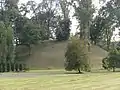
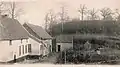
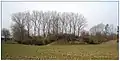
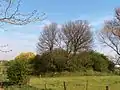
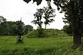
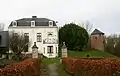
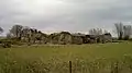
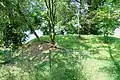
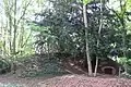
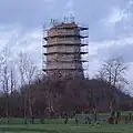
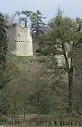
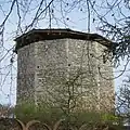
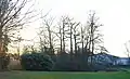
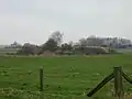
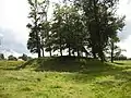
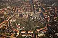
This list gives an overview of motte-and-bailey castles in Belgium with a motte that is still visible and that hasn't been completely levelled or disappeared. This list is not exhaustive.

List of motte castles in Belgium
ProvinceLocationTownNameHeritageCoordinatesImage
AntwerpBornemBornemDen Dulft10609151°05′43″N 4°13′48″E / 51.09532°N 4.23001°E / 51.09532; 4.23001
AntwerpBrechtBrechtWaterhoeve51°21′02″N 4°38′47″E / 51.35048°N 4.64652°E / 51.35048; 4.64652
AntwerpWestmeerbeekHulshoutOud Hof ter Borgt51°03′49″N 4°50′15″E / 51.06373°N 4.83740°E / 51.06373; 4.83740
AntwerpKontichKontichMotte bij Neerhoeve1352451°07′21″N 4°26′43″E / 51.12256°N 4.44522°E / 51.12256; 4.44522
AntwerpKontichKontichMotte van Boutersem14014551°08′10″N 4°27′44″E / 51.13617°N 4.46230°E / 51.13617; 4.46230
AntwerpPoederleeLilleOuden Hofberg51°12′45″N 4°50′18″E / 51.21245°N 4.83844°E / 51.21245; 4.83844
AntwerpRanstRanstZevenbergen51°11′42″N 4°33′23″E / 51.19505°N 4.55644°E / 51.19505; 4.55644
BrusselsBoitsfortWatermael-BoitsfortHondenberg50°47′50″N 4°24′58″E / 50.79729°N 4.41621°E / 50.79729; 4.41621
East FlandersMoorselAalstHof te Eksel30775850°56′37″N 4°05′38″E / 50.94354°N 4.09388°E / 50.94354; 4.09388
East FlandersTeralfeneAffligemAlvinneberg50°53′23″N 4°05′24″E / 50.88974°N 4.09009°E / 50.88974; 4.09009
East FlandersBeveren-WaasBeverenSingelberg841051°14′07″N 4°14′41″E / 51.23531°N 4.24479°E / 51.23531; 4.24479
East FlandersLiedekerkeDenderleeuwKasteelberg50°52′21″N 4°04′43″E / 50.87239°N 4.07857°E / 50.87239; 4.07857
East FlandersErpeErpe-MereKasteelberg9573950°56′07″N 3°58′33″E / 50.93515°N 3.97576°E / 50.93515; 3.97576
East FlandersErtveldeEvergemHoge Wal1096551°10′15″N 3°44′27″E / 51.17093°N 3.74088°E / 51.17093; 3.74088
East FlandersHeldergemHaaltertBoonhof30784450°53′08″N 3°56′48″E / 50.88556°N 3.94663°E / 50.88556; 3.94663
East FlandersRessegemHerzeleMotte De Wal925150°53′30″N 3°54′43″E / 50.89170°N 3.91194°E / 50.89170; 3.91194
East FlandersMunteMerelbekeKalvarieberg870950°56′37″N 3°44′30″E / 50.94360°N 3.74175°E / 50.94360; 3.74175
East FlandersBevereOudenaardeHof de Bruwaan50°51′41″N 3°35′05″E / 50.86144°N 3.58462°E / 50.86144; 3.58462
East FlandersMullemOudenaardeKlein Kasteeltje50°53′45″N 3°36′11″E / 50.89581°N 3.60319°E / 50.89581; 3.60319
East FlandersKemzekeStekeneAlvinusberg51°13′20″N 4°03′28″E / 51.2221°N 4.0579°E / 51.2221; 4.0579
East FlandersRoborstZwalmMotte van Roborst1102950°51′51″N 3°45′23″E / 50.86424°N 3.75640°E / 50.86424; 3.75640
Flemish BrabantBeverBeverBurght50°43′12″N 3°55′09″E / 50.71992°N 3.91917°E / 50.71992; 3.91917
Flemish BrabantButselBoutersemMotte12250°50′25″N 4°50′52″E / 50.84022°N 4.84785°E / 50.84022; 4.84785
Flemish BrabantDiestDiestTafelrondemotte55350°59′07″N 5°03′29″E / 50.98539°N 5.05819°E / 50.98539; 5.05819
Flemish BrabantGroot-BijgaardenDilbeekDonjon130450°52′24″N 4°15′49″E / 50.87331°N 4.26359°E / 50.87331; 4.26359
Flemish BrabantGeetbetsGeetbetsMotte50°53′19″N 5°07′07″E / 50.88851°N 5.11848°E / 50.88851; 5.11848
Flemish BrabantBorgtGrimbergenSenecaberg4394350°55′41″N 4°24′32″E / 50.9280°N 4.4088°E / 50.9280; 4.4088
Flemish BrabantSint-Agatha-RodeHuldenbergMotte50°47′11″N 4°38′09″E / 50.78644°N 4.63596°E / 50.78644; 4.63596
Flemish BrabantWaanrodeKortenbergMotte13419550°54′47″N 4°59′42″E / 50.91314°N 4.99493°E / 50.91314; 4.99493
Flemish BrabantLandenLandenHunsberg130150°44′53″N 5°03′56″E / 50.74817°N 5.06568°E / 50.74817; 5.06568
Flemish BrabantLandenLandenTombe van Pepijn129650°44′50″N 5°03′46″E / 50.74716°N 5.06267°E / 50.74716; 5.06267
Flemish BrabantRumsdorpLandenMotte van Rumsdorp57150°46′04″N 5°04′34″E / 50.76788°N 5.07616°E / 50.76788; 5.07616
Flemish BrabantWangeLandenMotte van Wange134050°47′14″N 5°01′48″E / 50.78715°N 5.03003°E / 50.78715; 5.03003
Flemish BrabantLonderzeelLonderzeelMotte De Burcht96251°00′06″N 4°18′02″E / 51.00180°N 4.30054°E / 51.00180; 4.30054
Flemish BrabantLubbeekLubbeekHof ter Hove/Stakenberg50°53′10″N 4°50′45″E / 50.8860°N 4.8457°E / 50.8860; 4.8457
Flemish BrabantSint-Brixius-RodeMeiseDe Borcht4566350°57′38″N 4°20′02″E / 50.96047°N 4.33390°E / 50.96047; 4.33390
Flemish BrabantMerchtemMerchtemHunsberg50°57′07″N 4°15′55″E / 50.95189°N 4.26528°E / 50.95189; 4.26528
Flemish BrabantMerchtemMerchtemBurcht3601450°57′31″N 4°14′05″E / 50.95873°N 4.23470°E / 50.95873; 4.23470
Flemish BrabantTieltTielt-WingeMotte Butsberg50°56′17″N 4°54′56″E / 50.93797°N 4.91548°E / 50.93797; 4.91548
Flemish BrabantZoutleeuwZoutleeuwCastelberg50°50′37″N 5°07′27″E / 50.84355°N 5.12407°E / 50.84355; 5.12407
HainautWarnetonComines-WarnetonMontagne du Château50°45′15″N 2°57′16″E / 50.75404°N 2.95432°E / 50.75404; 2.95432
HainautEnghienEnghienMotte de Brabant55010-CLT-0016-0150°41′37″N 4°02′33″E / 50.69351°N 4.04242°E / 50.69351; 4.04242
HainautLabliauEnghienMotte50°39′55″N 3°59′14″E / 50.6652°N 3.9873°E / 50.6652; 3.9873
HainautMarcqEnghienMotte de Bornival50°41′39″N 4°00′58″E / 50.69414°N 4.01614°E / 50.69414; 4.01614
HainautPetit-EngienEnghienMotte de Strihoux50°42′28″N 4°05′08″E / 50.70774°N 4.08567°E / 50.70774; 4.08567
HainautNechinEstaimpuisChâteau de la Royère50°40′33″N 3°16′33″E / 50.67572°N 3.27587°E / 50.67572; 3.27587
HainautQuaregnonQuaregnonCatiau du Diable53065-CLT-0004-0150°26′42″N 3°51′48″E / 50.4449°N 3.8634°E / 50.4449; 3.8634
HainautHovesSillyMotte féodale55039-CLT-0007-01650°40′14″N 4°02′04″E / 50.67056°N 4.03441°E / 50.67056; 4.03441
LiègeFoozAwansMotte féodale de Fooz62006-INV-0010-0150°40′46″N 5°26′18″E / 50.67941°N 5.43842°E / 50.67941; 5.43842
LiègeVille-en-HesbayeBraivesMotte50°36′58″N 5°06′56″E / 50.61603°N 5.11549°E / 50.61603; 5.11549
LiègeHaneffeDonceelMontagne du Maison forte50°38′19″N 5°19′04″E / 50.63873°N 5.31768°E / 50.63873; 5.31768
LiègeCellesFaimesMotte féodale64076-CLT-0001-0150°39′47″N 5°15′36″E / 50.66318°N 5.25993°E / 50.66318; 5.25993
LiègeLes WaleffesFaimesMotte féodale50°38′24″N 5°13′10″E / 50.64010°N 5.21942°E / 50.64010; 5.21942
LiègeOmalGeerMotte d’Omal64029-CLT-0021-0150°39′29″N 5°11′49″E / 50.65812°N 5.19689°E / 50.65812; 5.19689
LiègeHannutHannutPetit Bosquet64034-CLT-0015-0150°40′14″N 5°04′34″E / 50.67058°N 5.07614°E / 50.67058; 5.07614
LiègeLiersHerstalMotte féodale de Liers62051-CLT-0006-0150°41′38″N 5°33′54″E / 50.69380°N 5.56490°E / 50.69380; 5.56490
LiègeLamineRemicourtMotte castrale de Lamine 64063-CLT-0004-0150°41′22″N 5°20′10″E / 50.68945°N 5.33610°E / 50.68945; 5.33610
LiègeFize-FontaineVillers-le-BouilletMotte50°35′10″N 5°16′43″E / 50.58605°N 5.27849°E / 50.58605; 5.27849
LiègeVieux-WaleffeVillers-le-BouilletMotte féodale
LiègeWarnant-DreyeVillers-le-BouilletFerme des Burettes50°35′46″N 5°14′02″E / 50.59605°N 5.23390°E / 50.59605; 5.23390
LimburgTerkoestAlkenMot3170150°53′35″N 5°16′44″E / 50.89312°N 5.27891°E / 50.89312; 5.27891
LimburgBeverstBilzenSchuylenborg mot50°53′15″N 5°28′11″E / 50.88753°N 5.46970°E / 50.88753; 5.46970
LimburgGrote-SpouwenBilzenHeuvel50°50′01″N 5°33′08″E / 50.83362°N 5.55233°E / 50.83362; 5.55233
LimburgBorgloonBorgloonBurcht van Loon191650°48′03″N 5°20′38″E / 50.80089°N 5.34399°E / 50.80089; 5.34399
LimburgWaterscheiGenkMotteruïne Stalengoed50°59′14″N 5°30′54″E / 50.98724°N 5.51510°E / 50.98724; 5.51510
LimburgHasseltHasseltHenegauw50°53′40″N 5°21′03″E / 50.89432°N 5.35076°E / 50.89432; 5.35076
LimburgKuringenHasseltPrinsenhof2091350°56′40″N 5°18′31″E / 50.94437°N 5.30862°E / 50.94437; 5.30862
LimburgStevoortHasseltAsberg50°54′24″N 5°13′43″E / 50.90673°N 5.22867°E / 50.90673; 5.22867
LimburgHorpmaalHeersMotte hill3211050°45′22″N 5°20′11″E / 50.75602°N 5.33628°E / 50.75602; 5.33628
LimburgHoeseltHoeseltMot319750°51′06″N 5°29′04″E / 50.85178°N 5.48446°E / 50.85178; 5.48446
LimburgRomershovenHoeseltBlokkes-motte50°51′26″N 5°27′46″E / 50.85718°N 5.46265°E / 50.85718; 5.46265
LimburgWermHoeseltTom50°50′03″N 5°28′48″E / 50.83406°N 5.48007°E / 50.83406; 5.48007
LimburgKessenichKinrooiMotte of Kessenich320651°09′02″N 5°49′27″E / 51.15054°N 5.82430°E / 51.15054; 5.82430
LimburgGellikLanakenMotte in de Burg322350°52′50″N 5°36′34″E / 50.88067°N 5.60943°E / 50.88067; 5.60943
LimburgMillenRiemstToem364350°47′13″N 5°33′44″E / 50.78689°N 5.56235°E / 50.78689; 5.56235
LimburgBrustemSint-TruidenTorenburcht339350°48′06″N 5°13′03″E / 50.801667°N 5.2175°E / 50.801667; 5.2175
LimburgZepperenSint-TruidenNatenbampt50°50′48″N 5°15′08″E / 50.84662°N 5.25229°E / 50.84662; 5.25229
LimburgKolmontTongerenBurcht van Kolmont3752850°47′58″N 5°25′23″E / 50.79931°N 5.42297°E / 50.79931; 5.42297
LimburgMulkenTongerenBurchttoren van Mulken3742550°47′23″N 5°26′41″E / 50.78984°N 5.44467°E / 50.78984; 5.44467
LimburgRuttenTongerenMot205050°44′46″N 5°26′47″E / 50.74600°N 5.44635°E / 50.74600; 5.44635
LimburgWellenWellenMot50°51′11″N 5°20′45″E / 50.85304°N 5.34570°E / 50.85304; 5.34570
LuxembourgHeinstertAttertBurgknapp49°45′06″N 5°43′35″E / 49.75175°N 5.72640°E / 49.75175; 5.72640
LuxembourgBouillonBouillonBeaumont La ramonette49°47′22″N 5°03′46″E / 49.78941°N 5.06271°E / 49.78941; 5.06271
LuxembourgBuzenolÉtalleMontauban-motte85009-CLT-0001-0149°37′45″N 5°35′39″E / 49.62913°N 5.59415°E / 49.62913; 5.59415

LuxembourgBodangeFauvillersAlt Schlass (Vieux Château)49°51′42″N 5°41′25″E / 49.8618°N 5.6904°E / 49.8618; 5.6904
LuxembourgMellierLégliseHaut-de-la-Cour-motte84033-CLT-0001-0149°46′06″N 5°31′04″E / 49.7683°N 5.5177°E / 49.7683; 5.5177
LuxembourgMarcourtRendeuxMotte de l'Ermitage Saint-Thibaut50°12′36″N 5°31′00″E / 50.20989°N 5.51676°E / 50.20989; 5.51676
LuxembourgMirwartSaint-HubertMirwart Castle84059-CLT-0006-0150°03′17″N 5°15′28″E / 50.05466°N 5.25784°E / 50.05466; 5.25784
NamurAublainCouvinMotte féodale50°03′57″N 4°24′50″E / 50.06575°N 4.41386°E / 50.06575; 4.41386
NamurLiernuEghézéeMotte Del Rigadrie50°35′02″N 4°49′59″E / 50.58398°N 4.83313°E / 50.58398; 4.83313
NamurHaltinneGesvesMotte92054-CLT-0014-0150°27′02″N 5°04′30″E / 50.45058°N 5.07512°E / 50.45058; 5.07512
NamurPetite-HourHouyetChâteau de Hour91072-INV-0226-0150°10′14″N 5°01′39″E / 50.17048°N 5.02739°E / 50.17048; 5.02739
NamurSugnyVresse-sur-SemoisTchesté de la Rotche49°49′54″N 4°53′57″E / 49.83156°N 4.89923°E / 49.83156; 4.89923
Walloon BrabantBraine-le-ChâteauBraine-le-ChâteauLes Monts25015-CLT-0013-0150°41′12″N 4°15′37″E / 50.68670°N 4.26038°E / 50.68670; 4.26038
Walloon BrabantNethenGrez-DoiceauMotte de Nethen25037-CLT-0013-0150°47′03″N 4°40′32″E / 50.78429°N 4.67566°E / 50.78429; 4.67566
Walloon BrabantLasneLasneMotte50°41′09″N 4°29′22″E / 50.6857°N 4.4894°E / 50.6857; 4.4894
West FlandersDudzeleBrugesSchottenhof7457751°16′30″N 3°14′03″E / 51.27511°N 3.23415°E / 51.27511; 3.23415
West FlandersOostkerkeDammeHof van Lembeke51°16′09″N 3°18′16″E / 51.26920°N 3.30458°E / 51.26920; 3.30458
West FlandersOostkerkeDammeTen Doele6960351°17′53″N 3°18′03″E / 51.29799°N 3.30083°E / 51.29799; 3.30083
West FlandersOostkerkeDammeMotte ‘t Wallant3060551°17′08″N 3°17′17″E / 51.28548°N 3.28797°E / 51.28548; 3.28797
West FlandersGistelGistelGodelievemotte5200251°09′02″N 2°55′35″E / 51.15045°N 2.92647°E / 51.15045; 2.92647
West FlandersLokerHeuvellandGalooie-Mote1239450°46′40″N 2°46′14″E / 50.77767°N 2.77043°E / 50.77767; 2.77043
West FlandersMerkemHouthulstHoge Mote2858350°57′30″N 2°53′39″E / 50.95826°N 2.89410°E / 50.95826; 2.89410
West FlandersWerkenKortemarkHogen Andjoen1177251°01′44″N 2°57′42″E / 51.02876°N 2.96168°E / 51.02876; 2.96168
West FlandersWerkenKortemarkVrouwhillewal4944351°02′55″N 2°59′00″E / 51.04863°N 2.98346°E / 51.04863; 2.98346
West FlandersReningelstPoperingeMotte van kasteel van Reningelst1346650°49′00″N 2°45′53″E / 50.81659°N 2.7648°E / 50.81659; 2.7648
West FlandersSpiereSpiere-HelkijnCave aux diables1310950°43′41″N 3°20′57″E / 50.72809°N 3.34906°E / 50.72809; 3.34906
West FlandersVeurneVeurneWarandemotte51°04′20″N 2°39′37″E / 51.07231°N 2.66040°E / 51.07231; 2.66040
This article is issued from Wikipedia. The text is licensed under Creative Commons - Attribution - Sharealike. Additional terms may apply for the media files.