There are at least 59 named mountains in Granite County, Montana.
- Anaconda Hill, 46°49′55″N 113°20′56″W / 46.83194°N 113.34889°W, el. 6,214 feet (1,894 m)[1]
- Anderson Hill, 46°49′08″N 113°19′21″W / 46.81889°N 113.32250°W, el. 6,854 feet (2,089 m)[2]
- Babcock Mountain, 46°40′45″N 113°38′24″W / 46.67917°N 113.64000°W, el. 6,361 feet (1,939 m)[3]
- Burnt Mountain, 46°40′38″N 113°36′12″W / 46.67722°N 113.60333°W, el. 6,365 feet (1,940 m)[4]
- Cable Mountain, 46°15′10″N 113°11′36″W / 46.25278°N 113.19333°W, el. 8,143 feet (2,482 m)[5]
- Cinnabar Point, 46°33′59″N 113°48′14″W / 46.56639°N 113.80389°W, el. 7,241 feet (2,207 m)[6]
- Cinnamon Bear Point, 46°33′24″N 113°46′14″W / 46.55667°N 113.77056°W, el. 7,080 feet (2,160 m)[7]
- Congdon Peak, 46°05′10″N 113°46′16″W / 46.08611°N 113.77111°W, el. 8,894 feet (2,711 m)[8]
- Cutaway Mountain, 46°01′50″N 113°21′53″W / 46.03056°N 113.36472°W, el. 9,206 feet (2,806 m)[9]
- Douglas Mountain, 46°29′48″N 113°09′05″W / 46.49667°N 113.15139°W, el. 6,217 feet (1,895 m)[10]
- Duffy Hill, 46°19′50″N 113°17′55″W / 46.33056°N 113.29861°W, el. 5,331 feet (1,625 m)[11]
- Eagle Point, 46°22′57″N 113°47′58″W / 46.38250°N 113.79944°W, el. 7,979 feet (2,432 m)[12]
- East Hill, 46°40′07″N 113°35′02″W / 46.66861°N 113.58389°W, el. 6,132 feet (1,869 m)[13]
- Emerine Mount, 46°11′16″N 113°38′01″W / 46.18778°N 113.63361°W, el. 8,629 feet (2,630 m)[14]
- Fisher Point, Granite County, 46°24′42″N 113°39′54″W / 46.41167°N 113.66500°W, el. 6,913 feet (2,107 m)[15]
- Fox Peak, Granite County, 46°06′07″N 113°45′58″W / 46.10194°N 113.76611°W, el. 8,783 feet (2,677 m)[16]
- Franklin Hill, 46°19′15″N 113°15′58″W / 46.32083°N 113.26611°W, el. 6,818 feet (2,078 m)[17]
- Goat Mountain, 46°23′00″N 113°03′55″W / 46.38333°N 113.06528°W, el. 9,190 feet (2,800 m)[18]
- Golden Mountain, 46°38′27″N 113°35′05″W / 46.64083°N 113.58472°W, el. 6,617 feet (2,017 m)[19]
- Green Mountain, Granite County, 46°24′47″N 113°45′28″W / 46.41306°N 113.75778°W, el. 6,857 feet (2,090 m)[20]
- Harvey Point, Granite County, 46°36′54″N 113°23′50″W / 46.61500°N 113.39722°W, el. 6,293 feet (1,918 m)[21]
- Henderson Mountain, 46°27′23″N 113°19′03″W / 46.45639°N 113.31750°W, el. 7,100 feet (2,200 m)[22]
- Hickey Hill, 46°23′19″N 113°09′37″W / 46.38861°N 113.16028°W, el. 7,493 feet (2,284 m)[23]
- Hogback Point, 46°27′38″N 113°38′50″W / 46.46056°N 113.64722°W, el. 8,166 feet (2,489 m)[24]
- Hope Hill, 46°20′29″N 113°16′14″W / 46.34139°N 113.27056°W, el. 6,339 feet (1,932 m)[25]
- King Mountain, 46°44′03″N 113°10′55″W / 46.73417°N 113.18194°W, el. 6,630 feet (2,020 m)[26]
- Kurt Peak, 46°02′12″N 113°17′22″W / 46.03667°N 113.28944°W, el. 9,977 feet (3,041 m)[27]
- Medicine Tree Hill, 46°41′58″N 113°28′01″W / 46.69944°N 113.46694°W, el. 4,104 feet (1,251 m)[28]
- Moose Mountain, 46°05′18″N 113°38′00″W / 46.08833°N 113.63333°W, el. 7,897 feet (2,407 m)[29]
- Mount Baldy, 46°44′17″N 113°25′13″W / 46.73806°N 113.42028°W, el. 6,926 feet (2,111 m)[30]
- Mount Princeton, Granite County, 46°26′59″N 113°07′42″W / 46.44972°N 113.12833°W, el. 7,900 feet (2,400 m)[31]
- Mount Tiny, 46°03′34″N 113°16′27″W / 46.05944°N 113.27417°W, el. 9,869 feet (3,008 m)[32]
- Nineteen ten Ridge, 46°49′45″N 113°22′12″W / 46.82917°N 113.37000°W, el. 6,250 feet (1,900 m)[33]
- Nirling Hill, 46°33′56″N 113°19′16″W / 46.56556°N 113.32111°W, el. 5,679 feet (1,731 m)[34]
- Pierre Hill, 46°23′46″N 113°07′31″W / 46.39611°N 113.12528°W, el. 7,103 feet (2,165 m)[35]
- Quigg Peak, 46°28′56″N 113°43′06″W / 46.48222°N 113.71833°W, el. 8,330 feet (2,540 m)[36]
- Racetrack Peak, 46°21′11″N 113°03′34″W / 46.35306°N 113.05944°W, el. 9,367 feet (2,855 m)[37]
- Rainbow Mountain, 46°03′07″N 113°19′12″W / 46.05194°N 113.32000°W, el. 9,642 feet (2,939 m)[38]
- Ram Mountain, 46°22′25″N 113°34′56″W / 46.37361°N 113.58222°W, el. 6,837 feet (2,084 m)[39]
- Red Hill, 46°21′13″N 113°17′12″W / 46.35361°N 113.28667°W, el. 5,938 feet (1,810 m)[40]
- Red Lion Mountain, 46°17′13″N 113°11′57″W / 46.28694°N 113.19917°W, el. 8,733 feet (2,662 m)[41]
- Rose Mountain, 46°26′40″N 113°02′56″W / 46.44444°N 113.04889°W, el. 8,589 feet (2,618 m)[42]
- Rumsey Mountain, 46°15′45″N 113°14′50″W / 46.26250°N 113.24722°W, el. 8,159 feet (2,487 m)[43]
- Senate Mountain, 45°59′33″N 113°33′41″W / 45.99250°N 113.56139°W, el. 8,697 feet (2,651 m)[44]
- Silver King Mountain, 46°30′28″N 113°27′33″W / 46.50778°N 113.45917°W, el. 7,848 feet (2,392 m)[45]
- Sliderock Mountain, 46°35′19″N 113°33′18″W / 46.58861°N 113.55500°W, el. 7,789 feet (2,374 m)[46]
- Solomon Mountain, 46°37′56″N 113°41′00″W / 46.63222°N 113.68333°W, el. 6,893 feet (2,101 m)[47]
- Spink Point, 46°33′02″N 113°36′36″W / 46.55056°N 113.61000°W, el. 7,267 feet (2,215 m)[48]
- Strawberry Mountain, Granite County, 46°37′44″N 113°32′33″W / 46.62889°N 113.54250°W, el. 6,808 feet (2,075 m)[49]
- Sugarloaf, Granite County, 46°33′11″N 113°16′46″W / 46.55306°N 113.27944°W, el. 5,007 feet (1,526 m)[50]
- Sunrise Mountain, 46°29′11″N 113°19′29″W / 46.48639°N 113.32472°W, el. 6,608 feet (2,014 m)[51]
- Table Mountain, Granite County, 46°04′24″N 113°43′06″W / 46.07333°N 113.71833°W, el. 8,455 feet (2,577 m)[52]
- The Eyebrow, 46°31′57″N 113°16′09″W / 46.53250°N 113.26917°W, el. 4,964 feet (1,513 m)[53]
- Twin Peaks, Granite County, 46°17′12″N 113°08′13″W / 46.28667°N 113.13694°W, el. 9,039 feet (2,755 m)[54]
- Tyler Point, 46°38′33″N 113°28′01″W / 46.64250°N 113.46694°W, el. 6,877 feet (2,096 m)[55]
- Union Peak, Granite County, 46°48′28″N 113°23′56″W / 46.80778°N 113.39889°W, el. 6,821 feet (2,079 m)[56]
- Warren Peak, Granite County, 45°59′12″N 113°27′37″W / 45.98667°N 113.46028°W, el. 10,407 feet (3,172 m)[57]
- Welcome Hill, 46°13′49″N 113°08′23″W / 46.23028°N 113.13972°W, el. 8,756 feet (2,669 m)[58]
- West Fork Buttes, 46°16′12″N 113°34′03″W / 46.27000°N 113.56750°W, el. 7,064 feet (2,153 m)[59]
See also
Notes
- ↑ "Anaconda Hill". Geographic Names Information System. United States Geological Survey, United States Department of the Interior.
- ↑ "Anderson Hill". Geographic Names Information System. United States Geological Survey, United States Department of the Interior.
- ↑ "Babcock Mountain". Geographic Names Information System. United States Geological Survey, United States Department of the Interior.
- ↑ "Burnt Mountain". Geographic Names Information System. United States Geological Survey, United States Department of the Interior.
- ↑ "Cable Mountain". Geographic Names Information System. United States Geological Survey, United States Department of the Interior.
- ↑ "Cinnabar Point". Geographic Names Information System. United States Geological Survey, United States Department of the Interior.
- ↑ "Cinnamon Bear Point". Geographic Names Information System. United States Geological Survey, United States Department of the Interior.
- ↑ "Congdon Peak". Geographic Names Information System. United States Geological Survey, United States Department of the Interior.
- ↑ "Cutaway Mountain". Geographic Names Information System. United States Geological Survey, United States Department of the Interior.
- ↑ "Douglas Mountain". Geographic Names Information System. United States Geological Survey, United States Department of the Interior.
- ↑ "Duffy Hill". Geographic Names Information System. United States Geological Survey, United States Department of the Interior.
- ↑ "Eagle Point". Geographic Names Information System. United States Geological Survey, United States Department of the Interior.
- ↑ "East Hill". Geographic Names Information System. United States Geological Survey, United States Department of the Interior.
- ↑ "Emerine Mount". Geographic Names Information System. United States Geological Survey, United States Department of the Interior.
- ↑ "Fisher Point". Geographic Names Information System. United States Geological Survey, United States Department of the Interior.
- ↑ "Fox Peak". Geographic Names Information System. United States Geological Survey, United States Department of the Interior.
- ↑ "Franklin Hill". Geographic Names Information System. United States Geological Survey, United States Department of the Interior.
- ↑ "Goat Mountain". Geographic Names Information System. United States Geological Survey, United States Department of the Interior.
- ↑ "Golden Mountain". Geographic Names Information System. United States Geological Survey, United States Department of the Interior.
- ↑ "Green Mountain". Geographic Names Information System. United States Geological Survey, United States Department of the Interior.
- ↑ "Harvey Point". Geographic Names Information System. United States Geological Survey, United States Department of the Interior.
- ↑ "Henderson Mountain". Geographic Names Information System. United States Geological Survey, United States Department of the Interior.
- ↑ "Hickey Hill". Geographic Names Information System. United States Geological Survey, United States Department of the Interior.
- ↑ "Hogback Point". Geographic Names Information System. United States Geological Survey, United States Department of the Interior.
- ↑ "Hope Hill". Geographic Names Information System. United States Geological Survey, United States Department of the Interior.
- ↑ "King Mountain". Geographic Names Information System. United States Geological Survey, United States Department of the Interior.
- ↑ "Kurt Peak". Geographic Names Information System. United States Geological Survey, United States Department of the Interior.
- ↑ "Medicine Tree Hill". Geographic Names Information System. United States Geological Survey, United States Department of the Interior.
- ↑ "Moose Mountain". Geographic Names Information System. United States Geological Survey, United States Department of the Interior.
- ↑ "Mount Baldy". Geographic Names Information System. United States Geological Survey, United States Department of the Interior.
- ↑ "Mount Princeton". Geographic Names Information System. United States Geological Survey, United States Department of the Interior.
- ↑ "Mount Tiny". Geographic Names Information System. United States Geological Survey, United States Department of the Interior.
- ↑ "Nineteen ten Ridge". Geographic Names Information System. United States Geological Survey, United States Department of the Interior.
- ↑ "Nirling Hill". Geographic Names Information System. United States Geological Survey, United States Department of the Interior.
- ↑ "Pierre Hill". Geographic Names Information System. United States Geological Survey, United States Department of the Interior.
- ↑ "Quigg Peak". Geographic Names Information System. United States Geological Survey, United States Department of the Interior.
- ↑ "Racetrack Peak". Geographic Names Information System. United States Geological Survey, United States Department of the Interior.
- ↑ "Rainbow Mountain". Geographic Names Information System. United States Geological Survey, United States Department of the Interior.
- ↑ "Ram Mountain". Geographic Names Information System. United States Geological Survey, United States Department of the Interior.
- ↑ "Red Hill". Geographic Names Information System. United States Geological Survey, United States Department of the Interior.
- ↑ "Red Lion Mountain". Geographic Names Information System. United States Geological Survey, United States Department of the Interior.
- ↑ "Rose Mountain". Geographic Names Information System. United States Geological Survey, United States Department of the Interior.
- ↑ "Rumsey Mountain". Geographic Names Information System. United States Geological Survey, United States Department of the Interior.
- ↑ "Senate Mountain". Geographic Names Information System. United States Geological Survey, United States Department of the Interior.
- ↑ "Silver King Mountain". Geographic Names Information System. United States Geological Survey, United States Department of the Interior.
- ↑ "Sliderock Mountain". Geographic Names Information System. United States Geological Survey, United States Department of the Interior.
- ↑ "Solomon Mountain". Geographic Names Information System. United States Geological Survey, United States Department of the Interior.
- ↑ "Spink Point". Geographic Names Information System. United States Geological Survey, United States Department of the Interior.
- ↑ "Strawberry Mountain". Geographic Names Information System. United States Geological Survey, United States Department of the Interior.
- ↑ "Sugarloaf". Geographic Names Information System. United States Geological Survey, United States Department of the Interior.
- ↑ "Sunrise Mountain". Geographic Names Information System. United States Geological Survey, United States Department of the Interior.
- ↑ "Table Mountain". Geographic Names Information System. United States Geological Survey, United States Department of the Interior.
- ↑ "The Eyebrow". Geographic Names Information System. United States Geological Survey, United States Department of the Interior.
- ↑ "Twin Peaks". Geographic Names Information System. United States Geological Survey, United States Department of the Interior.
- ↑ "Tyler Point". Geographic Names Information System. United States Geological Survey, United States Department of the Interior.
- ↑ "Union Peak". Geographic Names Information System. United States Geological Survey, United States Department of the Interior.
- ↑ "Warren Peak". Geographic Names Information System. United States Geological Survey, United States Department of the Interior.
- ↑ "Welcome Hill". Geographic Names Information System. United States Geological Survey, United States Department of the Interior.
- ↑ "West Fork Buttes". Geographic Names Information System. United States Geological Survey, United States Department of the Interior.
Municipalities and communities of Granite County, Montana, United States | ||
|---|---|---|
| Towns | 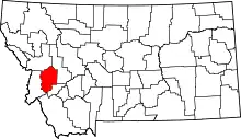 Granite County map | |
| CDPs | ||
| Unincorporated communities |
| |
| Ghost towns | ||
This article is issued from Wikipedia. The text is licensed under Creative Commons - Attribution - Sharealike. Additional terms may apply for the media files.