This is a list of parks and gardens in the Brussels-Capital Region divided by municipality.
A park or garden located on the territory of several municipalities is listed for each municipality.
Anderlecht
| name | district | coordinates | size | photo |
|---|---|---|---|---|
| Astrid Park | Meir Quarter | 50°49′59″N 4°17′53″E / 50.83306°N 4.29806°E | 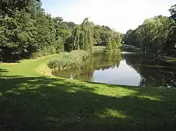 | |
| Parc Forestier/Bospark | 50°50′29″N 4°18′40″E / 50.84139°N 4.31111°E |  | ||
| Jean Vives Park | 50°49′34″N 4°16′56″E / 50.82611°N 4.28222°E |  | ||
| Pede Park | Neerpede | 50°49′32″N 4°16′19″E / 50.82556°N 4.27194°E |  | |
| Parc des Étangs/Vijverspark | 50°49′28″N 4°17′4″E / 50.82444°N 4.28444°E |  | ||
| Scherdemael Park | 50°49′54″N 4°17′15″E / 50.83167°N 4.28750°E |  |
Audergem/Oudergem
| name | district | coordinates | size | photo |
|---|---|---|---|---|
| Jean Massart Botanical Garden | 50°48′50″N 4°26′17″E / 50.81389°N 4.43806°E |  | ||
| Red Cloister | 50°48′28″N 4°26′38″E / 50.80778°N 4.44389°E | 13.61 ha (33.6 acres) |  | |
| Seny Park | 50°48′34″N 4°25′43″E / 50.80944°N 4.42861°E | _-_grass.jpg.webp) | ||
| Val Duchesse/Hertoginnedal | 50°49′13″N 4°26′01″E / 50.82028°N 4.43361°E |  | ||
| Woluwe Park | 50°49′44″N 4°25′37″E / 50.829°N 4.427°E | 69.28 ha (171.2 acres) | .JPG.webp) |
Berchem-Sainte-Agathe/Sint-Agatha-Berchem
| name | district | coordinates | size | photo |
|---|---|---|---|---|
| Wilder Wood | 50°51′31″N 4°17′26″E / 50.85861°N 4.29056°E | 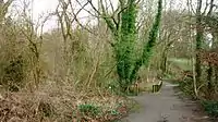 |
City of Brussels
Pentagon
| name | district | coordinates | size | photo |
|---|---|---|---|---|
| Brussels Park | Royal Quarter | 50°50′41″N 4°21′49″E / 50.8446°N 4.3637°E | 13.1 ha (32 acres)[1] | 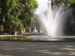 |
| Egmont Park | Sablon/Zavel | 50°50′19″N 4°21′26″E / 50.83861°N 4.35722°E | 1.42 ha (3.5 acres)[2] | 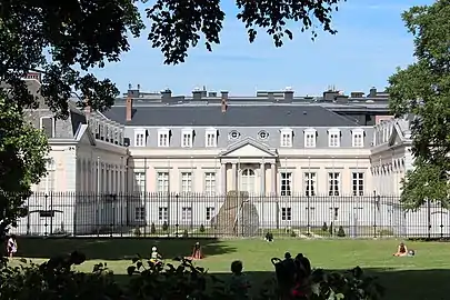 |
| Halle Gate Park | Marolles/Marollen | 50°49′59″N 4°20′41″E / 50.83306°N 4.34472°E | 3.2 ha (7.9 acres)[3] |  |
| Mont des Arts/Kunstberg | Royal Quarter | 50°50′38″N 04°21′24″E / 50.84389°N 4.35667°E | 1.4 ha (3.5 acres)[4] | 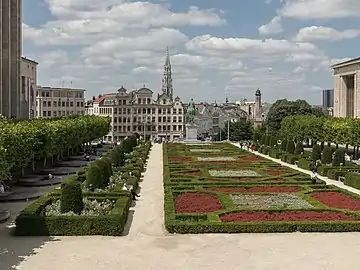 |
| Square of the Small Sablon | Sablon/Zavel | 50°50′24″N 04°21′22″E / 50.84000°N 4.35611°E | 0.29 ha (0.72 acres)[5] | 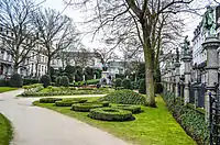 |
Eastern districts
| name | district | coordinates | size | photo |
|---|---|---|---|---|
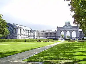
| Parc du Cinquantenaire/Jubelpark | European Quarter | 50°50′26″N 4°23′34″E / 50.84056°N 4.39278°E | 34.22 ha (84.6 acres)[6] | 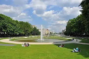 |
| Leopold Park | Leopold Quarter | 50°50′18″N 4°22′48″E / 50.83833°N 4.38000°E | 6.43 ha (15.9 acres)[7] | 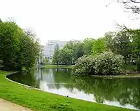 |
| Maelbeek Valley Garden | Leopold Quarter | 50°50′38″N 4°22′43″E / 50.84389°N 4.37861°E | 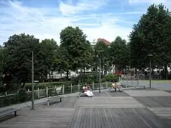 |
Northern districts
| name | district | coordinates | size | photo |
|---|---|---|---|---|
| Colonial Garden | 50°53′18″N 4°20′43″E / 50.88833°N 4.34528°E |  | ||
| Florist of Stuyvenberg's Garden | 50°53′07″N 4°20′55″E / 50.88528°N 4.34861°E |  | ||
| Laeken Park | 50°53′33″N 04°20′55″E / 50.89250°N 4.34861°E | 28.79 ha (71.1 acres)[8] |  | |
| Maximilian Park | Northern Quarter | 50°51′44″N 4°21′12″E / 50.86222°N 4.35333°E |  | |
| Osseg(h)em Park | Heysel Quarter | 50°53′44″N 4°20′47″E / 50.89556°N 4.34639°E | 15.9 ha (39 acres) |  |
| Sobieski Park | 50°53′08″N 4°20′43″E / 50.88556°N 4.34528°E | 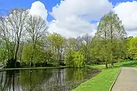 | ||
| Tour & Taxis Park | 50°52′13″N 4°20′31″E / 50.87028°N 4.34194°E | .JPG.webp) |
Southern districts
| name | district | coordinates | size | photo |
|---|---|---|---|---|
| Bois de la Cambre/Ter Kamerenbos | Louise/Louiza Quarter | 50°48′11″N 4°22′52″E / 50.80306°N 4.38111°E | 122.34 ha (302.3 acres)[9] | 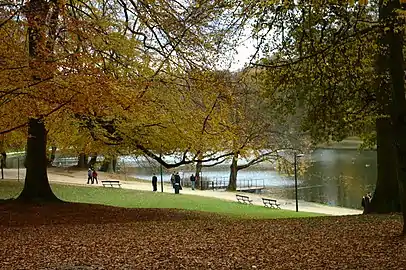 |
| King's Garden | Louise/Louiza Quarter | 50°49′18″N 4°22′17″E / 50.82167°N 4.37139°E |  | |
| La Cambre Abbey | Louise/Louiza Quarter | 50°49′08″N 4°22′27″E / 50.81889°N 4.37417°E |  |
Etterbeek
| name | district | coordinates | size | photo |
|---|---|---|---|---|
| Jean-Félix Hap Garden | 50°50′04″N 4°23′09″E / 50.83444°N 4.38583°E |  |
Evere
Forest/Vorst
| name | district | coordinates | size | photo |
|---|---|---|---|---|
| Duden Park | Altitude Cent/Hoogte Honderd | 50°49′01″N 4°19′52″E / 50.81694°N 4.33111°E | 22.76 ha (56.2 acres) |  |
| Forest/Vorst Park | Altitude Cent/Hoogte Honderd | 50°49′21″N 4°20′13″E / 50.82250°N 4.33694°E | 13 ha (32 acres) |  |
Ganshoren
| name | district | coordinates | size | photo |
|---|---|---|---|---|
| King Baudouin Park | 50°52′53″N 4°19′09″E / 50.88139°N 4.31917°E | 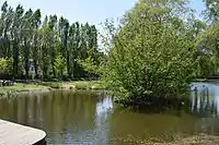 |
Ixelles/Elsene
| name | district | coordinates | size | photo |
|---|---|---|---|---|
| La Cambre Abbey | Louise/Louiza Quarter | 50°49′08″N 4°22′27″E / 50.81889°N 4.37417°E | | |
| Ixelles Ponds | Flagey Quarter | 50°49′25″N 4°22′24″E / 50.82361°N 4.37333°E | 5.5 ha (14 acres) | 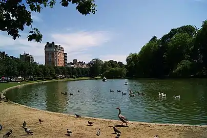 |
| Tenbosch Park | 50°49′12″N 4°21′53″E / 50.82000°N 4.36472°E | 1.8 ha (4.4 acres) | 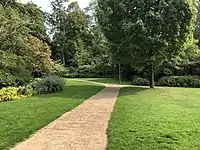 |
Jette
| name | district | coordinates | size | photo |
|---|---|---|---|---|
| Dieleg(h)em Wood | 50°53′14″N 4°19′26″E / 50.88722°N 4.32389°E | 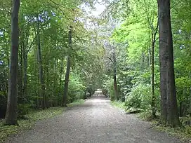 | ||
| King Baudouin Park | 50°52′53″N 4°19′09″E / 50.88139°N 4.31917°E | | ||
| Laerbeek Wood | 50°53′16″N 4°17′56″E / 50.88778°N 4.29889°E | 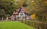 |
Koekelberg
| name | district | coordinates | size | photo |
|---|---|---|---|---|
| Elisabeth Park | 50°51′54″N 4°19′28″E / 50.86500°N 4.32444°E | 21 ha (52 acres) |  |
Molenbeek-Saint-Jean/Sint-Jans-Molenbeek
| name | district | coordinates | size | photo |
|---|---|---|---|---|
| Albert Park | Machtens Quarter | 50°51′05″N 4°18′55″E / 50.85139°N 4.31528°E | 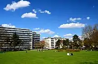 | |
| Karreveld Park | Karreveld Quarter | 50°51′37″N 4°18′55″E / 50.86028°N 4.31528°E |  | |
| Marie-José Park | Machtens Quarter | 50°51′5″N 4°19′8″E / 50.85139°N 4.31889°E | ||
| Scheutbos Park | Mettewie Quarter | 50°51′00″N 4°17′30″E / 50.85000°N 4.29167°E | 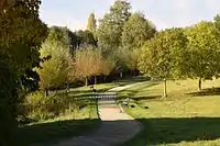 |
Saint Gilles/Saint-Gillis
| name | district | coordinates | size | photo |
|---|---|---|---|---|
| Pierre Paulus Park | 50°49′44″N 4°20′57″E / 50.82889°N 4.34917°E |  | ||
| Forest/Vorst Park | Altitude Cent/Hoogte Honderd | 50°49′21″N 4°20′13″E / 50.82250°N 4.33694°E | |
Saint-Josse-ten-Node/Sint-Joost-ten-Node
| name | district | coordinates | size | photo |
|---|---|---|---|---|
| Botanical Garden of Brussels | Northern Quarter | 50°51′18″N 4°21′55″E / 50.85488°N 4.365192°E | 5.15 ha (12.7 acres)[10] | 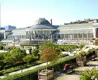 |
Schaerbeek/Schaarbeek
| name | district | coordinates | size | photo |
|---|---|---|---|---|
| Josaphat Park | Josaphat Quarter | 50°51′44″N 4°23′06″E / 50.86222°N 4.38500°E | 30 ha (74 acres) |  |
Uccle/Ukkel
| name | district | coordinates | size | photo |
|---|---|---|---|---|
| Brugmann Park | 50°48′35″N 4°21′07″E / 50.80972°N 4.35194°E |  | ||
| Montjoie Park | 50°48′35″N 4°21′27″E / 50.80972°N 4.35750°E |  | ||
| Wolvendael Park | 50°48′00″N 4°20′38″E / 50.80000°N 4.34389°E |  |
Watermael-Boitsfort/Watermaal-Bosvoorde
| name | district | coordinates | size | photo |
|---|---|---|---|---|
| Seny Park | 50°48′34″N 4°25′43″E / 50.80944°N 4.42861°E | | ||
| Tournay-Solvay Park | 50°47′36″N 4°24′40″E / 50.79333°N 4.41111°E | .jpg.webp) |
Woluwe-Saint-Lambert/Sint-Lambrechts-Woluwe
| name | district | coordinates | size | photo |
|---|---|---|---|---|
| Malou Park | 50°50′31″N 4°26′20″E / 50.842°N 4.439°E | .jpg.webp) |
Woluwe-Saint-Pierre/Sint-Pieters-Woluwe
| name | district | coordinates | size | photo |
|---|---|---|---|---|
| Mellaerts Ponds | 50°49′39″N 4°26′02″E / 50.82750°N 4.43389°E | 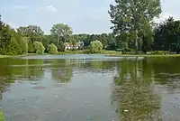 | ||
| Parmentier Park | 50°49′47″N 4°26′18″E / 50.82972°N 4.43833°E |  | ||
| Woluwe Park | 50°49′44″N 4°25′37″E / 50.829°N 4.427°E | 69.28 ha (171.2 acres) | |
References
Citations
- ↑ "Parc de Bruxelles". Bruxelles Environnement (in French). 2015-03-31. Retrieved 2019-11-01.
- ↑ "Parc d'Egmont". Bruxelles Environnement (in French). 2015-03-31. Retrieved 2019-11-01.
- ↑ "Parc de la Porte de Hal". Bruxelles Environnement (in French). 2015-03-31. Retrieved 2019-11-01.
- ↑ "Jardin du Mont des Arts". Bruxelles Environnement (in French). 2015-03-31. Retrieved 2019-11-01.
- ↑ "Square du Petit Sablon". Bruxelles Environnement (in French). 2015-03-31. Retrieved 2019-11-01.
- ↑ "Parc du Cinquantenaire". Bruxelles Environnement (in French). 2015-03-31. Retrieved 2019-11-01.
- ↑ "Parc Léopold". Bruxelles Environnement (in French). 2015-03-31. Retrieved 2019-11-01.
- ↑ "Parc de Laeken". Bruxelles Environnement (in French). 2015-03-31. Retrieved 2019-11-01.
- ↑ "Bois de la Cambre". Bruxelles Environnement (in French). 2015-03-31. Retrieved 2019-11-01.
- ↑ "Jardin Botanique". Bruxelles Environnement (in French). 2015-03-31. Retrieved 2019-11-01.
This article is issued from Wikipedia. The text is licensed under Creative Commons - Attribution - Sharealike. Additional terms may apply for the media files.