.jpg.webp)
Avenida Las Américas (PR-163), looking east
This article provides a listing, with brief descriptions, of the most traveled or best known streets and thoroughfares in Ponce, Puerto Rico. Unless otherwise noted, traffic is two-way. If traffic is two-way for the entire length of the street (as opposed to just a portion of its length), it is designated with the symbol "↔" under the column "Traffic direction"; otherwise, the dash symbol ("–") is used.
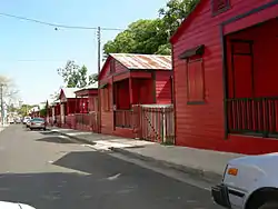
List of streets
.jpg.webp)
.jpg.webp)
%252C_mirando_al_norte_(DSC03632B).jpg.webp)
%252C_en_Ponce%252C_PR_(DSC01665).jpg.webp)
%252C_Bo._Machuelo_Abajo%252C_Ponce%252C_Puerto_Rico%252C_mirando_al_oeste_(IMG_3417).jpg.webp)
.jpg.webp)

%252C_en_Barrio_Sexto%252C_en_Ponce%252C_PR%252C_mirando_hacia_el_norte_(IMG_3684).jpg.webp)
%252C_Barrio_San_Ant%C3%B3n%252C_Ponce%252C_Puerto_Rico%252C_mirando_al_este-sureste_(DSC03365).jpg.webp)
_en_Ponce%252C_PR_(DSC01696).jpg.webp)
.jpg.webp)
.jpg.webp)
.jpg.webp)
.jpg.webp)
See also
References
- ↑ Eli D. Oquendo-Rodríguez. Pablo L. Crespo-Vargas, editor. "A Orillas del Mar Caribe: Boceto histórico de la Playa de Ponce - Desde sus primeros habitantes hasta principios del siglo XX." First edition. June 2017. Editorial Akelarre. Centro de Estudios e Investigaciones del Sur Oeste de Puerto Rico (CEISCO). Lajas, Puerto Rico. Page 48. ISBN 978-1547284931
- ↑ Carmelo Rosario Natal. Ponce En Su Historia Moderna: 1945-2002. Published by Secretaría de Cultura y Turismo of the Government of the Autonomous Municipality of Ponce. Ponce, Puerto Rico. 2003. p. 251.
External links
| External audio | |
|---|---|
 Media related to Streets in Ponce, Puerto Rico at Wikimedia Commons
This article is issued from Wikipedia. The text is licensed under Creative Commons - Attribution - Sharealike. Additional terms may apply for the media files.