| Little Pauls Creek Tributary to Pauls Creek | |
|---|---|
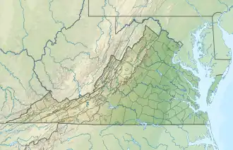 Location of Little Pauls Creek mouth  Little Pauls Creek (the United States) | |
| Location | |
| Country | United States |
| State | Virginia |
| County | Carroll County |
| Physical characteristics | |
| Source | East Fork Crooked Creek divide |
| • location | about 1 mile south of Skyland Lakes, Virginia |
| • coordinates | 36°37′50″N 080°44′18″W / 36.63056°N 80.73833°W[1] |
| • elevation | 2,660 ft (810 m)[2] |
| Mouth | |
• location | about 1.5 miles southwest of Cana, Virginia |
• coordinates | 36°34′26″N 080°42′11″W / 36.57389°N 80.70306°W[1] |
• elevation | 1,234 ft (376 m)[3] |
| Length | 5.28 mi (8.50 km)[4] |
| Basin size | 6.19 square miles (16.0 km2)[5] |
| Discharge | |
| • location | Pauls Creek |
| • average | 11.64 cu ft/s (0.330 m3/s) at mouth with Pauls Creek[5] |
| Basin features | |
| Progression | Pauls Creek → Stewarts Creek → Ararat River → Yadkin River → Pee Dee River → Winyah Bay → Atlantic Ocean |
| River system | Yadkin River |
| Tributaries | |
| • right | Spring Branch |
| Bridges | I-77, Lakeview Drive, Hurlrock Lane, Flower Gap Road |
Little Pauls Creek is a 5.28 mi (8.50 km) long 2nd order tributary to Pauls Creek in Carroll County, Virginia.
Course
Little Pauls Creek rises about 1 mile south of Skyland Lakes, Virginia, in Carroll County and then flows southeast to join Pauls Creek about 1.5 miles southwest of Cana, Virginia.[3]
Watershed
Little Pauls Creek drains 6.19 square miles (16.0 km2) of area, receives about 51.4 in/year of precipitation, has a wetness index of 303.56, and is about 73% forested.[5]
See also
References
- 1 2 "GNIS Detail - Little Pauls Creek". geonames.usgs.gov. US Geological Survey. Retrieved 19 July 2021.
- ↑ "Get Maps". USGS Topoview. US Geological Survey. Retrieved 19 July 2021.
- 1 2 "Get Maps". USGS Topoview. US Geological Survey. Retrieved 19 July 2021.
- ↑ "ArcGIS Web Application". epa.maps.arcgis.com. US EPA. Retrieved 18 July 2021.
- 1 2 3 "Little Pauls Creek Watershed Report". US EPA Geoviewer. US EPA. Retrieved 19 July 2021.
This article is issued from Wikipedia. The text is licensed under Creative Commons - Attribution - Sharealike. Additional terms may apply for the media files.