| Little Thompson River | |
|---|---|
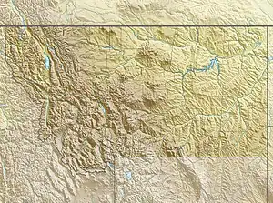 Location of the mouth of the Little Thompson River in Montana | |
| Location | |
| Country | United States |
| State | Montana |
| County | Sanders County |
| Physical characteristics | |
| Source | |
| • location | Lolo National Forest, Montana |
| • coordinates | 47°45′27″N 114°45′14″W / 47.75750°N 114.75389°W[1] |
| Mouth | Thompson River |
• coordinates | 47°43′46″N 115°01′46″W / 47.72944°N 115.02944°W[1] |
| Basin features | |
| Tributaries | |
| • left | |
| • right | |
Little Thompson River is a stream in Sanders County, Montana.[1] It is a left tributary of the larger Thompson River of Montana, itself a tributary of the Clark Fork River. It has its headwaters in Lolo National Forest, where it is fed by a number of smaller creeks and streams.
See also
References
- 1 2 3 U.S. Geological Survey Geographic Names Information System: Little Thompson River
- ↑ U.S. Geological Survey Geographic Names Information System: Nancy Creek
- ↑ U.S. Geological Survey Geographic Names Information System: McGinnis Creek
- ↑ U.S. Geological Survey Geographic Names Information System: Corona Creek
- ↑ U.S. Geological Survey Geographic Names Information System: Mudd Creek
- ↑ U.S. Geological Survey Geographic Names Information System: Alder Creek
- ↑ U.S. Geological Survey Geographic Names Information System: Tepee Creek
- ↑ U.S. Geological Survey Geographic Names Information System: Cabin Creek
- ↑ U.S. Geological Survey Geographic Names Information System: Snider Creek
- ↑ U.S. Geological Survey Geographic Names Information System: North Fork Little Thompson River
- ↑ U.S. Geological Survey Geographic Names Information System: Little Rock Creek
- ↑ U.S. Geological Survey Geographic Names Information System: Nancy Creek
This article is issued from Wikipedia. The text is licensed under Creative Commons - Attribution - Sharealike. Additional terms may apply for the media files.