| Long Run Tributary to Wheeling Creek | |
|---|---|
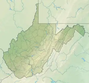 Location of Long Run mouth  Long Run (Wheeling Creek tributary) (the United States) | |
| Location | |
| Country | United States |
| State | West Virginia |
| County | Ohio |
| City | Wheeling |
| Physical characteristics | |
| Source | Short Creek divide |
| • location | about 2 miles west of Clinton, West Virginia |
| • coordinates | 40°07′22″N 080°39′24″W / 40.12278°N 80.65667°W[1] |
| • elevation | 1,100 ft (340 m)[2] |
| Mouth | Wheeling Creek |
• location | Wheeling, West Virginia |
• coordinates | 40°01′36″N 080°43′38″W / 40.02667°N 80.72722°W[1] |
• elevation | 640 ft (200 m)[3] |
| Length | 4.35 mi (7.00 km)[4] |
| Basin size | 6.90 square miles (17.9 km2)[5] |
| Discharge | |
| • location | Wheeling Creek |
| • average | 8.18 cu ft/s (0.232 m3/s) at mouth with Wheeling Creek[5] |
| Basin features | |
| Progression | Wheeling Creek → Ohio River → Mississippi River → Gulf of Mexico |
| River system | Ohio River |
| Tributaries | |
| • left | unnamed tributaries |
| • right | Pogue Run Waddles Run |
| Bridges | Shawnee Road, Pearson Drive, WV 7, WV 13, WV 7, Washington Farms, Bryan Drive, Wells Street, WV 88 (x2), Park Road, Homestead Avenue, US 40 |
Long Run is a 4.35 mi (7.00 km) long 2nd order tributary to Wheeling Creek in Ohio County, West Virginia.
Variant names
According to the Geographic Names Information System, it has also been known historically as:[1]
- Woods Run
Course
Long Run rises about 2 miles west of Clinton, West Virginia, in Ohio County and then flows southwest to Wheeling Creek at Wheeling.[3]
Watershed
Long Run drains 6.90 square miles (17.9 km2) of area, receives about 40.5 in/year of precipitation, has a wetness index of 298.89, and is about 53% forested.[5]
See also
References
- 1 2 3 "GNIS Detail - Long Run". geonames.usgs.gov. US Geological Survey. Retrieved 26 June 2021.
- ↑ "Get Maps". USGS Topoview. US Geological Survey. Retrieved 26 June 2021.
- 1 2 "Get Maps". USGS Topoview. US Geological Survey. Retrieved 26 June 2021.
- ↑ "ArcGIS Web Application". epa.maps.arcgis.com. US EPA. Retrieved 26 June 2021.
- 1 2 3 "Long Run Watershed Report". US EPA Geoviewer. US EPA. Retrieved 26 June 2021.
This article is issued from Wikipedia. The text is licensed under Creative Commons - Attribution - Sharealike. Additional terms may apply for the media files.