Méagui | |
|---|---|
City, sub-prefecture, and commune | |
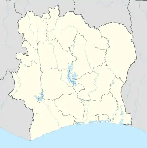 Méagui Location in Ivory Coast | |
| Coordinates: 5°24′N 6°34′W / 5.400°N 6.567°W | |
| Country | |
| District | Bas-Sassandra |
| Region | Nawa |
| Department | Méagui |
| Area | |
| • Total | 682 km2 (263 sq mi) |
| Population (2021 census)[1] | |
| • Total | 153,483 |
| • Density | 230/km2 (580/sq mi) |
| • City | 57,367[2] |
| (2014 census) | |
| Time zone | UTC+0 (GMT) |
Méagui is a city in south-western Ivory Coast. It is a sub-prefecture of and the seat of Méagui Department in Nawa Region, Bas-Sassandra District. Méagui is also a commune.
In 2021, the population of the sub-prefecture of Méagui was 153,483.[1]
Villages
The villages of the sub-prefecture of Méagui and their population in 2014 are:[3]
- Abodagui (1 402 )
- Ahoutouagui (3 406 )
- Blagbanié (2 086 )
- Gbogbo (1 685 )
- Gnititoigui 1 (4 524 )
- Gnititoigui 2 (3 288 )
- Koffiagui (1 559 )
- Krohon (2 644 )
- Méagui (57 367 )
- Négréagui (1 805 )
- Polo (1 141 )
- Téréagui 1 (858 )
- Téréagui 2 (1 486 )
- Touagui 1 (7 488 )
- Amoragui (1 409 )
- Bagui (2 098 )
- Kouadioagui (796 )
- Kouaméagui (1 604 )
- Kragui (6 628 )
- N'guessangui (1 109 )
- Pogréagui (11 924 )
- Sakiaré (3 006 )
- Tagba (1 883 )
- Tagboagui (798 )
- Touagui 2 (5 383 )
- Touanié 1 (3 571 )
- Yobouéagui (1 346 )
References
- 1 2 Citypopulation.de Population of the regions and sub-prefectures of Ivory Coast
- ↑ Citypopulation.de Population of cities & localities in Ivory Coast
- ↑ "RGPH 2014, Répertoire des localités, Région Nawa" (PDF). ins.ci. Retrieved 5 August 2019.
Regional seat: Soubré | ||
| Buyo Department | 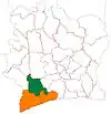 | |
| Guéyo Department | ||
| Méagui Department | ||
| Soubré Department | ||
* also a commune; Mayo in Soubré Department is a commune but not a sub-prefecture | ||
This article is issued from Wikipedia. The text is licensed under Creative Commons - Attribution - Sharealike. Additional terms may apply for the media files.