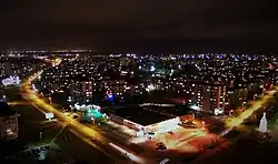
Mažeikiai Area Eldership
Mažeikių apylinkės seniūnija | |
|---|---|
 Mažeikiai | |
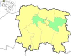 Location of Mažeikiai Area Eldership | |
| Coordinates: 56°19′16″N 22°21′25″E / 56.321°N 22.357°E | |
| Country | |
| Ethnographic region | Samogitia |
| County | Telšiai County |
| Municipality | Mažeikiai District Municipality |
| Administrative centre | Mažeikiai |
| Area | |
| • Total | 101 km2 (39 sq mi) |
| Population (2021)[1] | |
| • Total | 3,340 |
| • Density | 33/km2 (86/sq mi) |
| Time zone | UTC+2 (EET) |
| • Summer (DST) | UTC+3 (EEST) |
Mažeikiai Area Eldership (Lithuanian: Mažeikių apylinkės seniūnija) is a Lithuanian eldership, located in the central part of Mažeikiai District Municipality.
Populated places
Following settlements are located in the Mažeikiai Area Eldership (as for the 2021 census)[2]
| Locality | Total |
|---|---|
| Antanava | 13 |
| Bugeniai | 390 |
| Dargiai | 56 |
| Gargždai | 13 |
| Kalnėnai | 19 |
| Krakiai | 518 |
| Kurmaičiai | 827 |
| Linksnakiai | 14 |
| Naikiai | 440 |
| Pumpurai | 31 |
| Purvėnai | 181 |
| Ruzgai | 130 |
| Sovaičiai | 75 |
| Troškučiai | 448 |
| Zastaučiai | 30 |
| Žiogaičiai | 141 |
References
- ↑ "2021 census". Statistikos Departamentas (Lithuania). Retrieved November 10, 2021.
- ↑ "GYVENTOJAI GYVENAMOSIOSE VIETOVĖSE". Osp.stat.gov.lt. Archived from the original (XLSX) on 7 March 2022. Retrieved 17 July 2022.
This article is issued from Wikipedia. The text is licensed under Creative Commons - Attribution - Sharealike. Additional terms may apply for the media files.