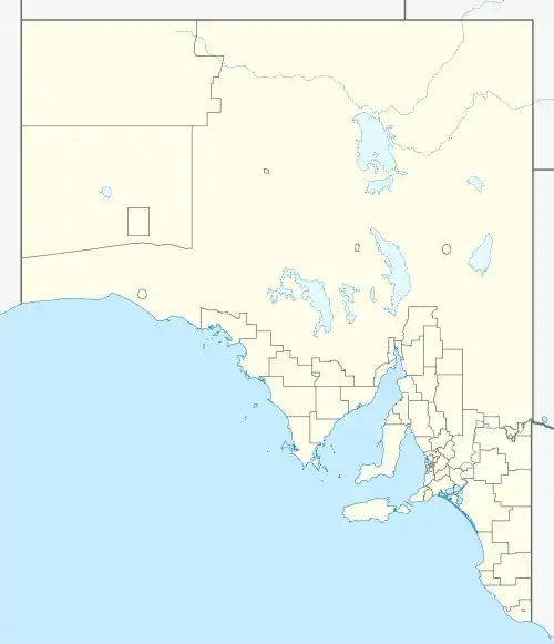
| Manoora South Australia | |||||||||||||||
|---|---|---|---|---|---|---|---|---|---|---|---|---|---|---|---|
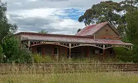 Former Manoora railway station | |||||||||||||||
 Manoora | |||||||||||||||
| Coordinates | 34°00′02″S 138°49′03″E / 34.0006°S 138.8174°E | ||||||||||||||
| Population | 134 (SAL 2021)[1] | ||||||||||||||
| Postcode(s) | 5414 | ||||||||||||||
| Location |
| ||||||||||||||
| LGA(s) | Clare and Gilbert Valleys Council | ||||||||||||||
| State electorate(s) | Electoral district of Frome | ||||||||||||||
| Federal division(s) | Grey | ||||||||||||||
| |||||||||||||||
Manoora is a settlement in the Mid North region of South Australia on the Barrier Highway and upper reaches of the Gilbert River.[2] It was also on the Peterborough railway line serving Burra until the line was closed. At the 2006 census, Manoora had a population of 277.[3]
The first Europeans to settle at Manoora, in about 1841, were the sheep pastoralists Edward and William Peter, of Scottish origin. Having established their head station near present Manoora, for a few years the brothers (or cousins) held extensive occupation licences reaching toward the Kapunda and Burra districts.
Manoora is named for another early station in the district owned by A W J Grant. The name is believed to be derived from a native name for a spring or water.[4]
References
- ↑ Australian Bureau of Statistics (28 June 2022). "Manoora (SA) (suburb and locality)". Australian Census 2021 QuickStats. Retrieved 28 June 2022.
- ↑ "2905.0 – Statistical Geography: Volume 2 -- Census Geographic Areas, Australia, 2006". Australian Bureau of Statistics. Retrieved 8 December 2009.
- ↑ Australian Bureau of Statistics (25 October 2007). "Manoora (State Suburb)". 2006 Census QuickStats. Retrieved 26 September 2011.
- ↑ "Placename Details: Manoora". Property Location Browser. government of South Australia. 1 September 2008. SA0042541. Archived from the original on 12 October 2016. Retrieved 31 August 2015.