Mohanlalganj
Mohanlālganj | |
|---|---|
Populated place | |
 Map of Mohanlalganj CD block | |
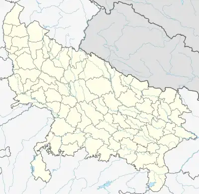 Mohanlalganj Location in Uttar Pradesh, India  Mohanlalganj Mohanlalganj (India) | |
| Coordinates: 26°40′47″N 80°58′57″E / 26.67985°N 80.98237°E[1] | |
| Country | |
| State | Uttar Pradesh |
| District | Lucknow |
| Elevation | 125 m (410 ft) |
| Languages | |
| • Official | Hindi |
| Time zone | UTC+5:30 (IST) |
Mohanlalganj is a tehsil and community development block in Lucknow district, Uttar Pradesh, India.[2] It has historically constituted part of the village of Mau.[3]
History
The eponymous market, called Mohanlalganj, was established in 1859 by Raja Kashi Parshad and named after his father-in-law, Mohan Lal, from whom he had received his estate.[3] Kashi Parshad had spent 50,000 rupees to finance its construction, and later additions costing a further 30,000 rupees were made, including drains and masonry verandas.[3] At the turn of the 20th century, the Mohanlalganj bazaar was described as an important commercial center, mainly for grain and cloth, and its entrances were marked by two grand archways.[3] Kashi Parshad also built a 250-foot-tall temple for one lakh (100,000) rupees; the temple was built from brick and given a veneer of marble and black stone.[3]
Mohanlalganj historically was the seat of a pargana, having succeeded Amethi in this capacity.[3]
Villages
Mohanlalganj block comprises the following 113 villages:[2]
| Village name | Total land area (hectares) | Population (in 2011) |
|---|---|---|
| Sarthuwa | 225.4 | 1,194 |
| Mohiuddinpur | 91.7 | 807 |
| Shivdhara | 151.2 | 975 |
| Puranpur | 151.4 | 981 |
| Daudnagar | 223.7 | 1,192 |
| Perehta | 382.6 | 3,435 |
| Dahiyar | 228.2 | 2,444 |
| Khujauli | 692.6 | 4,666 |
| Harikansh Garhi | 106.7 | 738 |
| Dalauna | 232 | 1,252 |
| Purseni | 815.9 | 5,037 |
| Inderjeet Khera | 177.8 | 610 |
| Dharmawat Khera | 56.2 | 599 |
| Dharamgad Khera | 132.5 | 546 |
| Mau (contains block headquarters) | 956.2 | 13,655 |
| Rambhan Khera | 233.3 | 1,514 |
| Khujehra | 529.4 | 2,310 |
| Dehwa | 357.6 | 2,781 |
| Bhasanda | 498.5 | 3,358 |
| Uttaar Gaon | 565.2 | 3,518 |
| Bhaudhari | 690 | 3,227 |
| Dhanuwa Sand | 448.8 | 2,310 |
| Bhadeshwa | 658.6 | 2,902 |
| Kodara Raypur | 343.7 | 2,252 |
| Sisandi | 747.7 | 6,804 |
| Sulsamau | 544.5 | 2,775 |
| Minapur | 290.4 | 936 |
| Bhilampur | 98.2 | 779 |
| Devareya (Bharsawa) | 407.6 | 2,659 |
| Miranpur | 219 | 1,377 |
| Gobindpur | 643.8 | 2,440 |
| Jabarauli | 998.9 | 4,107 |
| Gautam Khera | 228.3 | 919 |
| Paraspur Thaththa | 345.4 | 1,236 |
| Kushmaura | 406 | 2,095 |
| Barbaliya | 427.8 | 1,775 |
| Gaura | 655.9 | 5,160 |
| Atrauli | 358.6 | 2,971 |
| Hulas Khera | 811.1 | 5,049 |
| Dada Sikandarpur | 128.7 | 902 |
| Gadiyana | 73.2 | 859 |
| Bindaua | 204 | 1,378 |
| Ahmadpur Khalsa | 131.7 | 711 |
| Kura | 483.4 | 1,784 |
| Gaureya Khurd | 181 | 738 |
| Dewati | 827.2 | 2,358 |
| Kubhara | 243.9 | 1,654 |
| Tamoriya | 612 | 2,086 |
| Madarpur | 262 | 512 |
| Karora | 505.9 | 3,289 |
| Achalikhera | 362.5 | 1,959 |
| Jamalpur Daduri | 361.5 | 1,451 |
| Balsingh Khera | 363.1 | 1,777 |
| Mehdauli | 339.2 | 1,507 |
| Garhi | 320.3 | 3,427 |
| Kankaha | 935.8 | 6,460 |
| Madapur | 132 | 966 |
| Mastipur | 109.3 | 1,472 |
| Tikara | 87.4 | 692 |
| Mangteya | 438.1 | 2,692 |
| Bhajmar Mau | 87.5 | 285 |
| Dayal Pur | 723.6 | 4,877 |
| Baddhi Khera | 85.3 | 459 |
| Sirsa | 508.8 | 4,173 |
| Harnam Khera | 121.2 | 11 |
| Madari Khera | 91.6 | 535 |
| Raghunath Khera | 286.2 | 1,688 |
| Akbarpur Beniganj | 202.9 | 1,125 |
| Rati | 439.5 | 2,190 |
| Birsinghpur | 312 | 1,592 |
| Kamalpur Bichlika | 374 | 2,138 |
| Utrawan | 1,139.2 | 8,316 |
| Dedhari | 158.9 | 1,309 |
| Patauna | 577.8 | 2,274 |
| Samesi | 2,143.1 | 11,646 |
| Shahmohammadpur Apaeya | 201.3 | 1,482 |
| Ahmadpur Ajamli | 151.1 | 497 |
| Nagram | 1,282 | 3,485 |
| Kakorwa | 207.3 | 1,391 |
| Amba Muratajapur | 248.3 | 1,505 |
| Aslam Nagar | 166.7 | 1,104 |
| Katra Nagram | 231.5 | 1 |
| Abbas Nagar | 353.5 | 1,133 |
| Garna | 192.4 | 1,414 |
| Meerakh Nagar | 550.8 | 4,260 |
| Kata Karaudi | 308.6 | 2,174 |
| Salempur Achaka | 429.5 | 1,576 |
| Chhatauni | 333 | 2,037 |
| Kaneri | 301.6 | 1,671 |
| Hasanpur | 132.8 | 1,368 |
| Bhawa Khera | 121 | 1,703 |
| Uday Pur | 268.6 | 1,270 |
| Brahmedas Pur | 177.1 | 1,093 |
| Rampur Garhi Jamuni | 286.2 | 2,001 |
| Karan Pur | 171.9 | 1,464 |
| Bairisal Pur | 111.8 | 1,840 |
| Nigohan | 639.9 | 6,474 |
| Sherpur Lawal | 503 | 2,901 |
| Adhaeya | 154.4 | 1,056 |
| Harihar Pur Par--Sa | 186.7 | 669 |
| Amleha Khera | 84.9 | 337 |
| Bhagwan Pur | 106.5 | 1,331 |
| Lalpur | 162.3 | 1,217 |
| Ratana Pur | 100.8 | 909 |
| Bhatwara | 141.4 | 603 |
| Nadauli | 276.8 | 1,511 |
| Khuddi Khera | 60.9 | 488 |
| Puraheya | 294.7 | 2,113 |
| Dakhena Sekhpur | 219.1 | 1,784 |
| Badhauna | 160.8 | 1,113 |
| Jamoriya | 52.4 | 105 |
| Ramdas Pur | 277.5 | 1,375 |
| Natauli | 240.7 | 5,380 |
References
- 1 2 "Geonames.org. Mohanlālganj". Retrieved 15 March 2021.
- 1 2 "Census of India 2011: Uttar Pradesh District Census Handbook - Lucknow, Part A (Village and Town Directory)". Census 2011 India. pp. 203–221. Retrieved 16 March 2021.
- 1 2 3 4 5 6 Nevill, H.R. (1904). Lucknow - A Gazetteer. Allahabad: Government Press. pp. 247–55. Retrieved 16 March 2021.