Montmérac | |
|---|---|
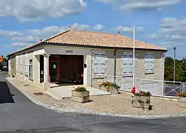 The town hall in Montmérac | |
.svg.png.webp) Coat of arms | |
Location of Montmérac | |
 Montmérac  Montmérac | |
| Coordinates: 45°26′56″N 0°12′04″W / 45.449°N 0.201°W | |
| Country | France |
| Region | Nouvelle-Aquitaine |
| Department | Charente |
| Arrondissement | Cognac |
| Canton | Charente-Sud |
| Government | |
| • Mayor (2020–2026) | Frédéric Bergeon[1] |
| Area 1 | 23.39 km2 (9.03 sq mi) |
| Population | 719 |
| • Density | 31/km2 (80/sq mi) |
| Time zone | UTC+01:00 (CET) |
| • Summer (DST) | UTC+02:00 (CEST) |
| INSEE/Postal code | 16224 /16300 |
| 1 French Land Register data, which excludes lakes, ponds, glaciers > 1 km2 (0.386 sq mi or 247 acres) and river estuaries. | |
Montmérac (French pronunciation: [mɔ̃meʁak]) is a commune in the Charente department of southwestern France. The municipality was established on 1 January 2016 and consists of the former communes of Montchaude and Lamérac.[3]
See also
References
Wikimedia Commons has media related to Montmérac.
- ↑ "Répertoire national des élus: les maires" (in French). data.gouv.fr, Plateforme ouverte des données publiques françaises. 13 September 2022.
- ↑ "Populations légales 2021". The National Institute of Statistics and Economic Studies. 28 December 2023.
- ↑ Charente, Six communes nouvelles en Charente à compter du 1er janvier 2016 (in French)
This article is issued from Wikipedia. The text is licensed under Creative Commons - Attribution - Sharealike. Additional terms may apply for the media files.