Moravany nad Váhom | |
|---|---|
Village | |
 | |
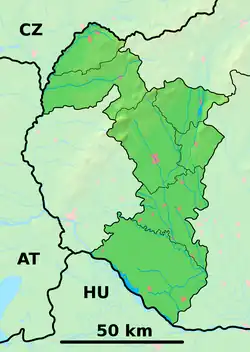 Moravany nad Váhom Location of Moravany nad Váhom in the Trnava Region 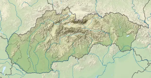 Moravany nad Váhom Moravany nad Váhom (Slovakia) | |
| Coordinates: 48°36′10″N 17°51′50″E / 48.60278°N 17.86389°E | |
| Country | Slovakia |
| Region | Trnava |
| District | Piešťany |
| First mentioned | 1348 |
| Area | |
| • Total | 10.78[1] km2 (4.16[1] sq mi) |
| Elevation | 174[2] m (571[2] ft) |
| Population (2021) | |
| • Total | 2,456[3] |
| Postal code | 922 21[2] |
| Area code | +421 33[2] |
| Car plate | PN |
| Website | www.moravany.sk |
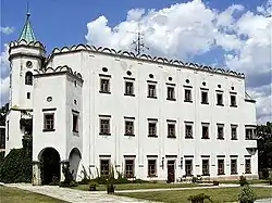
Moravany nad Váhom (Hungarian: Moraván) is a village and municipality in Piešťany District in the Trnava Region of western Slovakia.
History

Venus of Moravany
In historical records the village was first mentioned in 1348.
A small female figurine called the Venus of Moravany was found near the village.
Geography
The municipality lies at an elevation of 200 metres and covers an area of 10.786 km². It has a population of about 2041.
References
- 1 2 "Hustota obyvateľstva - obce [om7014rr_ukaz: Rozloha (Štvorcový meter)]". www.statistics.sk (in Slovak). Statistical Office of the Slovak Republic. 2022-03-31. Retrieved 2022-03-31.
- 1 2 3 4 "Základná charakteristika". www.statistics.sk (in Slovak). Statistical Office of the Slovak Republic. 2015-04-17. Retrieved 2022-03-31.
- ↑ "Počet obyvateľov podľa pohlavia - obce (ročne)". www.statistics.sk (in Slovak). Statistical Office of the Slovak Republic. 2022-03-31. Retrieved 2022-03-31.
External links
![]() Media related to Moravany nad Váhom at Wikimedia Commons
Media related to Moravany nad Váhom at Wikimedia Commons
Municipalities of Piešťany District | ||
|---|---|---|
This article is issued from Wikipedia. The text is licensed under Creative Commons - Attribution - Sharealike. Additional terms may apply for the media files.