| Muddy Creek Tributary to French Creek | |
|---|---|
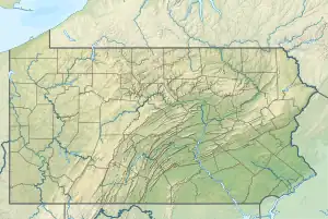 Location of Muddy Creek mouth  Muddy Creek (French Creek tributary) (the United States) | |
| Location | |
| Country | United States |
| State | Pennsylvania |
| County | Crawford |
| Borough | Townville |
| Physical characteristics | |
| Source | Woodcock Creek divide |
| • location | about 0.5 miles north of South Richmond Corners, Pennsylvania |
| • coordinates | 41°42′05″N 079°56′19″W / 41.70139°N 79.93861°W[1] |
| • elevation | 1,505 ft (459 m)[2] |
| Mouth | French Creek |
• location | about 0.5 miles south of Millers Station, Pennsylvania |
• coordinates | 41°48′01″N 079°59′37″W / 41.80028°N 79.99361°W[1] |
• elevation | 1,138 ft (347 m)[3] |
| Length | 22.42 mi (36.08 km)[4] |
| Basin size | 495.85 square miles (1,284.2 km2)[5] |
| Discharge | |
| • location | French Creek |
| • average | 146.44 cu ft/s (4.147 m3/s) at mouth with French Creek[5] |
| Basin features | |
| Progression | generally northwest[4] |
| River system | Allegheny River |
| Tributaries | |
| • left | Mackey Run Dead Creek |
| • right | Navy Run East Branch Muddy Creek Federal Run |
| Bridges | PA 408, Carpenter Road, Mercer Road, Centerville Road, Armstrong Road, Dewey Road, Three Bridges Road, Hamilton Road, PA 77, Teepleville Road, Eddie Road, Teepleville Road, Swamp Road, Johnstown Road |
Muddy Creek is a 22.42 mi (36.08 km) long 4th order tributary to French Creek in Crawford County, Pennsylvania.
Course
Muddy Creek rises about 0.5 miles north-northwest of S Richmond Corners, Pennsylvania, and then flows east and turns northwest to join French Creek about 0.5 miles south of Millers Station, Pennsylvania.[3]
Watershed
Muddy Creek drains 495.85 square miles (1,284.2 km2) of area, receives about 45.2 in/year of precipitation, has a wetness index of 462.98, and is about 44% forested.[5]
See also
References
- 1 2 "GNIS Detail - Muddy Creek". geonames.usgs.gov. US Geological Survey. Retrieved 10 May 2021.
- ↑ "Get Maps". USGS Topoview. US Geological Survey. Retrieved 10 May 2021.
- 1 2 "Get Maps". USGS Topoview. US Geological Survey. Retrieved 10 May 2021.
- 1 2 "ArcGIS Web Application". epa.maps.arcgis.com. US EPA. Retrieved 10 May 2021.
- 1 2 3 "Muddy Creek Watershed Report". US EPA Geoviewer. US EPA. Retrieved 10 May 2021.
This article is issued from Wikipedia. The text is licensed under Creative Commons - Attribution - Sharealike. Additional terms may apply for the media files.