Nauagarhi | |
|---|---|
Village | |
 Nauagarhi | |
| Coordinates: 25°20′37″N 86°32′06″E / 25.34361°N 86.53500°E | |
| Country | |
| State | Bihar |
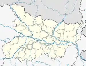
| District | Munger |
| Block | Munger |
| Government | |
| • Type | Sarpanch |
| Area | |
| • Total | 8.12 km2 (3.14 sq mi) |
| Elevation | 50 m (160 ft) |
| Population (2011) | |
| • Total | 34,356 |
| • Density | 4,200/km2 (11,000/sq mi) |
| Languages | |
| • Official | Hindi |
| Time zone | UTC+5:30 (IST) |
| PIN | 811211 |
| STD code | 06344 |
| Vehicle registration | BR-08 |
Nauagarhi is a village in Munger District, Bihar, India. It is situated on the northern portion of Munger District. The village had a population of 34,356 as of the 2011 census.[1]
Geography
Nauagarhi is located on the southern bank of the Ganges River, with the National Highway 33 passing through it. The village has a total area of 812 hectares.
Demographics
At the 2011 census, Nauagarhi had a population of 34,356. The male population was 18,359, and the female population was 15,997. The working population constituted 28.08% of the total residents. The village's literacy rate stood at 60.52%, with 12,370 of the male residents and 8,422 of the female residents being literate.[1]
References
- 1 2 "Population finder 2011". Office of the Registrar General $ Census Commissioner, India. Retrieved 1 October 2023.
This article is issued from Wikipedia. The text is licensed under Creative Commons - Attribution - Sharealike. Additional terms may apply for the media files.