Nesse-Apfelstädt | |
|---|---|
 Coat of arms | |
Location of Nesse-Apfelstädt within Gotha district  | |
 Nesse-Apfelstädt 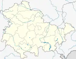 Nesse-Apfelstädt | |
| Coordinates: 50°55′N 10°55′E / 50.917°N 10.917°E | |
| Country | Germany |
| State | Thuringia |
| District | Gotha |
| Founded | 2009 |
| Subdivisions | 6 villages |
| Government | |
| • Mayor (2022–28) | Christian Jacob[1] |
| Area | |
| • Total | 39.47 km2 (15.24 sq mi) |
| Elevation | 265 m (869 ft) |
| Population (2022-12-31)[2] | |
| • Total | 5,936 |
| • Density | 150/km2 (390/sq mi) |
| Time zone | UTC+01:00 (CET) |
| • Summer (DST) | UTC+02:00 (CEST) |
| Postal codes | 99192 |
| Dialling codes | 036202, 036208 |
| Vehicle registration | GTH |
| Website | nesse-apfelstaedt.de |
Nesse-Apfelstädt is a municipality in the district of Gotha, in Thuringia, Germany. It was formed by the merger of the previously independent municipalities Apfelstädt, Gamstädt, Ingersleben and Neudietendorf, on 1 December 2009.
Villages
 The six villages of Nesse-Apfelstädt |
The municipality Nesse-Apfelstädt consists of the following six villages:
- Apfelstädt
- Gamstädt
- Ingersleben
- Kleinrettbach
- Kornhochheim
- Neudietendorf
 View of Apfelstädt from south, with St Walpurga's Church
 Organ of St Michael's Church in Gamstädt
 Local museum in Ingersleben
 Rettbach stream in Kleinrettbach
 Village square in Kornhochheim
 Bahnhofstraße (Station Street) in Neudietendorf
References
- ↑ Gewählte Bürgermeister - aktuelle Landesübersicht, Freistaat Thüringen, accessed 5 September 2022.
- ↑ "Bevölkerung der Gemeinden, erfüllenden Gemeinden und Verwaltungsgemeinschaften in Thüringen Gebietsstand: 31.12.2022" (in German). Thüringer Landesamt für Statistik. June 2023.
This article is issued from Wikipedia. The text is licensed under Creative Commons - Attribution - Sharealike. Additional terms may apply for the media files.