Norene, Tennessee | |
|---|---|
 Norene as seen from State Route 266 | |
| Coordinates: 36°03′24″N 86°14′33″W / 36.05667°N 86.24250°W | |
| Country | United States |
| State | Tennessee |
| County | Wilson |
| Area | |
| • Total | 1.71 sq mi (4.43 km2) |
| • Land | 1.71 sq mi (4.43 km2) |
| • Water | 0.00 sq mi (0.00 km2) |
| Elevation | 741 ft (226 m) |
| Population | |
| • Total | 148 |
| • Density | 86.55/sq mi (33.42/km2) |
| Time zone | UTC-6 (Central (CST)) |
| • Summer (DST) | UTC-5 (CDT) |
| ZIP code | 37136 |
| Area code | 615 |
| GNIS feature ID | 1304185[3] |
Norene is an unincorporated community in Wilson County, in the U.S. state of Tennessee. It is located along Tennessee State Route 266. The community has a general store, post office and churches.
Demographics
| Census | Pop. | Note | %± |
|---|---|---|---|
| 2020 | 148 | — | |
| U.S. Decennial Census[4] | |||
History
The community was once called "Henderson's Cross Roads" by the local post office upon establishment in 1878. The community's name was officially changed to Norene on February 17, 1915.[5] By 1916 it was one of the eight largest villages in Wilson County with residents numbering 100. By 1930 the population had increased to 120.[6]
Education
Norene is served by Wilson County Schools.[7] Its zoned schools are Watertown Elementary School, Watertown Middle School, and Watertown High School.[8]
Photo gallery
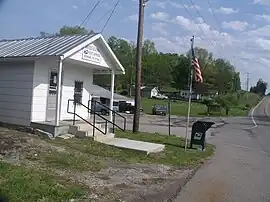
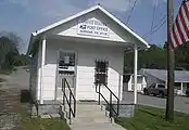 Norene Post Office
 Norene General Store
Notes
- ↑ "ArcGIS REST Services Directory". United States Census Bureau. Retrieved October 15, 2022.
- ↑ "Census Population API". United States Census Bureau. Retrieved October 15, 2022.
- ↑ "US Board on Geographic Names". United States Geological Survey. October 25, 2007. Retrieved January 31, 2008.
- ↑ "Census of Population and Housing". Census.gov. Retrieved June 4, 2016.
- ↑ "History of Wilson County, Tennessee - Its Land and Its Life", G. Frank Burns, Editor, pg. 249.
- ↑ "History of Wilson County, Tennessee - Its Land and Its Life", G. Frank Burns, Editor, pg. 250.
- ↑ "2020 CENSUS - SCHOOL DISTRICT REFERENCE MAP: Wilson County, TN" (PDF). U.S. Census Bureau. Retrieved July 6, 2021.
- ↑ "School Zone Maps". Wilson County School District. Retrieved July 6, 2021. - See Watertown Elementary, Watertown Middle, and Watertown High School zones.
Municipalities and communities of Wilson County, Tennessee, United States | ||
|---|---|---|
| Cities | ||
| Town | ||
| CDPs | ||
| Other communities | ||
| Ghost towns | ||
This article is issued from Wikipedia. The text is licensed under Creative Commons - Attribution - Sharealike. Additional terms may apply for the media files.