Notre-Dame-de-la-Rouvière | |
|---|---|
Part of Val-d'Aigoual | |
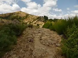 A view near the summit of the Serre de Borgne | |
.svg.png.webp) Coat of arms | |
Location of Notre-Dame-de-la-Rouvière | |
 Notre-Dame-de-la-Rouvière  Notre-Dame-de-la-Rouvière | |
| Coordinates: 44°02′57″N 3°42′06″E / 44.0492°N 3.7017°E | |
| Country | France |
| Region | Occitania |
| Department | Gard |
| Arrondissement | Le Vigan |
| Canton | Le Vigan |
| Commune | Val-d'Aigoual |
| Area 1 | 16.49 km2 (6.37 sq mi) |
| Population (2016)[1] | 408 |
| • Density | 25/km2 (64/sq mi) |
| Time zone | UTC+01:00 (CET) |
| • Summer (DST) | UTC+02:00 (CEST) |
| Postal code | 30570 |
| Elevation | 273–1,165 m (896–3,822 ft) (avg. 380 m or 1,250 ft) |
| 1 French Land Register data, which excludes lakes, ponds, glaciers > 1 km2 (0.386 sq mi or 247 acres) and river estuaries. | |
Notre-Dame-de-la-Rouvière (French pronunciation: [nɔtʁ dam də la ʁuvjɛʁ]; Occitan: Nòstra Dama de la Rovièira) is a former commune in the Gard department in southern France. On 1 January 2019, it was merged into the new commune Val-d'Aigoual.[2]
Population
| Year | Pop. | ±% |
|---|---|---|
| 1962 | 350 | — |
| 1968 | 414 | +18.3% |
| 1975 | 346 | −16.4% |
| 1982 | 364 | +5.2% |
| 1990 | 355 | −2.5% |
| 1999 | 354 | −0.3% |
| 2008 | 418 | +18.1% |
See also
References
- ↑ Téléchargement du fichier d'ensemble des populations légales en 2016, INSEE
- ↑ Arrêté préfectoral 26 September 2018 (in French)
Wikimedia Commons has media related to Notre-Dame-de-la-Rouvière.
This article is issued from Wikipedia. The text is licensed under Creative Commons - Attribution - Sharealike. Additional terms may apply for the media files.