Nyírcsaholy | |
|---|---|
 Coat of arms | |
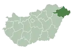
 Nyírcsaholy Location of Nyírcsaholy in Hungary | |
| Coordinates: 47°54′12″N 22°20′09″E / 47.90333°N 22.33583°E | |
| Country | Hungary |
| Region | Northern Great Plain |
| County | Szabolcs-Szatmár-Bereg |
| Area | |
| • Total | 34.3 km2 (13.2 sq mi) |
| Population (2011)[2] | |
| • Total | 2,119 |
| • Density | 62/km2 (160/sq mi) |
| Time zone | UTC+1 (CET) |
| • Summer (DST) | UTC+2 (CEST) |
| Postal code | 4356 |
| Area code | +36 74 |
| Website | www.nyircsaholy.hu |
Nyírcsaholy is a village in Szabolcs-Szatmár-Bereg County, Hungary.
References
- ↑ Nyírcsaholy at the Hungarian Central Statistical Office (Hungarian).
- ↑ Nyírcsaholy at the Hungarian Central Statistical Office (Hungarian). 2011

This article is issued from Wikipedia. The text is licensed under Creative Commons - Attribution - Sharealike. Additional terms may apply for the media files.