Oberwölz Stadt | |
|---|---|
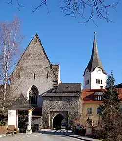 Hintereggertor, St. Sigismund church and St. Martin parish church | |
 Coat of arms | |
 Oberwölz Stadt Location within Austria | |
| Coordinates: 47°12′00″N 14°17′00″E / 47.20000°N 14.28333°E | |
| Country | Austria |
| State | Styria |
| District | Murau |
| Government | |
| • Mayor | Gunner Bischof [1] (ÖVP) |
| Area | |
| • Total | 4.64 km2 (1.79 sq mi) |
| Elevation | 830 m (2,720 ft) |
| Population (1 January 2016)[2] | |
| • Total | 987 |
| • Density | 210/km2 (550/sq mi) |
| Time zone | UTC+1 (CET) |
| • Summer (DST) | UTC+2 (CEST) |
| Postal code | 8832 |
| Area code | 03581 |
| Vehicle registration | MU |
| Website | www.oberwoelz-stadt.steiermark.at |
Oberwölz Stadt is a town and a former municipality in the district of Murau in the Austrian state of Styria. Since the 2015 Styria municipal structural reform, it is part of the municipality Oberwölz.[3]
Population
| Year | Pop. | ±% |
|---|---|---|
| 1869 | 747 | — |
| 1880 | 762 | +2.0% |
| 1890 | 769 | +0.9% |
| 1900 | 731 | −4.9% |
| 1910 | 681 | −6.8% |
| 1923 | 635 | −6.8% |
| 1934 | 616 | −3.0% |
| 1939 | 644 | +4.5% |
| 1951 | 844 | +31.1% |
| 1961 | 944 | +11.8% |
| 1971 | 908 | −3.8% |
| 1981 | 979 | +7.8% |
| 1991 | 1,026 | +4.8% |
| 2001 | 1,055 | +2.8% |
| 2011 | 971 | −8.0% |
References
This article is issued from Wikipedia. The text is licensed under Creative Commons - Attribution - Sharealike. Additional terms may apply for the media files.