Onton | |
|---|---|
Census-designated place (CDP) | |
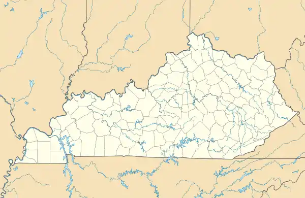 Onton Location within the state of Kentucky | |
| Coordinates: 37°33′28″N 87°26′13″W / 37.55778°N 87.43694°W | |
| Country | United States |
| State | Kentucky |
| County | Webster |
| Area | |
| • Total | 0.83 sq mi (2.15 km2) |
| • Land | 0.82 sq mi (2.14 km2) |
| • Water | 0.00 sq mi (0.01 km2) |
| Elevation | 476 ft (145 m) |
| Population (2020) | |
| • Total | 138 |
| • Density | 167.27/sq mi (64.58/km2) |
| Time zone | UTC-6 (Central (CST)) |
| • Summer (DST) | UTC-5 (CST) |
| FIPS code | 21-58116 |
| GNIS feature ID | 2629659[2] |
Onton (/ˈɒntən/) is a census-designated place (CDP) in Webster County, Kentucky, United States.
Demographics
| Census | Pop. | Note | %± |
|---|---|---|---|
| 2020 | 138 | — | |
| U.S. Decennial Census[3] | |||
References
- ↑ "2020 U.S. Gazetteer Files". United States Census Bureau. Retrieved March 18, 2022.
- ↑ U.S. Geological Survey Geographic Names Information System: Onton, Kentucky
- ↑ "Census of Population and Housing". Census.gov. Retrieved June 4, 2016.
Municipalities and communities of Webster County, Kentucky, United States | ||
|---|---|---|
| Cities | 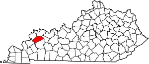 Map of Kentucky highlighting Webster County | |
| CDPs | ||
| Other unincorporated communities | ||
| Footnotes | ‡This populated place also has portions in an adjacent county or counties | |
This article is issued from Wikipedia. The text is licensed under Creative Commons - Attribution - Sharealike. Additional terms may apply for the media files.