| Pahranagat Range | |
|---|---|
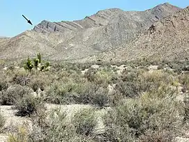 Landscape showing the Devonian Alamo bolide impact breccia (arrow) near Hancock Summit | |
| Highest point | |
| Elevation | 2,268 m (7,441 ft) |
| Geography | |
| Country | United States |
| State | Nevada |
| District | Lincoln County |
| Range coordinates | 37°22′4.855″N 115°22′7.083″W / 37.36801528°N 115.36863417°W |
| Topo map | USGS Badger Spring |

The Pahranagat Range is a mountain range in Lincoln County, Nevada.[1]
References
See also
This article is issued from Wikipedia. The text is licensed under Creative Commons - Attribution - Sharealike. Additional terms may apply for the media files.