Phillips Township | |
|---|---|
 | |
.svg.png.webp) Location of Illinois in the United States | |
| Coordinates: 38°10′09″N 88°02′58″W / 38.16917°N 88.04944°W | |
| Country | United States |
| State | Illinois |
| County | White |
| Organized | November 7, 1871 |
| Area | |
| • Total | 66.38 sq mi (171.9 km2) |
| • Land | 65.05 sq mi (168.5 km2) |
| • Water | 1.33 sq mi (3.4 km2) |
| Elevation | 476 ft (145 m) |
| Population (2010) | |
| • Estimate (2016)[1] | 1,214 |
| Time zone | UTC-6 (CST) |
| • Summer (DST) | UTC-5 (CDT) |
| ZIP code | XXXXX |
| Area code | 618 |
| FIPS code | 17-193-59507 |
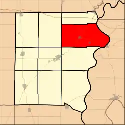
Phillips Township is located in White County, Illinois. As of the 2010 census, its population was 1,258 and it contained 610 housing units.[2]
History
Phillips Township was likely named for Major Alexander Phillips, who made a land entry in 1817 for a quarter section of land abutting to the west of where Phillipstown, Illinois would be platted two decades later. [3]
Geography
According to the 2010 census, the township has a total area of 66.38 square miles (171.9 km2), of which 65.05 square miles (168.5 km2) (or 98.00%) is land and 1.33 square miles (3.4 km2) (or 2.00%) is water.[2]
Demographics
| Census | Pop. | Note | %± |
|---|---|---|---|
| 2016 (est.) | 1,214 | [1] | |
| U.S. Decennial Census[4] | |||
References
- 1 2 "Population and Housing Unit Estimates". Retrieved June 9, 2017.
- 1 2 "Population, Housing Units, Area, and Density: 2010 - County -- County Subdivision and Place -- 2010 Census Summary File 1". United States Census. Archived from the original on February 12, 2020. Retrieved May 28, 2013.
- ↑ "Illinois Public Domain Land Tracts Sales Database". Illinois State Archives. Retrieved April 21, 2014.
- ↑ "Census of Population and Housing". Census.gov. Retrieved June 4, 2016.
External links
Municipalities and communities of White County, Illinois, United States | ||
|---|---|---|
| Cities | Map of Illinois highlighting White County | |
| Villages | ||
| Townships | ||
| Unincorporated communities | ||
| Footnotes | ‡This populated place also has portions in an adjacent county or counties | |
This article is issued from Wikipedia. The text is licensed under Creative Commons - Attribution - Sharealike. Additional terms may apply for the media files.