< Portal:Austria < WD
This list is automatically generated from data in Wikidata and is periodically updated by Listeriabot.
Edits made within the list area will be removed on the next update!
BDA Modellierungsartefakt


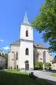
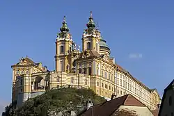
Catholic pilgrimage church
| # | WD item | article | description | is a | municipality | commons category | picture | coordinates | position map |
|---|---|---|---|---|---|---|---|---|---|
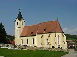
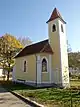
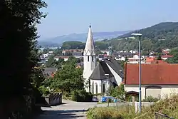
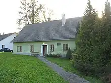
| 1 | Q61774901 | Pilgrimage church Maria Steinparz | church building in Schollach, Austria | Catholic pilgrimage church church building |
Schollach | Wallfahrtskirche Maria Steinparz |  |
48°10′19″N 15°21′06″E / 48.172063°N 15.351777°E | |
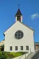
| 2 | Q2542886 | Wallfahrtskirche Maria Taferl | church building in Maria Taferl, Austria | Catholic pilgrimage church museum |
Maria Taferl | Wallfahrtskirche Maria Taferl | .JPG.webp) |
48°13′31″N 15°09′22″E / 48.2253°N 15.1562°E |
Gasthaus


Hausberg


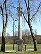
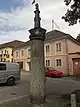
Maria column
| # | WD item | article | description | is a | municipality | commons category | picture | coordinates | position map |
|---|---|---|---|---|---|---|---|---|---|
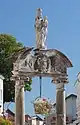
| 1 | Q38101897 | Mariensäule mit Maria Immaculata Ybbs an der Donau | building in Ybbs an der Donau, Austria | Maria column | Ybbs an der Donau | Mariensäule mit Maria Immaculata Ybbs an der Donau |  |
48°10′37″N 15°05′00″E / 48.17705°N 15.08345°E | |
| 2 | Q38144983 | Mariensäule und Pranger | building in Dunkelsteinerwald, Austria | Maria column | Dunkelsteinerwald | 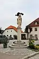 |
48°18′24″N 15°28′20″E / 48.3066°N 15.47222°E | ||
| 3 | Q38153962 | Mariensäule, Familiensäule | building in Sankt Leonhard am Forst, Austria | Maria column | Sankt Leonhard am Forst |  |
48°08′33″N 15°17′05″E / 48.14259°N 15.28462°E | ||
| 4 | Q38150727 | Mariensäule, Schlangenkreuz | building in Mank, Austria | Maria column | Mank |  |
48°07′53″N 15°21′49″E / 48.13151°N 15.36352°E |
Ortsteil
| # | WD item | article | description | is a | municipality | commons category | picture | coordinates | position map |
|---|---|---|---|---|---|---|---|---|---|
| 1 | Q121434949 | Kemmelbach bei Ybbs | Ortsteil | Neumarkt an der Ybbs | |||||
| 2 | Q121434953 | Sankt Georgen | Ortsteil | Emmersdorf an der Donau |
Schloss
| # | WD item | article | description | is a | municipality | commons category | picture | coordinates | position map |
|---|---|---|---|---|---|---|---|---|---|
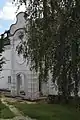
| 1 | Q17591773 | Schloss Grünbühel | Schloss | Kilb | Schloss Grünbühel (Lower Austria) |  |
48°06′00″N 15°24′12″E / 48.1°N 15.40338°E | ||
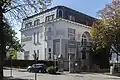
| 2 | Q38134338 | Schloss Hubertendorf Blindenmarkt | museum in Austria | Schloss museum |
Blindenmarkt | Schloss Hubertendorf Blindenmarkt |  |
48°07′59″N 15°01′19″E / 48.13319°N 15.02197°E |
Wikimedia list article
agricultural structure


bridge


building


burgus
| # | WD item | article | description | is a | municipality | commons category | picture | coordinates | position map |
|---|---|---|---|---|---|---|---|---|---|
| 1 | Q37832395 | Spätantikes Kleinkastell (Burgus) Ad Pontem Ises am Kirchenplatz | burgus in Ybbs an der Donau, Austria | burgus | Ybbs an der Donau | 48°10′40″N 15°05′08″E / 48.17781°N 15.08549°E | |||
| 2 | Q1016128 | Wachtürme Ybbs | burgus | burgus | Ybbs an der Donau | 48°10′00″N 15°04′00″E / 48.1667°N 15.0667°E |
cadastral municipality of Austria


castle


castle ruin
| # | WD item | article | description | is a | municipality | commons category | picture | coordinates | position map |
|---|---|---|---|---|---|---|---|---|---|
| 1 | Q1015423 | Burgruine Mollenburg | castle ruin | castle ruin ruins |
Weiten | Burgruine Mollenburg | .JPG.webp) |
48°17′42″N 15°15′23″E / 48.295°N 15.2565°E | |
| 2 | Q98609696 | Burgruine Peilstein | castle ruin | Sankt Leonhard am Forst | 48°09′29″N 15°17′53″E / 48.158173°N 15.29793°E | ||||
| 3 | Q98164267 | Burgruine Sichtenberg | castle ruin, Austria | castle ruin | Schollach | 48°10′31″N 15°22′29″E / 48.17523°N 15.37473°E | |||
| 4 | Q30013340 | Burgruine Weitenegg | building in Leiben, Austria | castle ruin ruins |
Leiben | Burgruine Weitenegg | .JPG.webp) |
48°13′48″N 15°17′38″E / 48.23°N 15.294°E | |
| 5 | Q1015614 | Burgruine Zelking | castle ruin in Austria | castle ruin | Zelking-Matzleinsdorf | Burgruine Zelking |  |
48°11′03″N 15°16′03″E / 48.1842°N 15.2675°E | |
| 6 | Q117268045 | Sichtenberg | castle ruin | Schollach |
castrum
| # | WD item | article | description | is a | municipality | commons category | picture | coordinates | position map |
|---|---|---|---|---|---|---|---|---|---|
| 1 | Q2654485 | Castra Arelape | Roman fort | castrum grave field ancient Roman structure |
Pöchlarn |  |
48°12′N 15°12′E / 48.2°N 15.2°E | ||
| 2 | Q2739868 | Castra Namare | Roman fort | castrum cultural property ancient Roman structure |
Schönbühel-Aggsbach |  |
48°16′35″N 15°23′46″E / 48.2763°N 15.39603°E |
cemetery


_-_Kirche.JPG.webp)

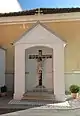
cemetery chapel
| # | WD item | article | description | is a | municipality | commons category | picture | coordinates | position map |
|---|---|---|---|---|---|---|---|---|---|
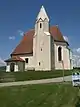
| 1 | Q38144191 | Friedhofskapelle | cemetery chapel in Hürm, Austria | cemetery chapel | Hürm |  |
48°09′13″N 15°24′37″E / 48.1536°N 15.41019°E | ||
| 2 | Q38150076 | Friedhofskapelle | cemetery in Ruprechtshofen, Austria | cemetery chapel | Ruprechtshofen |  |
48°08′02″N 15°16′31″E / 48.13381°N 15.27523°E | ||
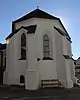
| 3 | Q38121838 | Friedhofskapelle Schmerzhafte Muttergottes, Pöchlarn | cemetery in Pöchlarn, Austria | cemetery chapel | Pöchlarn | Friedhofskapelle Schmerzhafte Muttergottes, Pöchlarn |  |
48°12′39″N 15°13′09″E / 48.21077°N 15.21906°E |
chapel


kapelle_-_02.jpg.webp)


_-_Ursprungskapelle.JPG.webp)


_-_Wegkapelle.JPG.webp)


church building


.JPG.webp)


.jpg.webp)


_-_Pfarrkirche_hl._Johann_Nepomuk_und_Kriegerdenkmal_-_01.jpg.webp)


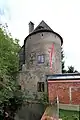
château


.jpg.webp)


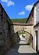
city fortifications
| # | WD item | article | description | is a | municipality | commons category | picture | coordinates | position map |
|---|---|---|---|---|---|---|---|---|---|
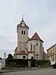
| 1 | Q96195613 | Stadtbefestigung Pöchlarn | city fortifications | Pöchlarn | Stadtbefestigung Pöchlarn |  |
48°12′44″N 15°12′33″E / 48.21211°N 15.20918°E | ||
| 2 | Q96313786 | Stadtbefestigung Ybbs an der Donau | city fortifications | Ybbs an der Donau | Stadtbefestigung Ybbs an der Donau |  |
48°10′40″N 15°05′08″E / 48.17777°N 15.0855°E |
concentration camp
| # | WD item | article | description | is a | municipality | commons category | picture | coordinates | position map |
|---|---|---|---|---|---|---|---|---|---|
| 1 | Q53865641 | Emmersdorf an der Donau concentration camp | concentration camp | Emmersdorf an der Donau | |||||
| 2 | Q1719398 | Melk concentration camp | sub-camp of Mauthausen concentration camp (1944-1945) | concentration camp | Melk | Melk concentration camp | 48°13′14″N 15°19′27″E / 48.2205°N 15.3243°E | ||
| 3 | Q53866079 | Persenbeug concentration camp | concentration camp | Persenbeug-Gottsdorf | |||||
| 4 | Q53866189 | Schönbühel an der Donau concentration camp | concentration camp | Schönbühel-Aggsbach |
cultural property


.jpg.webp)


_-_Pfarrhof.JPG.webp)


_-_Pfarrhof.JPG.webp)


.jpg.webp)


_-_Pranger.JPG.webp)


_-_01.jpg.webp)
_-_01.jpg.webp)


farm
| # | WD item | article | description | is a | municipality | commons category | picture | coordinates | position map |
|---|---|---|---|---|---|---|---|---|---|
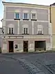
| 1 | Q38115862 | Bauernhaus | human settlement in Austria | farm | Melk |  |
48°13′36″N 15°19′53″E / 48.22665°N 15.33138°E | ||
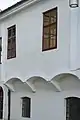
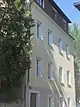
| 2 | Q37954404 | Farmhouse, Emmersdorf an der Donau 6 | human settlement in Austria | farm | Emmersdorf an der Donau | Farmhouse, Emmersdorf an der Donau 6 |  |
48°14′30″N 15°20′14″E / 48.24165°N 15.33718°E | |
| 3 | Q55182218 | Gutscherhof | farm | Münichreith-Laimbach |
fire station
.jpg.webp)
_Fire_station_of_Freiwillige_Feuerwehr_Altenmarkt%252C_Yspertal%252C_Lower_Austria%252C_Austria.jpg.webp)


forester's lodge
| # | WD item | article | description | is a | municipality | commons category | picture | coordinates | position map |
|---|---|---|---|---|---|---|---|---|---|
| 1 | Q37957635 | Ehem. Forsthaus | building in Leiben, Austria | forester's lodge | Leiben |  |
48°14′40″N 15°17′02″E / 48.24431°N 15.28384°E | ||
| 2 | Q38153092 | Mauthaus Aggstein | building in Schönbühel-Aggsbach, Austria | forester's lodge | Schönbühel-Aggsbach | Mauthaus Aggstein |  |
48°18′39″N 15°24′45″E / 48.31078°N 15.41239°E |
grave field
| # | WD item | article | description | is a | municipality | commons category | picture | coordinates | position map |
|---|---|---|---|---|---|---|---|---|---|
| 1 | Q37829758 | Gräberfeld Haidenschaft | building in Neumarkt an der Ybbs, Austria | grave field | Neumarkt an der Ybbs | 48°08′48″N 15°03′22″E / 48.1467°N 15.05608°E | |||
| 2 | Q38022540 | Hügelgräberfeld Thurnhofer Leithen | building in Hürm, Austria | grave field | Hürm | 48°08′29″N 15°24′00″E / 48.14151°N 15.39999°E | |||
| 3 | Q38022552 | Hügelgräberfeld Thurnhofer Leithen | building in Hürm, Austria | grave field | Hürm | 48°08′31″N 15°24′00″E / 48.142°N 15.39994°E | |||
| 4 | Q37828602 | Spätbronzezeitliches Gräberfeld in der Flur Edichenthal | building in Bergland, Austria | grave field | Bergland | 48°09′11″N 15°09′52″E / 48.15302°N 15.16437°E |
heritage site


hilltop settlement
| # | WD item | article | description | is a | municipality | commons category | picture | coordinates | position map |
|---|---|---|---|---|---|---|---|---|---|
| 1 | Q38024885 | Befestigte Höhensiedlung Anzenberger Höhe | human settlement in Austria | hilltop settlement | Zelking-Matzleinsdorf | 48°09′40″N 15°14′27″E / 48.16108°N 15.24078°E | |||
| 2 | Q38024428 | Befestigte Höhensiedlung Wachberg | hilltop settlement | Loosdorf | 48°12′50″N 15°22′00″E / 48.21377°N 15.36677°E |
historic street
| # | WD item | article | description | is a | municipality | commons category | picture | coordinates | position map |
|---|---|---|---|---|---|---|---|---|---|
| 1 | Q64692019 | Ehemalige Fürnberg’sche Poststraße (Abschnitt in der KG Aich) | historic street | Artstetten-Pöbring | Fürnbergsche Poststraße |  |
|||
| 2 | Q64692022 | Fürnberg´sche Poststraße (Abschnitt in der KG St. Georgen) | old post road in Emmersdorf an der Donau, Austria | historic street | Emmersdorf an der Donau |  |
hospital
| # | WD item | article | description | is a | municipality | commons category | picture | coordinates | position map |
|---|---|---|---|---|---|---|---|---|---|
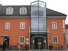
| 1 | Q1802294 | Landesklinikum Melk | hospital in Austria | hospital chapel |
Melk | Landesklinikum Melk |  |
48°13′35″N 15°20′21″E / 48.2264°N 15.3393°E | |
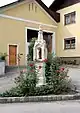
| 2 | Q2419467 | Ybbs Pflegezentrum | hospital in Austria | hospital monastery |
Ybbs an der Donau | Ybbs Pflegezentrum |  |
48°10′53″N 15°04′46″E / 48.1814°N 15.0794°E |
hotel


human settlement
locality

_Way_from_Haltgraben_to_Gr%C3%BCntalkogelh%C3%BCtte%252C_view_to_St._Gotthard_in_Nieder%C3%B6sterreich.jpg.webp)

_View_from_Schwabeckkreuz_at_Haltgraben%252C_Frankenfels%252C_to_Texing%252C_Austria.jpg.webp)
mansion


market municipality


.jpg.webp)
_-_Pfarrkirche_hl._Johann_Nepomuk_und_Kriegerdenkmal_-_02.jpg.webp)


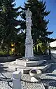
monument
| # | WD item | article | description | is a | municipality | commons category | picture | coordinates | position map |
|---|---|---|---|---|---|---|---|---|---|
| 1 | Q66817808 | Falco-Denkmal Gansbach | monument in Dunkelsteinerwald, Austria | monument | Dunkelsteinerwald | Falco-Denkmal Gansbach |  |
48°18′20″N 15°28′28″E / 48.305433°N 15.474306°E | |
| 2 | Q897771 | Monument to the victims of the fire in Melk Abbey (1805) | monument sepulchral monument |
Melk | Monument to the fire in Melk Abbey (1805) |  |
48°13′05″N 15°18′35″E / 48.21817°N 15.30976°E | ||
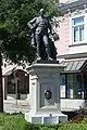
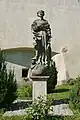
| 3 | Q98594789 | Schubert Denkmal, Stadtpark Melk | statue in Melk, Austria | monument bust |
Melk | Schubert Denkmal, Stadtpark Melk |  |
48°13′32″N 15°19′49″E / 48.225655555555555°N 15.330216666666669°E |
mountain
municipality of Austria

museum


.jpg.webp)

navigable aqueduct
| # | WD item | article | description | is a | municipality | commons category | picture | coordinates | position map |
|---|---|---|---|---|---|---|---|---|---|
| 1 | Q113565047 | Kanalbrücke Sattlehen | navigable aqueduct | Kirnberg an der Mank | 48°04′00″N 15°18′41″E / 48.06665°N 15.31149°E | ||||
| 2 | Q113565039 | Kanalbrücke Teufelsbach Kilb | navigable aqueduct | Kilb | Kanalbrücke Teufelsbach Kilb |  |
48°04′52″N 15°24′20″E / 48.08103°N 15.40565°E |
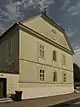
parish church


public library
railway station

_Bahnhof_Melk.jpg.webp)
_Bahnhof_P%C3%B6chlarn.jpg.webp)

rathaus


residential building


%252C_Persenbeug.jpg.webp)


rocca
| # | WD item | article | description | is a | municipality | commons category | picture | coordinates | position map |
|---|---|---|---|---|---|---|---|---|---|
| 1 | Q698689 | Aggstein Castle | Ruins of Castle Aggstein | rocca ruins museum |
Schönbühel-Aggsbach | Burgruine Aggstein |  |
48°18′50″N 15°25′18″E / 48.31388888888889°N 15.421666666666669°E | |
| 2 | Q494695 | Plankenstein Castle | rocca near Texing in Lower Austria | rocca chapel castle museum |
Texingtal | Burg Plankenstein | 48°01′31″N 15°16′44″E / 48.02524°N 15.27889°E |
ruins
| # | WD item | article | description | is a | municipality | commons category | picture | coordinates | position map |
|---|---|---|---|---|---|---|---|---|---|
| 1 | Q1711277 | Burg Streitwiesen | ruins | Weiten | Burg Streitwiesen |  |
48°18′50″N 15°14′02″E / 48.314°N 15.234°E | ||
| 2 | Q114853906 | Burgruine Gossam | Castle ruins near Melk, Lower Austria | ruins castle |
Goßam | 48°15′47″N 15°20′08″E / 48.26297°N 15.33548°E | |||
| 3 | Q114859987 | Burgruine Karlsbach | Castle ruins near Melk, Lower Austria | ruins | Karlsbach | 48°09′46″N 15°02′27″E / 48.16282°N 15.04088°E | |||
| 4 | Q100742773 | Burgruine Wimberg (Yspertal) | castle ruins in Yspertal | ruins | Yspertal | 48°19′49″N 15°03′19″E / 48.33038°N 15.05534°E | |||
| 5 | Q37963220 | Burgruine Wolfstein, Schönbühel-Aggsbach | ruins | Schönbühel-Aggsbach | Burgruine Wolfstein, Schönbühel-Aggsbach |  |
48°16′24″N 15°26′04″E / 48.2733°N 15.43435°E | ||
| 6 | Q38144693 | Burgruine und Stöckl Hürm | ruins | Hürm | Burgruine und Stöckl Hürm |  |
48°09′59″N 15°22′01″E / 48.16635°N 15.36699°E | ||
| 7 | Q61451527 | Ruine Weissenberg | ruins | Münichreith-Laimbach |
run-of-the-river power station
| # | WD item | article | description | is a | municipality | commons category | picture | coordinates | position map |
|---|---|---|---|---|---|---|---|---|---|
| 1 | Q1786155 | Melk power station | building in Lower Austria, Austria | run-of-the-river power station | Melk Zelking-Matzleinsdorf Leiben Emmersdorf an der Donau |
Kraftwerk Melk | 48°13′28″N 15°18′14″E / 48.2245°N 15.304°E | ||
| 2 | Q1786238 | Ybbs-Persenbeug power station | power station in Lower Austria, Austria | run-of-the-river power station museum |
Ybbs an der Donau Hofamt Priel Persenbeug-Gottsdorf |
Kraftwerk Ybbs-Persenbeug | 48°11′25″N 15°04′13″E / 48.1903°N 15.0703°E |
rural municipality of Austria


school
| # | WD item | article | description | is a | municipality | commons category | picture | coordinates | position map |
|---|---|---|---|---|---|---|---|---|---|
| 1 | Q5877467 | Hohe Schule, Loosdorf, Austria | building in Loosdorf, Austria | school school building |
Loosdorf | Hohe Schule, Loosdorf |  |
48°11′56″N 15°24′06″E / 48.19892°N 15.40162°E | |
| 2 | Q24026705 | Höhere Lehranstalt für Umwelt und Wirtschaft Yspertal | school in Yspertal, Austria | school | Yspertal | 48°17′06″N 15°03′47″E / 48.285°N 15.063°E | |||
| 3 | Q1678868 | Jakob-Prandtauer-Volks-und-Hauptschule | school in Melk, Austria | school | Melk | 48°13′30″N 15°20′21″E / 48.225°N 15.3392°E | |||
| 4 | Q20182494 | Schule, ehem. Bürgerspital Ybbs | building in Ybbs an der Donau, Austria | school school building former hospital |
Ybbs an der Donau | Schule, ehem. Bürgerspital Ybbs |  |
48°10′37″N 15°04′54″E / 48.1770219°N 15.0816872°E |
school building


station building
| # | WD item | article | description | is a | municipality | commons category | picture | coordinates | position map |
|---|---|---|---|---|---|---|---|---|---|
| 1 | Q106813401 | Aufnahmsgebäude Bahnhof Melk | station building in Melk | station building cultural property |
Melk | Aufnahmsgebäude Bahnhof Melk | 48°13′29″N 15°19′51″E / 48.22481°N 15.33081°E | ||
| 2 | Q38041315 | Bahnhof St. Leonhard am Forst | building in Sankt Leonhard am Forst, Austria | station building | Sankt Leonhard am Forst | Bahnhof St. Leonhard am Forst |  |
48°08′39″N 15°17′00″E / 48.14408°N 15.28345°E | |
| 3 | Q38042241 | Bahnhof Weins-Isperdorf | building in Hofamt Priel, Austria | station building railway station |
Hofamt Priel | Bahnhof Weins-Isperdorf |  |
48°11′46″N 15°01′23″E / 48.19604°N 15.02296°E | |
| 4 | Q122975224 | Emmersdorf an der Donau station building | railway station building in Emmersdorf an der Donau, protected building | station building | Emmersdorf an der Donau |  |
48°14′35″N 15°20′15″E / 48.2431°N 15.3374°E |
villa


.jpg.webp)

village
| # | WD item | article | description | is a | municipality | commons category | picture | coordinates | position map |
|---|---|---|---|---|---|---|---|---|---|
| 1 | Q56117979 | Donaudorf | locality and cadastral community in Melk District | village cadastral municipality of Austria locality |
Ybbs an der Donau | 48°11′39″N 15°03′07″E / 48.1941666666667°N 15.0519444444444°E | |||
| 2 | Q1343455 | Ennsbach | village in Sankt Martin-Karlsbach, Austria | village | Sankt Martin-Karlsbach | 48°08′47″N 15°01′42″E / 48.1464°N 15.0283°E | |||
| 3 | Q55342137 | Löbersdorf | locality in Melk District | village | Hürm | 48°10′19″N 15°24′23″E / 48.1719444444444°N 15.4063888888889°E | |||
| 4 | Q54680072 | Wohlfahrtsbrunn | human settlement in Melk District | village | Bergland | 48°09′49″N 15°11′10″E / 48.16369°N 15.18623°E | |||
| 5 | Q96774814 | Würnsdorf | locality and cadastral Community in Melk district | village cadastral municipality of Austria locality |
Pöggstall | 48°18′56″N 15°10′18″E / 48.315555555555555°N 15.171666666666669°E |
war memorial


water well


watercourse
| # | WD item | article | description | is a | municipality | commons category | picture | coordinates | position map |
|---|---|---|---|---|---|---|---|---|---|
| 1 | Q111397220 | Dollbach | watercourse | Petzenkirchen | 48°11′43″N 15°11′08″E / 48.195278°N 15.185556°E | ||||
| 2 | Q111253373 | Lojabach | watercourse | Persenbeug-Gottsdorf | 48°12′11″N 15°06′45″E / 48.203056°N 15.1125°E | ||||
| 3 | Q111397190 | Mühlbach | watercourse | Petzenkirchen | 48°09′08″N 15°10′11″E / 48.152222°N 15.169722°E | ||||
| 4 | Q111253614 | Wehrbach | watercourse | Weiten | 48°18′13″N 15°15′26″E / 48.303611°N 15.257222°E |
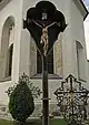
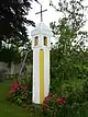
wayside cross
| # | WD item | article | description | is a | municipality | commons category | picture | coordinates | position map |
|---|---|---|---|---|---|---|---|---|---|
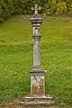
| 1 | Q112730894 | Fürst-Kreuz | wayside cross near Winden, Lower Austria, Austria | wayside cross | Winden |  |
48°12′43″N 15°19′12″E / 48.21194°N 15.31994°E | ||
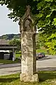
| 2 | Q112894269 | wayside cross (Pöverding) | wayside cross west of Pöverding, Lower Austria, Austria | wayside cross | Melk |  |
48°12′35″N 15°19′27″E / 48.20983826009409°N 15.324125442615372°E |
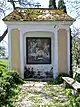
wayside shrine


Misc


.JPG.webp)


_Bicycle_way_over_Kraftwerk_Melk%252C_Austria.jpg.webp)

.jpg.webp)

.JPG.webp)


End of auto-generated list.
This article is issued from Wikipedia. The text is licensed under Creative Commons - Attribution - Sharealike. Additional terms may apply for the media files.