| Potecasi Creek Tributary to Meherrin River | |
|---|---|
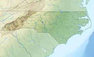 Location of Potecasi Creek mouth  Potecasi Creek (the United States) | |
| Location | |
| Country | United States |
| State | North Carolina |
| County | Hertford Northampton |
| Physical characteristics | |
| Source | confluence of Ramsey Creek and Wiccacanee Swamp |
| • location | about 2 miles east of Jackson, North Carolina |
| • coordinates | 36°23′26″N 077°20′47″W / 36.39056°N 77.34639°W[1] |
| • elevation | 65 ft (20 m)[2] |
| Mouth | Meherrin River |
• location | Parkers Ferry on Meherrin River |
• coordinates | 36°26′11″N 076°57′24″W / 36.43639°N 76.95667°W[1] |
• elevation | 0 ft (0 m)[3] |
| Length | 41.28 mi (66.43 km)[4] |
| Basin size | 41.28 square miles (106.9 km2)[5] |
| Discharge | |
| • location | Meherrin River |
| • average | 263.69 cu ft/s (7.467 m3/s) at mouth with Meherrin River[5] |
| Basin features | |
| Progression | Meherrin River → Chowan River → Albemarle Sound[4] |
| River system | Chowan River |
| Tributaries | |
| • left | Wildcat Swamp Paddys Delight Creek Panther Swamp Old Tree Swamp Bells Branch |
| • right | Urabaw Swamp Cutawhiskie Creek Mill Branch |
| Bridges | Creeksville Road, NC 35, US 258, Benthall Bridge Road, NC 11, US 158 |
Potecasi Creek is a 41.28 mi (66.43 km) long 4th order tributary to the Meherrin River in Hertford County, North Carolina. This is the only stream of this name in the United States.[1]
Variant names
According to the Geographic Names Information System, it has also been known historically as:[1]
- Catawhisky Creek
- Meherrin Creek
Course
Potecasi Creek begins at the confluence of Ramsey Creek and Wiccacanee Swamp in Northampton County, North Carolina about 2 miles east of Jackson, and then flows easterly into Hertford County to join the Meherrin River at Parkers Ferry.[3]
Watershed
Potecasi Creek drains 257.42 square miles (666.7 km2) of area, receives about 47.3 in/year of precipitation, has a wetness index of 592.69, and is about 29% forested.[5]
See also
References
- 1 2 3 4 "GNIS Detail - Potecasi Creek". geonames.usgs.gov. US Geological Survey. Retrieved 19 May 2021.
- ↑ "Get Maps". USGS Topoview. US Geological Survey. Retrieved 19 May 2021.
- 1 2 "Get Maps". USGS Topoview. US Geological Survey. Retrieved 19 May 2021.
- 1 2 "ArcGIS Web Application". epa.maps.arcgis.com. US EPA. Retrieved 19 May 2021.
- 1 2 3 "Potecasi Creek Watershed Report". US EPA Geoviewer. US EPA. Retrieved 19 May 2021.
This article is issued from Wikipedia. The text is licensed under Creative Commons - Attribution - Sharealike. Additional terms may apply for the media files.