Ringen | |
|---|---|
_COA.svg.png.webp) Coat of arms | |
Location of Ringen (Verbandsgemeinde) | |
 Ringen 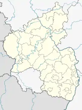 Ringen | |
| Coordinates: 50°34′N 7°6′E / 50.567°N 7.100°E | |
| Country | Germany |
| State | Rhineland-Palatinate |
| District | Landkreis Ahrweiler |
| Disbanded | 1974 |
| Subdivisions | 12 Gemeinden |
| Area | |
| • Total | 61.88 km2 (23.89 sq mi) |
| Population (1974) | |
| • Total | 6,566 |
| • Density | 110/km2 (270/sq mi) |
| Time zone | UTC+01:00 (CET) |
| • Summer (DST) | UTC+02:00 (CEST) |
| Vehicle registration | AW |
Ringen is a former Verbandsgemeinde ("collective municipality") in the district of Ahrweiler, in Rhineland-Palatinate, Germany. The seat of the municipality was in Ringen. It existed from 1 October 1968 until 16 March 1974, when the new municipality Grafschaft was formed.[1]
The Verbandsgemeinde Ringen consisted of the following 12 Ortsgemeinden ("local municipalities") (population as of 1974):[2]
| Municipality | Area (km²) | Population | |
|---|---|---|---|
| Bengen | 413 | ||
| Birresdorf | 369 | ||
| Eckendorf | 287 | ||
| Gelsdorf | 823 | ||
| Holzweiler | 623 | ||
| Kalenborn | 453 | ||
| Karweiler | 457 | ||
| Lantershofen | 690 | ||
| Leimersdorf | 603 | ||
| Nierendorf | 418 | ||
| Ringen * | 948 | ||
| Vettelhoven | 482 | ||
| Verbandsgemeinde Ringen | 61.88 | 6,566 |
* seat of the Verbandsgemeinde
References
- ↑ Sechzehntes Landesgesetz über die Verwaltungsvereinfachung im Lande Rheinland-Pfalz vom 19. Dezember 1973 (GVBl. p. 541) (in German)
- ↑ [https://web.archive.org/web/20171222053010/http://www.statistik.rlp.de/fileadmin/dokumente/Verzeichnisse/AmtlichesGemeindeverzeichnis_2006.pdf Amtliches Gemeindeverzeichnis 2006 - Statistisches Landesamt Rheinland-Pfalz (p. 177)] at the Wayback Machine (archived 22 December 2017) (in German)
This article is issued from Wikipedia. The text is licensed under Creative Commons - Attribution - Sharealike. Additional terms may apply for the media files.