Rohrbach-Steinberg | |
|---|---|
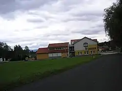 Rohrbach-Steinberg town hall | |
 Coat of arms | |
 Location within Graz-Umgebung district | |
 Rohrbach-Steinberg Location within Austria | |
| Coordinates: 47°03′44″N 15°17′44″E / 47.06222°N 15.29556°E | |
| Country | Austria |
| State | Styria |
| District | Graz-Umgebung |
| Government | |
| • Mayor | Heribert Uhl (SPÖ) |
| Area | |
| • Total | 8.41 km2 (3.25 sq mi) |
| Elevation | 405 m (1,329 ft) |
| Population (1 January 2016)[1] | |
| • Total | 1,421 |
| • Density | 170/km2 (440/sq mi) |
| Time zone | UTC+1 (CET) |
| • Summer (DST) | UTC+2 (CEST) |
| Postal code | 8151 |
| Area code | 03123 |
| Vehicle registration | GU |
| Website | www.rohrbach-steinberg.at |
Rohrbach-Steinberg is a former municipality in the district of Graz-Umgebung in the Austrian state of Styria. Since the 2015 Styria municipal structural reform, it is part of the municipality Hitzendorf.[2]
Population
| Year | Pop. | ±% |
|---|---|---|
| 1869 | 800 | — |
| 1880 | 784 | −2.0% |
| 1890 | 774 | −1.3% |
| 1900 | 777 | +0.4% |
| 1910 | 730 | −6.0% |
| 1923 | 720 | −1.4% |
| 1934 | 732 | +1.7% |
| 1939 | 684 | −6.6% |
| 1951 | 739 | +8.0% |
| 1961 | 767 | +3.8% |
| 1971 | 903 | +17.7% |
| 1981 | 1,035 | +14.6% |
| 1991 | 1,177 | +13.7% |
| 2001 | 1,285 | +9.2% |
References
This article is issued from Wikipedia. The text is licensed under Creative Commons - Attribution - Sharealike. Additional terms may apply for the media files.