Ronco, Pennsylvania | |
|---|---|
 Ronco  Ronco | |
| Coordinates: 39°52′07″N 79°55′16″W / 39.86861°N 79.92111°W | |
| Country | United States |
| State | Pennsylvania |
| County | Fayette |
| Township | German |
| Area | |
| • Total | 0.57 sq mi (1.47 km2) |
| • Land | 0.51 sq mi (1.32 km2) |
| • Water | 0.06 sq mi (0.14 km2) |
| Elevation | 984 ft (300 m) |
| Population | |
| • Total | 209 |
| • Density | 409.80/sq mi (158.16/km2) |
| Time zone | UTC-5 (Eastern (EST)) |
| • Summer (DST) | UTC-4 (EDT) |
| ZIP code | 15476 |
| FIPS code | 42-65976 |
| GNIS feature ID | 2634272 |
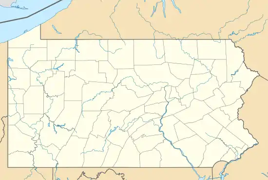
Ronco is an unincorporated community and census-designated place in German Township, Fayette County, Pennsylvania, United States. It is located 2 miles (3 km) north of the borough of Masontown, along the east bank of the Monongahela River. As of the 2010 census, the population of Ronco was 256.[3]
Demographics
| Census | Pop. | Note | %± |
|---|---|---|---|
| 2020 | 209 | — | |
| U.S. Decennial Census[4] | |||
References
- ↑ "ArcGIS REST Services Directory". United States Census Bureau. Retrieved August 8, 2023.
- ↑ "Census Population API". United States Census Bureau. Retrieved August 8, 2023.
- ↑ "Geographic Identifiers: 2010 Census Summary File 1 (G001), Ronco CDP, Pennsylvania". American FactFinder. U.S. Census Bureau. Archived from the original on February 13, 2020. Retrieved July 27, 2016.
- ↑ "Census of Population and Housing". Census.gov. Retrieved June 4, 2016.
External links
Municipalities and communities of Fayette County, Pennsylvania, United States | ||
|---|---|---|
| Cities | 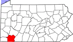 | |
| Boroughs | ||
| Townships | ||
| CDPs | ||
| Unincorporated communities |
| |
| Footnotes | ‡This populated place also has portions in an adjacent county or counties | |
This article is issued from Wikipedia. The text is licensed under Creative Commons - Attribution - Sharealike. Additional terms may apply for the media files.