 | ||||
|---|---|---|---|---|
| כביש 977 | ||||
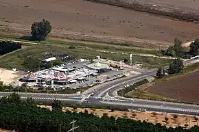 Goma Junction at the start of Route 977 | ||||
| Route information | ||||
| Length | 7 km (4.3 mi) | |||
| Major junctions | ||||
| West end | Gome Junction | |||
| East end | Lehavot HaBashan Junction | |||
| Location | ||||
| Country | Israel | |||
| Highway system | ||||
| ||||
Route 977 is an east-west regional highway in the Israeli-occupied portion of the Golan Heights, stretching from the Goma junction to the Lehavot HaBashan junction.
Junctions (West to East)
| District[1] | Location[2] | km | mi | Name | Destinations | Notes |
|---|---|---|---|---|---|---|
| Northern | Ein Bedolah Nature Reserve | 0 | 0.0 | צומת גומא (Gome Junction) | ||
| Kfar Blum | 2.5 | 1.6 | מסעף כפר בלום דרום (South Kfar Blum Branch) | |||
| Neot Mordechai | 3.5 | 2.2 | מסעף נאות מרדכי (Neot Mordechai Branch) | Entrance road | ||
| Lehavot HaBashan | 7 | 4.3 | צומת להבות הבשן (Lehavot HaBashan Junction) | |||
| 1.000 mi = 1.609 km; 1.000 km = 0.621 mi | ||||||
References
- ↑ Survey of Israel (October 31, 2018). "מחוזות משרד הפנים" [Ministry of Interior districts] (Map). Govmap (in Hebrew). Retrieved October 31, 2018.
- ↑ Survey of Israel (October 31, 2018). "גבולות ישובים" [Locality borders] (Map). Govmap (in Hebrew). Retrieved October 31, 2018.
| Roads |
| ||||
|---|---|---|---|---|---|
| Bus operators | |||||
| Rail transport |
| ||||
| Cycling | |||||
| Sea ports | |||||
| Aviation |
| ||||
| Cable cars | |||||
| By city | |||||
| Smart cards | |||||
This article is issued from Wikipedia. The text is licensed under Creative Commons - Attribution - Sharealike. Additional terms may apply for the media files.