Sabará | |
|---|---|
| Municipality of Sabará | |
 Flag  Seal | |
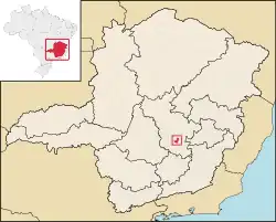 Location in Minas Gerais | |
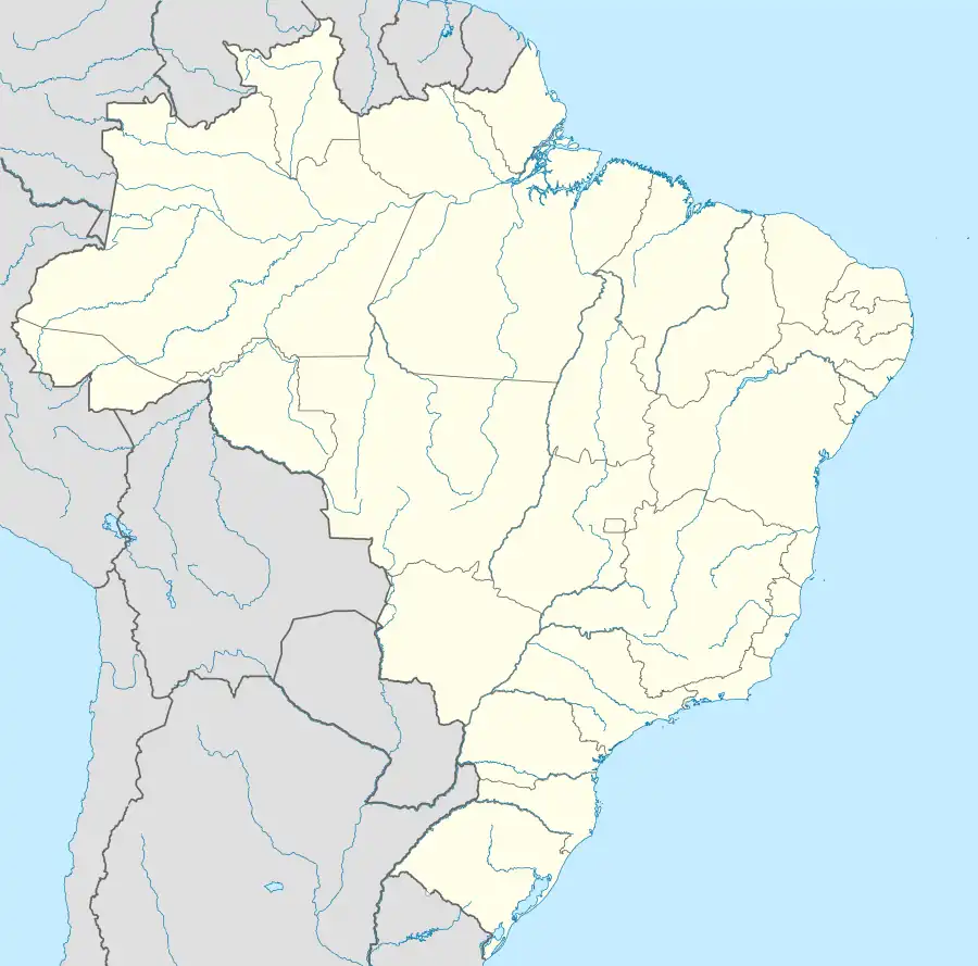 Sabará Location in Brazil | |
| Coordinates: 19°53′09″S 43°48′25″W / 19.88583°S 43.80694°W | |
| Country | |
| Region | Southeast |
| State | |
| Founded | 1675 |
| Government | |
| • Mayor | Wander José Goddard Borges (2021-2024) |
| Area | |
| • Total | 302.419 km2 (116.765 sq mi) |
| Elevation | 705 m (2,313 ft) |
| Population (2020 est.)[2] | |
| • Total | 137,125 |
| • Density | 450/km2 (1,200/sq mi) |
| Time zone | UTC−3 (BRT) |
| HDI (2010) | 0.731 – high[3] |

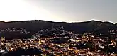
Sabará is a Brazilian municipality located in the state of Minas Gerais. The city belongs to the Belo Horizonte metropolitan region and to the associated microregion.
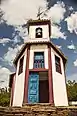
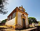
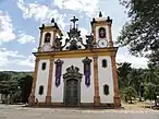
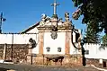
It is a well preserved historic city and retains the characteristics of a baroque city, with its churches, buildings and museums.
Other historical cities in Minas Gerais are Ouro Preto, São João del-Rei, Diamantina, Mariana, Tiradentes and Congonhas.
Historic structures
Sabará is home to numerous colonial-period historic structures, many designated as Brazilian national monuments by the National Institute of Historic and Artistic Heritage (IPHAN); others are designated as state monuments or recognized as Portuguese-era monuments as Heritage of Portuguese Influence by Calouste Gulbenkian Foundation.[4]
- Hospice of the Holy Land and Chapel of Our Lady of Pilar (Hospício da Terra Santa e Capela de Nossa Senhora do Pilar)
- Chapel of Our Lady of the Rosary (Capela de Nossa Senhora do Rosário)
- Parish Church of Our Lady of the Conception (Igreja Matriz de Nossa Senhora da Conceição)
- Church of Our Lady of Mercy (Igreja de Nossa Senhora das Mercês)
- Church of Our Lady of Mount Carmel (Igreja de Nossa Senhora do Carmo)
- Church of Our Lady of the Rosary (Igreja de Nossa Senhora do Rosário dos Pretos)
- Church of Our Lady of Ó (Igreja de Nossa Senhora do Ó)
- Church of Saint Anne (Igreja de Santana)
- Church of the Archbrotherhood of Saint Francis of Assisi (Church of the Archbrotherhood of Saint Francis of Assisi)
- Chapel of Saint Antony of Pompéu (Capela de Santo António de Pompéu)
- Chapels of the Stations of the Passion (Sabará) (Capelas dos Passos)
- Station of the Passion in Rua do Carmo (Passo do Carmo)
- Station of the Passion in Rua Marquês de Sapucaí (Station of the Passion in Rua Marquês de Sapucaí)
- Museum of Gold (Museu do Ouro, Antiga Casa de Intendência)
- Municipal Theater of Sabará (Teatro Municipal de Sabará)
- Caquende Fountain (Chafariz do Caquende)
- Rosário Fountain (Chafariz do Rosário)[4]
- Casa Azul
- House of Padre Correia (Solar do Padre Correia)
See also
References
- ↑ "Brazilian Institute of Geography and Statistics" (in Portuguese). 2017. Retrieved 27 March 2019.
2018 Area Total
- ↑ IBGE 2020
- ↑ "Archived copy" (PDF). United Nations Development Programme (UNDP). Archived from the original (PDF) on July 8, 2014. Retrieved August 1, 2013.
{{cite web}}: CS1 maint: archived copy as title (link) - 1 2 "Sabará". Lisbon, Portugal: Heritage of Portuguese Influence/Património de Influência Portuguesa. 2012. Retrieved 2022-09-23.

19°53′9″S 43°48′25″W / 19.88583°S 43.80694°W