Saint-Émile-de-Suffolk | |
|---|---|
 | |
| Motto(s): Une municiplalité en Outaouais à découvrir. ("A municipality in Outaouais to discover") | |
 Location within Papineau RCM | |
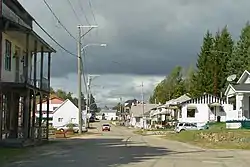
 Saint-Émile-de-Suffolk Location in western Quebec | |
| Coordinates: 45°56′N 74°55′W / 45.933°N 74.917°W[1] | |
| Country | Canada |
| Province | Quebec |
| Region | Outaouais |
| RCM | Papineau |
| Settled | 1860s |
| Constituted | January 1, 1881 |
| Government | |
| • Mayor | Hugo Desormeaux |
| • Federal riding | Argenteuil—Papineau—Mirabel |
| • Prov. riding | Papineau |
| Area | |
| • Total | 59.20 km2 (22.86 sq mi) |
| • Land | 55.68 km2 (21.50 sq mi) |
| Population (2021)[3] | |
| • Total | 512 |
| • Density | 9.2/km2 (24/sq mi) |
| • Pop 2016-2021 | |
| • Dwellings | 416 |
| Time zone | UTC−5 (EST) |
| • Summer (DST) | UTC−4 (EDT) |
| Postal code(s) | |
| Area code | 819 |
| Highways | |
| Website | www |
Saint-Émile-de-Suffolk is a municipality in the Outaouais region of Quebec, Canada, part of the Papineau Regional County Municipality. Until 1994 it was known as United Township Municipality of Suffolk-et-Addington.
This farming community, 40 kilometres (25 mi) north of Montebello, is often visited by cottage vacationers for hunting and fishing in the numerous lakes of the area.[1]
Geography
The area is characterized by rugged terrain of the Laurentian Mountains, marked here and there by mountains that rise more than 400 meters (1,300 ft) above sea level.[4] Its principal streams are the Little Rouge River and the Suffolk Creek that feeds it, the first being a tributary of the Petite-Nation River.[5]
History

Suffolk Township (named after the county in England) was already on the Gale and Duberger map of 1795, but not officially established until 1874.[5] Municipally it was part of the United Township Municipality of Hartwell-et-Suffolk until 1880 when the municipality separated[6] and the Township Municipality of Suffolk was formed, taking effect on January 1, 1881.
In 1885, Addington Township (named after Henry Addington, 1st Viscount Sidmouth) [4] was merged with Suffolk Township, creating the United Township Municipality of Suffolk-et-Addington.[1] This county consisted of Vinoy, Namur, Saint-Émile, Lac-des-Plages and part of Vendée.
In 1889, the Parish of Saint-Émile-de-Suffolk was formed. This name paid tribute to Émile Quesnel of Saint-Andre-Avellin, who had been particularly generous toward the early settlers of the area.[1]
Piece by piece, portions of the united township were detached to form new municipalities: Vinoy in 1920 (which became part of Chénéville in 1996), Lac-des-Plages in 1950, and finally Namur in 1964.[7]
In 1994, the name and status were changed to that of Municipality of Saint-Émile-de-Suffolk.[1]
Demographics
| 2021 | 2016 | 2011 | |
|---|---|---|---|
| Population | 512 (+7.3% from 2016) | 477 (-15.7% from 2011) | 566 (5.4% from 2006) |
| Land area | 55.68 km2 (21.50 sq mi) | 56.68 km2 (21.88 sq mi) | 58.40 km2 (22.55 sq mi) |
| Population density | 9.2/km2 (24/sq mi) | 8.4/km2 (22/sq mi) | 9.7/km2 (25/sq mi) |
| Median age | 54.4 (M: 55.2, F: 53.2) | 54.6 (M: 54.8, F: 54.4) | 49.5 (M: 50.0, F: 49.0) |
| Private dwellings | 416 (total) | 433 (total) | 410 (total) |
| Median household income | $40,832 |
| Year | Pop. | ±% |
|---|---|---|
| 1986 | 481 | — |
| 1991 | 491 | +2.1% |
| 1996 | 433 | −11.8% |
| 2001 | 528 | +21.9% |
| 2006 | 537 | +1.7% |
| 2011 | 566 | +5.4% |
| 2016 | 477 | −15.7% |
| 2021 | 512 | +7.3% |
| Population amounts are not adjusted for boundary changes. Source: Statistics Canada | ||
Local government
List of former mayors:
- Serge Carrière (2001–2005)
- Martin Blais (2005-2009)
- Michel Samson (2009-2013)
- Hugo Desormeaux (2013–present)
Education
Sir Wilfrid Laurier School Board operates Anglophone public schools:
References
- 1 2 3 4 5 "Saint-Émile-de-Suffolk (Municipalité)" (in French). Commission de toponymie du Québec. Retrieved 2010-04-27.
- 1 2 Ministère des Affaires municipales, des Régions et de l'Occupation du territoire - Répertoire des municipalités: Saint-Émile-de-Suffolk
- 1 2 "Profile table, Census Profile, 2021 Census of Population - Saint-Émile-de-Suffolk, Municipalité (MÉ) [Census subdivision], Quebec". 9 February 2022.
- 1 2 "Addington (Canton)" (in French). Commission de toponymie du Québec. Retrieved 2009-01-13.
- 1 2 "Suffolk (Canton)" (in French). Commission de toponymie du Québec. Retrieved 2009-01-13.
- ↑ "Lac-Simon (Municipalité)" (in French). Commission de toponymie du Québec. Retrieved 2008-12-02.
- ↑ "Namur (Municipalité)" (in French). Commission de toponymie du Québec. Retrieved 2009-01-12.
- ↑ "2021 Community Profiles". 2021 Canadian Census. Statistics Canada. February 4, 2022. Retrieved 2022-04-27.
- ↑ "2016 Community Profiles". 2016 Canadian Census. Statistics Canada. August 12, 2021. Retrieved 2020-01-30.
- ↑ "2011 Community Profiles". 2011 Canadian Census. Statistics Canada. March 21, 2019. Retrieved 2020-01-30.
- ↑ "2006 Community Profiles". 2006 Canadian Census. Statistics Canada. August 20, 2019.
- ↑ "2001 Community Profiles". 2001 Canadian Census. Statistics Canada. July 18, 2021.
- ↑ "LAURENTIAN REGIONAL HS ZONE." Sir Wilfrid Laurier School Board. Retrieved on September 4, 2017.
External links
![]() Media related to Saint-Émile-de-Suffolk at Wikimedia Commons
Media related to Saint-Émile-de-Suffolk at Wikimedia Commons
Places adjacent to Saint-Émile-de-Suffolk, Quebec | ||||||||||||||||
|---|---|---|---|---|---|---|---|---|---|---|---|---|---|---|---|---|
| ||||||||||||||||
| Cities | |
|---|---|
| Municipalities | |
| Townships | |
| |