Saint-Aulaye | |
|---|---|
Part of Saint-Aulaye-Puymangou | |
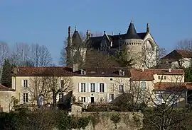 The castle seen from the west | |
.svg.png.webp) Coat of arms | |
Location of Saint-Aulaye | |
 Saint-Aulaye  Saint-Aulaye | |
| Coordinates: 45°12′11″N 0°08′06″E / 45.2031°N 0.135°E | |
| Country | France |
| Region | Nouvelle-Aquitaine |
| Department | Dordogne |
| Arrondissement | Périgueux |
| Canton | Montpon-Ménestérol |
| Commune | Saint-Aulaye-Puymangou |
| Area 1 | 34.71 km2 (13.40 sq mi) |
| Population (2019)[1] | 1,357 |
| • Density | 39/km2 (100/sq mi) |
| Time zone | UTC+01:00 (CET) |
| • Summer (DST) | UTC+02:00 (CEST) |
| Postal code | 24410 |
| Elevation | 32–132 m (105–433 ft) (avg. 76 m or 249 ft) |
| 1 French Land Register data, which excludes lakes, ponds, glaciers > 1 km2 (0.386 sq mi or 247 acres) and river estuaries. | |
Saint-Aulaye (French pronunciation: [sɛ̃.t‿olɛ]; Occitan: Senta Aulaia) is a former commune in Dordogne, France. On 1 January 2016, it was merged into the new commune Saint-Aulaye-Puymangou.[2] Jeanne Baret, the first woman to travel round the world, retired to Saint-Aulaye, where she died in 1807.
Population
|
|
See also
References
- ↑ Téléchargement du fichier d'ensemble des populations légales en 2019, INSEE
- ↑ Arrêté préfectoral 14 December 2015 (in French)
Wikimedia Commons has media related to Saint-Aulaye.
This article is issued from Wikipedia. The text is licensed under Creative Commons - Attribution - Sharealike. Additional terms may apply for the media files.