Saint-Bandry | |
|---|---|
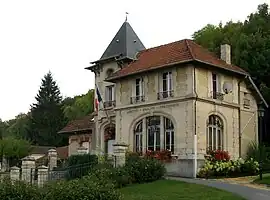 Town hall | |
Location of Saint-Bandry | |
 Saint-Bandry  Saint-Bandry | |
| Coordinates: 49°22′21″N 3°10′04″E / 49.3725°N 3.1678°E | |
| Country | France |
| Region | Hauts-de-France |
| Department | Aisne |
| Arrondissement | Soissons |
| Canton | Vic-sur-Aisne |
| Government | |
| • Mayor (2020–2026) | Jean-Yves Seznec[1] |
| Area 1 | 6.02 km2 (2.32 sq mi) |
| Population | 247 |
| • Density | 41/km2 (110/sq mi) |
| Time zone | UTC+01:00 (CET) |
| • Summer (DST) | UTC+02:00 (CEST) |
| INSEE/Postal code | 02672 /02290 |
| Elevation | 49–157 m (161–515 ft) (avg. 100 m or 330 ft) |
| 1 French Land Register data, which excludes lakes, ponds, glaciers > 1 km2 (0.386 sq mi or 247 acres) and river estuaries. | |
Saint-Bandry (French pronunciation: [sɛ̃ bɑ̃dʁi]) is a commune in the Aisne department in Hauts-de-France in northern France.
Population
| Year | Pop. | ±% |
|---|---|---|
| 1962 | 221 | — |
| 1968 | 221 | +0.0% |
| 1975 | 214 | −3.2% |
| 1982 | 200 | −6.5% |
| 1990 | 202 | +1.0% |
| 1999 | 238 | +17.8% |
| 2008 | 223 | −6.3% |
See also
References
- ↑ "Répertoire national des élus: les maires". data.gouv.fr, Plateforme ouverte des données publiques françaises (in French). 2 December 2020.
- ↑ "Populations légales 2021". The National Institute of Statistics and Economic Studies. 28 December 2023.
Wikimedia Commons has media related to Saint-Bandry.
This article is issued from Wikipedia. The text is licensed under Creative Commons - Attribution - Sharealike. Additional terms may apply for the media files.