Saint-Maurice-sur-Mortagne | |
|---|---|
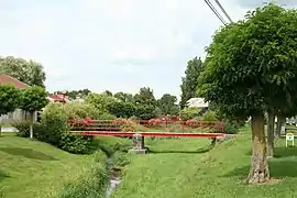 The Nauve | |
Location of Saint-Maurice-sur-Mortagne | |
 Saint-Maurice-sur-Mortagne  Saint-Maurice-sur-Mortagne | |
| Coordinates: 48°23′14″N 6°35′03″E / 48.3872°N 6.5842°E | |
| Country | France |
| Region | Grand Est |
| Department | Vosges |
| Arrondissement | Épinal |
| Canton | Charmes |
| Intercommunality | Région de Rambervillers |
| Government | |
| • Mayor (2020–2026) | Michel Herbé[1] |
| Area 1 | 6.78 km2 (2.62 sq mi) |
| Population | 180 |
| • Density | 27/km2 (69/sq mi) |
| Time zone | UTC+01:00 (CET) |
| • Summer (DST) | UTC+02:00 (CEST) |
| INSEE/Postal code | 88425 /88700 |
| Elevation | 257–325 m (843–1,066 ft) (avg. 315 m or 1,033 ft) |
| 1 French Land Register data, which excludes lakes, ponds, glaciers > 1 km2 (0.386 sq mi or 247 acres) and river estuaries. | |
Saint-Maurice-sur-Mortagne (French pronunciation: [sɛ̃ mɔʁis syʁ mɔʁtaɲ] ⓘ) is a commune in the Vosges department in Grand Est in northeastern France.
Geography
The river Mortagne forms most of the commune's eastern border.
Population
| Year | Pop. | ±% p.a. |
|---|---|---|
| 1968 | 173 | — |
| 1975 | 156 | −1.47% |
| 1982 | 143 | −1.24% |
| 1990 | 163 | +1.65% |
| 1999 | 163 | +0.00% |
| 2007 | 177 | +1.04% |
| 2012 | 184 | +0.78% |
| 2017 | 181 | −0.33% |
| Source: INSEE[3] | ||
See also
References
- ↑ "Répertoire national des élus: les maires" (in French). data.gouv.fr, Plateforme ouverte des données publiques françaises. 13 September 2022.
- ↑ "Populations légales 2021". The National Institute of Statistics and Economic Studies. 28 December 2023.
- ↑ Population en historique depuis 1968, INSEE
Wikimedia Commons has media related to Saint-Maurice-sur-Mortagne.
This article is issued from Wikipedia. The text is licensed under Creative Commons - Attribution - Sharealike. Additional terms may apply for the media files.