Saint-Pierre-du-Chemin | |
|---|---|
 The church in Saint-Pierre-du-Chemin | |
Location of Saint-Pierre-du-Chemin | |
 Saint-Pierre-du-Chemin 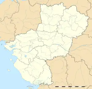 Saint-Pierre-du-Chemin | |
| Coordinates: 46°41′49″N 0°41′55″W / 46.6969°N 0.6986°W | |
| Country | France |
| Region | Pays de la Loire |
| Department | Vendée |
| Arrondissement | Fontenay-le-Comte |
| Canton | La Châtaigneraie |
| Intercommunality | Pays de la Châtaigneraie |
| Government | |
| • Mayor (2020–2026) | Daniel Mottard[1] |
| Area 1 | 29.65 km2 (11.45 sq mi) |
| Population | 1,327 |
| • Density | 45/km2 (120/sq mi) |
| Time zone | UTC+01:00 (CET) |
| • Summer (DST) | UTC+02:00 (CEST) |
| INSEE/Postal code | 85264 /85120 |
| Elevation | 133–237 m (436–778 ft) |
| 1 French Land Register data, which excludes lakes, ponds, glaciers > 1 km2 (0.386 sq mi or 247 acres) and river estuaries. | |
Saint-Pierre-du-Chemin (French pronunciation: [sɛ̃ pjɛʁ dy ʃəmɛ̃]) is a commune in the Vendée department in the Pays de la Loire region in western France.
Personalities
It was the birthplace of Pierre Bersuire (c. 1290-1362).
Geography
The river Lay has its source in the commune.
See also
References
- ↑ "Répertoire national des élus: les maires" (in French). data.gouv.fr, Plateforme ouverte des données publiques françaises. 13 September 2022.
- ↑ "Populations légales 2021". The National Institute of Statistics and Economic Studies. 28 December 2023.
Wikimedia Commons has media related to Saint-Pierre-du-Chemin.
This article is issued from Wikipedia. The text is licensed under Creative Commons - Attribution - Sharealike. Additional terms may apply for the media files.