Saxon, Wisconsin | |
|---|---|
_highlighted.svg.png.webp) Location in Iron County and the state of Wisconsin. | |
| Coordinates: 46°29′36″N 90°24′52″W / 46.49333°N 90.41444°W | |
| Country | United States |
| State | Wisconsin |
| County | Iron |
| Town | Saxon |
| Area | |
| • Total | 1.215 sq mi (3.15 km2) |
| • Land | 1.215 sq mi (3.15 km2) |
| • Water | 0 sq mi (0 km2) |
| Elevation | 1,119 ft (341 m) |
| Population (2010) | |
| • Total | 90 |
| • Density | 74/sq mi (29/km2) |
| Time zone | UTC-6 (Central (CST)) |
| • Summer (DST) | UTC-5 (CDT) |
| ZIP code | 54559 |
| Area code(s) | 715 & 534 |
| GNIS feature ID | 1573758[1] |
Saxon is an unincorporated census-designated place located in the town of Saxon, Iron County, Wisconsin, United States. Saxon is located on Wisconsin Highway 122 11 miles (18 km) west-northwest of Hurley. Saxon has a post office with ZIP code 54559.[2] As of the 2010 census, its population is 90.[3]
History
A post office called Saxon has been in operation since 1887.[4] The community was named after the Saxons, the ancient German people.[5] Joseph J. Defer (1866-1929) served as postmaster of Saxon from 1904 to 1914 and as sheriff of Iron County. He owned a general store and sawmill. Defer served in the Wisconsin Assembly in 1919 and 1920.[6]
References
- ↑ U.S. Geological Survey Geographic Names Information System: Saxon (CDP), Wisconsin
- ↑ ZIP Code Lookup
- ↑ "U.S. Census website". U.S. Census Bureau. Retrieved April 20, 2011.
- ↑ "Iron County". Jim Forte Postal History. Retrieved March 28, 2015.
- ↑ Chicago and North Western Railway Company (1908). A History of the Origin of the Place Names Connected with the Chicago & North Western and Chicago, St. Paul, Minneapolis & Omaha Railways. p. 123.
- ↑ 'Wisconsin Blue Book 1919,' Biographical Sketch of Joseph J. De Fer, pg. 465
Municipalities and communities of Iron County, Wisconsin, United States | ||
|---|---|---|
| Cities | 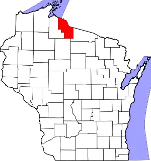 | |
| Towns | ||
| CDPs | ||
| Unincorporated communities | ||
| Indian reservations | ||
| Footnotes | ‡This populated place also has portions in an adjacent county or counties | |
This article is issued from Wikipedia. The text is licensed under Creative Commons - Attribution - Sharealike. Additional terms may apply for the media files.