| Serebryanka | |
|---|---|
 | |
| Native name | Серебрянка (Russian) |
| Location | |
| Country | Russia |
| Physical characteristics | |
| Mouth | Chusovaya |
• coordinates | 57°48′11″N 58°46′26″E / 57.8031°N 58.7739°E |
| Length | 147 km (91 mi) |
| Basin size | 1,240 km2 (480 sq mi) |
| Basin features | |
| Progression | Chusovaya→ Kama→ Volga→ Caspian Sea |
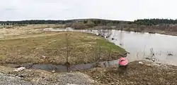
The Serebryanka (Russian: Серебрянка, also: Серебряная - Serebryanaya) is a river in Sverdlovsk Oblast in Russia, a right tributary of the Chusovaya (Kama basin).[1] The river is 147 kilometres (91 mi) long. The area of its drainage basin is 1,240 square kilometres (480 sq mi).[2] The Serebryanka freezes up in November and stays icebound until April.
References
- ↑ Серебрянка (река), Great Soviet Encyclopedia
- ↑ «Река Серебряная (Серебрянка)», Russian State Water Registry
This article is issued from Wikipedia. The text is licensed under Creative Commons - Attribution - Sharealike. Additional terms may apply for the media files.