Simmonsville, Virginia | |
|---|---|
 | |
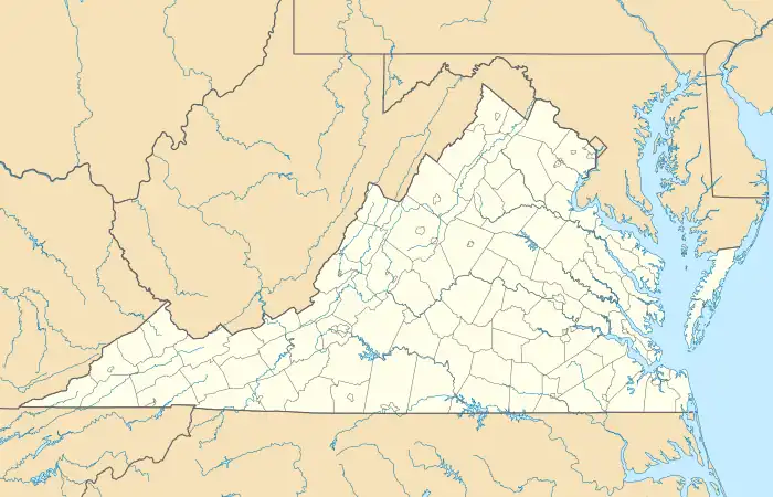 Simmonsville Location in Virginia | |
| Coordinates: 37°23′3″N 80°21′42″W / 37.38417°N 80.36167°W | |
| Country | United States |
| State | Virginia |
| County | Craig |
| Elevation | 2,267 ft (691 m) |
| Time zone | UTC−5 (Eastern (EST)) |
| • Summer (DST) | UTC−4 (EDT) |
| Area code | 540 |
Simmonsville is an unincorporated hamlet in southwestern Craig County, Virginia, United States. There are no businesses or services there, only a handful of houses. Simmonsville lies along a T-intersection of State Route 42 and Cumberland Gap Road, 18 miles (29 km) southwest of New Castle.[2]
References
- ↑ USGS. "Geographic Names Information System Feature Detail Report: Simmonsville, Virginia". Retrieved July 19, 2008.
- ↑ "Google Maps". Retrieved July 19, 2008.
Municipalities and communities of Craig County, Virginia, United States | ||
|---|---|---|
| Town | 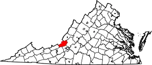 Map of Virginia highlighting Craig County | |
| Unincorporated communities | ||
This article is issued from Wikipedia. The text is licensed under Creative Commons - Attribution - Sharealike. Additional terms may apply for the media files.