Soldier Township | |
|---|---|
 Location in Jackson County | |
| Coordinates: 39°31′33″N 95°57′31″W / 39.52583°N 95.95861°W | |
| Country | United States |
| State | Kansas |
| County | Jackson |
| Area | |
| • Total | 42.63 sq mi (110.4 km2) |
| • Land | 42.55 sq mi (110.21 km2) |
| • Water | 0.07 sq mi (0.19 km2) 0.17% |
| Elevation | 1,230 ft (375 m) |
| Population (2000) | |
| • Total | 403 |
| • Density | 9.5/sq mi (3.7/km2) |
| GNIS feature ID | 0472569 |
Soldier Township is a township in Jackson County, Kansas, USA. As of the 2000 census, its population was 403.
History
Soldier Township was formed in 1872.[1]
Geography
Soldier Township covers an area of 42.63 square miles (110.4 square kilometers); of this, 0.07 square miles (0.19 square kilometers) or 0.17 percent is water.
Cities and towns
Adjacent townships
- Reilly Township, Nemaha County (north)
- Jefferson Township (east)
- Banner Township (southeast)
- Grant Township (south)
- Lincoln Township, Pottawatomie County (southwest)
- Grant Township, Pottawatomie County (west)
- Red Vermillion Township, Nemaha County (northwest)
Major highways
References
- ↑ Barr, Elizabeth N. (1907). Business directory and history of Jackson County. p. 13.
External links
Municipalities and communities of Jackson County, Kansas, United States | ||
|---|---|---|
| Cities | 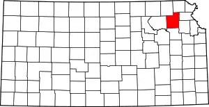 Map of Kansas highlighting Jackson County | |
| Unincorporated communities | ||
| Indian reservations | ||
| Townships | ||
| Footnotes | ‡This community also has portions in an adjacent county or counties. | |
This article is issued from Wikipedia. The text is licensed under Creative Commons - Attribution - Sharealike. Additional terms may apply for the media files.