Southfield, Massachusetts | |
|---|---|
 Southfield Store | |
 Southfield | |
| Coordinates: 42°6′3.6″N 73°14′1.2″W / 42.101000°N 73.233667°W | |
| Country | United States |
| State | Massachusetts |
| County | Berkshire |
| Elevation | 1,211 ft (369 m) |
| Population (2010) | |
| • Total | 0 |
| Time zone | UTC-5 (Eastern (EST)) |
| • Summer (DST) | UTC-4 (EDT) |
| ZIP codes | 01259 |
| GNIS feature ID | 607726 |
Southfield is a village located at the junction of Norfolk and East Hill Roads within the town of New Marlborough in Berkshire County. It is also a post office location for the surrounding area with ZIP Code 01259.
Geography
Southfield is located at 42°6′3.6″N 73°14′1.2″W / 42.101000°N 73.233667°W (42.1014802, -73.2328889).[1]
History
Southfield was named in 1775 for its location in the southwestern portion of the state.
References
- ↑ "Geographic Names Information Systems". Retrieved 2022-01-10.
Municipalities and communities of Berkshire County, Massachusetts, United States | ||
|---|---|---|
| Cities | 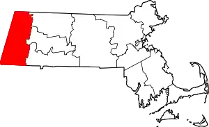 Berkshire County’s location in Massachusetts | |
| Towns | ||
| CDPs | ||
| Other villages | ||
This article is issued from Wikipedia. The text is licensed under Creative Commons - Attribution - Sharealike. Additional terms may apply for the media files.