Stainz bei Straden | |
|---|---|
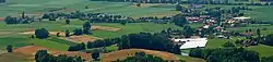 View of Stainz bei Straden | |
 Coat of arms | |
 Stainz bei Straden Location within Austria | |
| Coordinates: 46°49′00″N 15°54′00″E / 46.81667°N 15.90000°E | |
| Country | Austria |
| State | Styria |
| District | Südoststeiermark |
| Government | |
| • Mayor | Karl Lenz (ÖVP) |
| Area | |
| • Total | 13.68 km2 (5.28 sq mi) |
| Elevation | 251 m (823 ft) |
| Population (1 January 2016)[1] | |
| • Total | 995 |
| • Density | 73/km2 (190/sq mi) |
| Time zone | UTC+1 (CET) |
| • Summer (DST) | UTC+2 (CEST) |
| Postal code | 8345, 8355 |
| Area code | +43 3473 |
| Vehicle registration | FB |
| Website | www.stainz-straden.gv.at |
Stainz bei Straden is a former municipality in the district of Südoststeiermark in the Austrian state of Styria. Since the 2015 Styria municipal structural reform, it is part of the municipality Straden.[2]
Population
| Year | Pop. | ±% |
|---|---|---|
| 1869 | 1,279 | — |
| 1880 | 1,345 | +5.2% |
| 1890 | 1,437 | +6.8% |
| 1900 | 1,339 | −6.8% |
| 1910 | 1,341 | +0.1% |
| 1923 | 1,309 | −2.4% |
| 1934 | 1,237 | −5.5% |
| 1939 | 1,116 | −9.8% |
| 1951 | 1,040 | −6.8% |
| 1961 | 1,046 | +0.6% |
| 1971 | 1,105 | +5.6% |
| 1981 | 1,099 | −0.5% |
| 1991 | 1,024 | −6.8% |
| 2001 | 1,013 | −1.1% |
| 2012 | 995 | −1.8% |
References
This article is issued from Wikipedia. The text is licensed under Creative Commons - Attribution - Sharealike. Additional terms may apply for the media files.