Stainztal | |
|---|---|
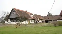 Old farm in Stainztal | |
 Coat of arms | |
 Stainztal Location within Austria | |
| Coordinates: 46°51′58″N 15°20′13″E / 46.86611°N 15.33694°E | |
| Country | Austria |
| State | Styria |
| District | Deutschlandsberg |
| Government | |
| • Mayor | Johann Tomberger (ÖVP) |
| Area | |
| • Total | 19.82 km2 (7.65 sq mi) |
| Elevation | 304 m (997 ft) |
| Population (1 January 2016)[1] | |
| • Total | 1,444 |
| • Density | 73/km2 (190/sq mi) |
| Time zone | UTC+1 (CET) |
| • Summer (DST) | UTC+2 (CEST) |
| Postal code | 8503,8504,8510,8522 |
| Area code | 03185, 03463, 03464, 03136 |
| Vehicle registration | DL |
| Website | www.stainztal.at |
Stainztal is a former municipality in the district of Deutschlandsberg in the Austrian state of Styria. Since the 2015 Styria municipal structural reform, it is part of the municipality Stainz.[2]
Population
| Year | Pop. | ±% |
|---|---|---|
| 1869 | 1,444 | — |
| 1880 | 1,530 | +6.0% |
| 1890 | 1,594 | +4.2% |
| 1900 | 1,494 | −6.3% |
| 1910 | 1,483 | −0.7% |
| 1923 | 1,499 | +1.1% |
| 1934 | 1,476 | −1.5% |
| 1939 | 1,347 | −8.7% |
| 1951 | 1,369 | +1.6% |
| 1961 | 1,328 | −3.0% |
| 1971 | 1,277 | −3.8% |
| 1981 | 1,363 | +6.7% |
| 1991 | 1,440 | +5.6% |
| 2001 | 1,433 | −0.5% |
| 2011 | 1,463 | +2.1% |
References
This article is issued from Wikipedia. The text is licensed under Creative Commons - Attribution - Sharealike. Additional terms may apply for the media files.