Sterling, North Dakota | |
|---|---|
 Sterling  Sterling | |
| Coordinates: 46°48′50″N 100°17′29″W / 46.81389°N 100.29139°W[1] | |
| Country | United States |
| State | North Dakota |
| County | Burleigh |
| Area | |
| • Total | 36.0 sq mi (93.2 km2) |
| • Land | 36.0 sq mi (93.2 km2) |
| • Water | 0.0 sq mi (0.0 km2) |
| Elevation | 1,828 ft (557 m) |
| Population (2000) | |
| • Total | 172 |
| • Density | 4.8/sq mi (1.8/km2) |
| Time zone | UTC-6 (Central (CST)) |
| • Summer (DST) | UTC-5 (CDT) |
| ZIP code | 58572 |
| Area code | 701 |
| FIPS code | 38-75940[2] |
| GNIS feature ID | 1032304[1] |
Sterling is an unincorporated rural hamlet in Burleigh County, North Dakota, United States at the intersection of Interstate 94 and U.S. Route 83. There is an elementary school there, a post office and a large agricultural services complex.
Sterling is part of the "Bismarck, ND Metropolitan Statistical Area" or "Bismarck-Mandan".
Demographics
Population figures are estimates.
| Census | Pop. | Note | %± |
|---|---|---|---|
| 1900 | 198 | — | |
| 1910 | 190 | −4.0% | |
| 1920 | 176 | −7.4% | |
| 1930 | 170 | −3.4% | |
| 1940 | 134 | −21.2% | |
| 1950 | 110 | −17.9% | |
| 1960 | 119 | 8.2% | |
| 1970 | 124 | 4.2% | |
| 1980 | 102 | −17.7% | |
| 1990 | 67 | −34.3% | |
| 2000 | 46 | −31.3% | |
| 2010 | 35 | −23.9% | |
| 2017 (est.) | 32 | [3] | −8.6% |
| U.S. Decennial Census[4] 2015 Estimate[5] | |||
References
- 1 2 3 U.S. Geological Survey Geographic Names Information System: Sterling, North Dakota
- ↑ "U.S. Census website". United States Census Bureau. Retrieved January 31, 2008.
- ↑ "Population and Housing Unit Estimates". Retrieved June 9, 2017.
- ↑ United States Census Bureau. "Census of Population and Housing". Retrieved July 19, 2013.
- ↑ "Population Estimates". United States Census Bureau. Retrieved June 24, 2016.
Municipalities and communities of Burleigh County, North Dakota, United States | ||
|---|---|---|
| Cities | 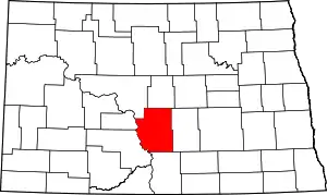 Map of North Dakota highlighting Burleigh County | |
| Townships |
| |
| Unorganized territories |
| |
| CDPs | ||
| Other communities | ||
| Ghost town | ||
| Footnotes | ‡This populated place also has portions in an adjacent county or counties | |
Bismarck–Mandan Metropolitan Area (ND) | ||
|---|---|---|
| Counties | 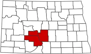 | |
| Core cities | ||
| Surrounding areas | ||
This article is issued from Wikipedia. The text is licensed under Creative Commons - Attribution - Sharealike. Additional terms may apply for the media files.