Tân Phú Tây
Xã Tân Phú Tây | |
|---|---|
Commune and village | |
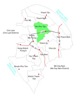 Location in Mỏ Cày Bắc District | |
 Tân Phú Tây | |
| Coordinates: 10°12′17″N 106°17′33″E / 10.20472°N 106.29250°E | |
| Country | |
| Region | Mekong Delta |
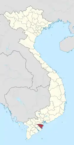
| Province | Bến Tre |
| District | Mỏ Cày Bắc |
| Area | |
| • Total | 3.9 sq mi (10.2 km2) |
| Population (1999) | |
| • Total | 7,262 |
| • Density | 1,840/sq mi (712/km2) |
| Time zone | UTC+07:00 (Indochina Time) |
| Postal code | 28912 |
Tân Phú Tây is a rural commune of Mỏ Cày Bắc District, Bến Tre Province, Vietnam. The commune covers 10.2 km2. In 1999 it had a population of 7,262 and a population density of 712 inhabitants/km2.[1]
References
- ↑ "List of populated places in Vietnam". Ministry of Information and Communications of Vietnam. Archived from the original on 2013-03-24. Retrieved 2012-08-30.
Capital: Bến Tre | ||
| Bến Tre |
|  |
| Ba Tri District |
| |
| Bình Đại District |
| |
| Châu Thành District |
| |
| Chợ Lách District |
| |
| Giồng Trôm District |
| |
| Mỏ Cày Bắc District | ||
| Mỏ Cày Nam District |
| |
| Thạnh Phú District |
| |
This article is issued from Wikipedia. The text is licensed under Creative Commons - Attribution - Sharealike. Additional terms may apply for the media files.