| Taylor River[1] | |
|---|---|
.JPG.webp) Taylor River in Almont, Colorado | |
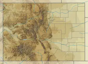 Location of mouth in O | |
| Location | |
| Country | United States |
| State | Colorado |
| Physical characteristics | |
| Source | |
| • location | Gunnison County, Colorado |
| • coordinates | 38°58′12″N 106°47′27″W / 38.97000°N 106.79083°W |
| Mouth | |
• location | Confluence with East River |
• coordinates | 38°39′49″N 106°50′50″W / 38.66361°N 106.84722°W |
• elevation | 8,005 ft (2,440 m) |
| Basin features | |
| Progression | Gunnison—Colorado |
The Taylor River rises between Star Peak and Crystal Peak in Colorado's Elk Mountains in the northeast part of Gunnison County, near the Continental Divide. [2] Flowing southeast, the river goes through Taylor Park Reservoir, created by the Taylor Park Dam. From there it flows southwest. At Almont, the Taylor River joins with the East River to form the Gunnison River. The river is 48.2 miles (77.6 km) long.[3]
Most of the river lies within the Gunnison National Forest. It is a popular river for fly fishing of trout[4][5] and for whitewater rafting.[6]
See also
References
- ↑ "Taylor River". Geographic Names Information System. United States Geological Survey, United States Department of the Interior. Retrieved 2011-01-27.
- ↑ Cohen, Saul Bernard (1998). The Columbia gazetteer of the world. Columbia University Press. ISBN 0-231-11040-5.
- ↑ U.S. Geological Survey. National Hydrography Dataset high-resolution flowline data. The National Map, accessed March 18, 2011
- ↑ Taylor River: trout fly fishing. Retrieved 23 January 2011.
- ↑ Fishing the Taylor River. Retrieved 23 January 2011.
- ↑ Taylor River: white water rafting. Retrieved 23 January 2011.
External links
- Taylor River rafting agreement 2010. Retrieved 23 January 2011.
- Rafting on the Taylor River video. Retrieved 23 January 2011.
This article is issued from Wikipedia. The text is licensed under Creative Commons - Attribution - Sharealike. Additional terms may apply for the media files.