Tegh
Տեղ | |
|---|---|
 | |
| Coordinates: 39°35′N 46°26′E / 39.583°N 46.433°E | |
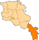
| Country | Armenia |
| Province | Syunik |
| Formed | 17 June 2016 |
| Administrative centre | Tegh |
| Government | |
| • Mayor | Nerses Shadunts |
| Population (2011 census) | |
| • Total | 5,994 |
| Time zone | AMT (UTC+04) |
| Postal code | 3201–3519 |
| ISO 3166 code | AM-SU |
| FIPS 10-4 | AM08 |
Tegh Municipality, referred to as Tegh Community (Armenian: Տեղ Համայնք Tegh Hamaynk), is a rural community and administrative subdivision of Syunik Province of Armenia, at the south of the country. Consisted of a group of settlements, its administrative centre is the village of Tegh.[1]
Included settlements
| Settlement | Type | Population (2011 census)[2] |
|---|---|---|
| Tegh | Village, administrative centre | 2,443 |
| Aravus | Village | 171 |
| Karashen | Village | 550 |
| Khnatsakh | Village | 998 |
| Khoznavar | Village | 396 |
| Kornidzor | Village | 1,100 |
| Vaghatur | Village | 336 |
See also
References
This article is issued from Wikipedia. The text is licensed under Creative Commons - Attribution - Sharealike. Additional terms may apply for the media files.