| Tillari Dam | |
|---|---|
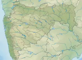 Location of Tillari Dam in Maharashtra | |
| Official name | Tillari (Main) Dam D04937 |
| Location | Chandgad |
| Coordinates | 15°47′55″N 74°20′36″E / 15.798696°N 74.343281°E |
| Opening date | 1986[1] |
| Owner(s) | Government of Maharashtra, India |
| Dam and spillways | |
| Type of dam | Gravity |
| Impounds | Tillari river |
| Height | 38.05 m (124.8 ft) |
| Length | 485 m (1,591 ft) |
| Dam volume | 250 km3 (60 cu mi) |
| Reservoir | |
| Total capacity | 92,020 km3 (22,080 cu mi) |
| Surface area | 9,290 km2 (3,590 sq mi) |
Tillari (Main) Dam is a gravity dam on Tillari river near Chandgad, Kolhapur district in the state of Maharashtra in India.
Specifications
The height of the dam above the lowest foundation is 38.05 m (124.8 ft) while the length is 485 m (1,591 ft). Its volume content is 250 km3 (60 cu mi) and its gross storage capacity is 113,266.00 km3 (27,173.96 cu mi).[2]
Purpose
- Hydroelectricity power generation
See also
References
- ↑ "Tillari (Main) D04937". Retrieved April 2, 2013.
- ↑ Specifications of large dams in India Archived 2011-07-21 at the Wayback Machine
External links
- Goa wants water from Maharashtra's Tillari dam. Indian Express Location: Panaji, Date: December 29, 2012, Retrieved: April 2, 2013
- Maharashtra govt releases Tillari water to Goa. The Navhind Times Location: Sanquelim, Date: January 3, 2013, Retrieved: April 2, 2013
Kolhapur district topics | |||||
|---|---|---|---|---|---|
| History | .svg.png.webp) | ||||
| Geography | |||||
| Cities and towns | |||||
| Transport | |||||
| Visitor attractions | |||||
| Culture | |||||
| Education | |||||
| Lok Sabha constituencies | |||||
| Vidhan Sabha constituencies |
| ||||
| Taluka/Tehsil | |||||
| Stadiums | |||||
‡ This constituency also has portions in Sangli district
| |||||
This article is issued from Wikipedia. The text is licensed under Creative Commons - Attribution - Sharealike. Additional terms may apply for the media files.