Turah, Montana | |
|---|---|
Populated Place | |
| Coordinates: 46°50′09″N 113°49′46″W / 46.83583°N 113.82944°W | |
| Country | United States |
| State | Montana |
| County | Missoula |
| Area | |
| • Total | 1.33 sq mi (3.45 km2) |
| • Land | 1.33 sq mi (3.45 km2) |
| • Water | 0.00 sq mi (0.00 km2) |
| Elevation | 3,329 ft (928 m) |
| Population (2020) | |
| • Total | 364 |
| • Density | 272.86/sq mi (105.36/km2) |
| Time zone | UTC-7 (Mountain (MST)) |
| • Summer (DST) | UTC-6 (MDT) |
| Area code | 406 |
| FIPS code | 30-75175 |
Turah is an unincorporated community located in the eastern half of Missoula County, Montana, United States along Interstate 90. It has a population of 306 as of 2010 census.[2]
Demographics
| Census | Pop. | Note | %± |
|---|---|---|---|
| 2020 | 364 | — | |
| U.S. Decennial Census[3] | |||
References
- ↑ "ArcGIS REST Services Directory". United States Census Bureau. Retrieved September 18, 2022.
- ↑ "Turah - Local Information, Resources & Photos". Montana Hometownlocator. Retrieved September 4, 2012.
- ↑ "Census of Population and Housing". Census.gov. Retrieved June 4, 2016.
Municipalities and communities of Missoula County, Montana, United States | ||
|---|---|---|
| City | 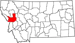 Missoula County map | |
| CDPs | ||
| Other communities | ||
| Ghost towns | ||
| Indian reservation | ||
| Footnotes | ‡This populated place also has portions in an adjacent county or counties | |
This article is issued from Wikipedia. The text is licensed under Creative Commons - Attribution - Sharealike. Additional terms may apply for the media files.